Route Planning
Algonquin camping trips are usually planned with either an official route map or a similarly detailed alternate map spread out on a table, with pencil and paper in hand .. or by accessing its online version.
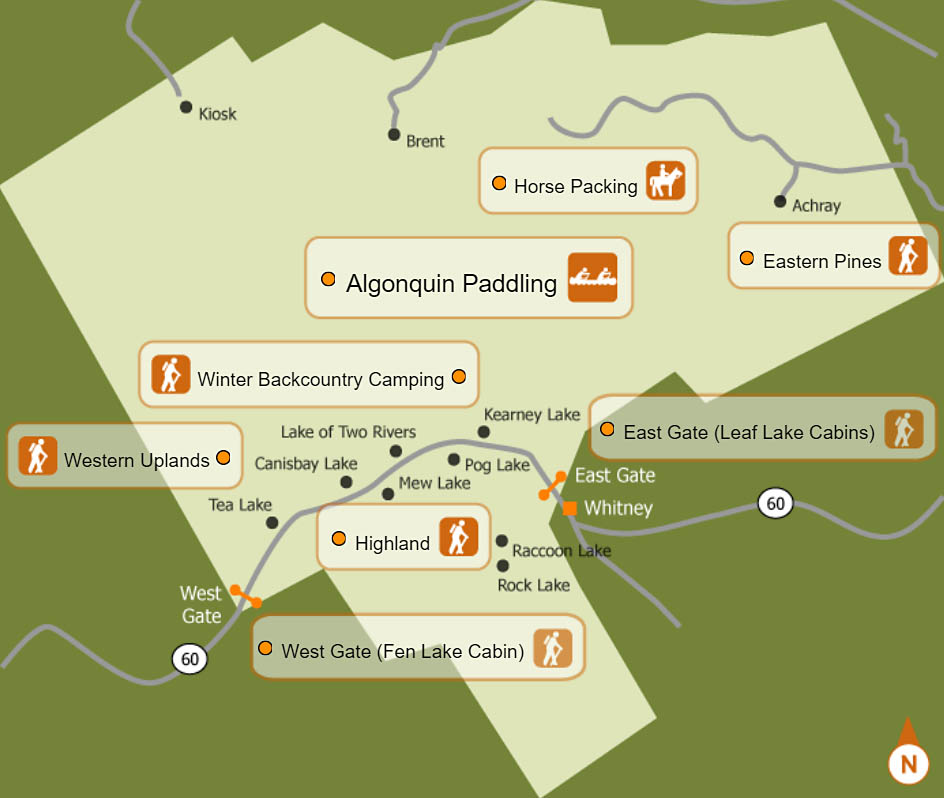
Usually, a general area and its corresponding "Access Point" are chosen as the starting point.
Left: This is the kind of detail found on the official reservation website's maps.
From the Access Point on, the daily hiking distances and times become the deciding factors.
At the outset of the planning process, you should have an honest awareness of your physical ability and your personal preferences.
Do you want a leisurely trip, with opportunities to explore shorelines, search out wildlife, fish, swim and lay about? Or do you want to cover a lot of distance in a relatively short period of time?
Your expectations, combined with your abilities and the potential demands of each day's hiking, should determine the "location" at which you plan to be each evening.
The actual roughness of the trail(rocks, roots and/or muck) are typically learned from those who have already travelled them before. This information can be gleened from personal contacts, printed accounts and online trip-logs.
A period of rainfall can turn a rocky trail into a slow and slippery affair, demanding much more time to carefully maneuver. Likewise, a lowland trail can become a struggle through mud and over slippery boardwalks.
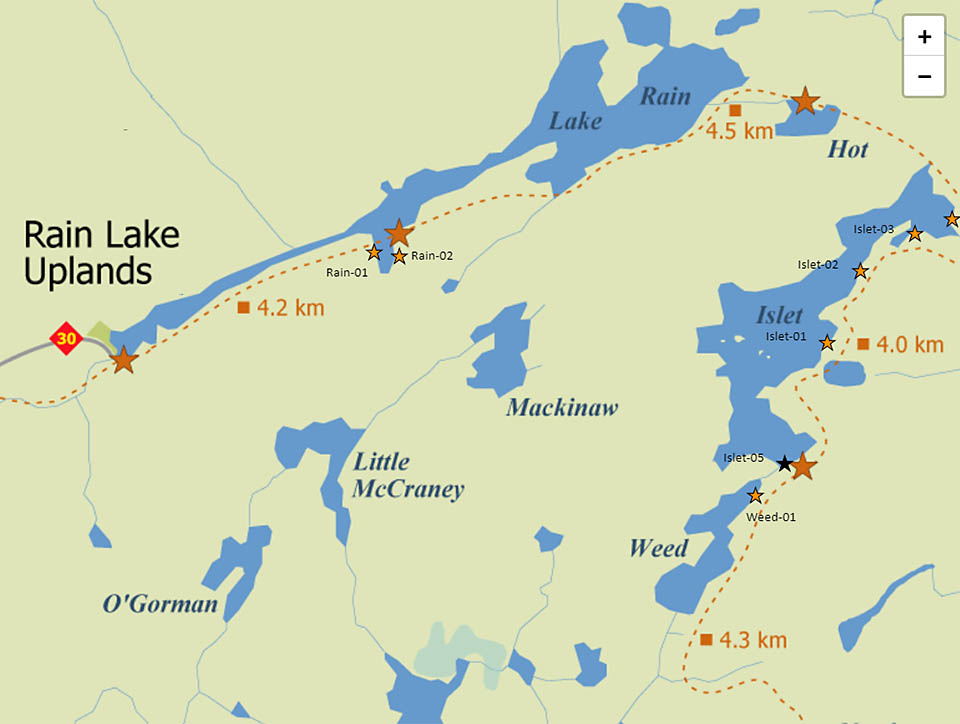
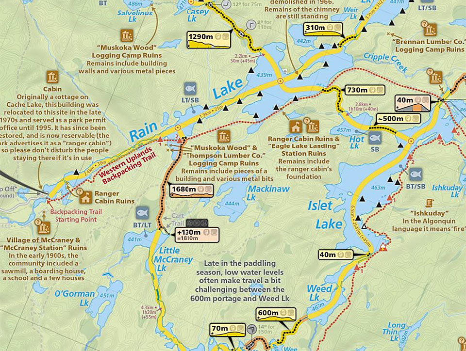
Right: A very impressive alternative map is produced by Maps By Jeff.
It can be accessed and purchased here .
Arriving at your destination both wet and in the dark is far from an enjoyable end to the day.
It is much preferred to have your camp pitched, a good meal eaten, dishes washed and the next day's drinking water prepared ... all before a lazy rest in front of the sunset and campfire.
If the weather does turned on you, at least you'll have the "buffer" to fall back on.
January 4, 2024