Day Hike to Robitaille Lake
.. by Jim R.
March 14, 2024
.. by Jim R.
March 14, 2024
>> Some images can be clicked on to access slightly larger sizes.<<<
|
|
Day Hike to Robitaille Lake
.. by Jim R. March 14, 2024 >> Some images can be clicked on to access slightly larger sizes.<<< |
|
Over the years I heard my father (who was born in 1914) talk about walking to Robitaille Lake from Basin Depot in the 1930s. Times were tough then and a meal of trout was something truly appreciated. I have always wanted to search for the trail he would have used, and thanks to the historic maps made available by Bob and Diana McElroy, there are helpful resources online that outline the early portage trails and tote roads in the eastern section of the Park. Normally, we would not get hiking in the Park until well into April, but with the mild winter we have had and reduced snowpack we thought it would be worth a try in mid-March. Below is one of the earlier maps of the Park. On this map the lake and creek are named Rabbittail Lake and Rabbittail Creek. 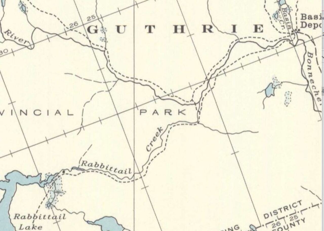 Rabbittail Lake The forecast for March 14 was sunny with an afternoon temperature of 12 degrees. Our intended route would start at an isolated Park entrance on the west side of the Bonnechere River just above Couchain Lake. This area along the Bonnechere River is managed out of MNR office located at Round Lake Provincial Park. Day passes for Algonquin Park are available at this office. We started our day at Round Lake to check whether the lake had started to open up. 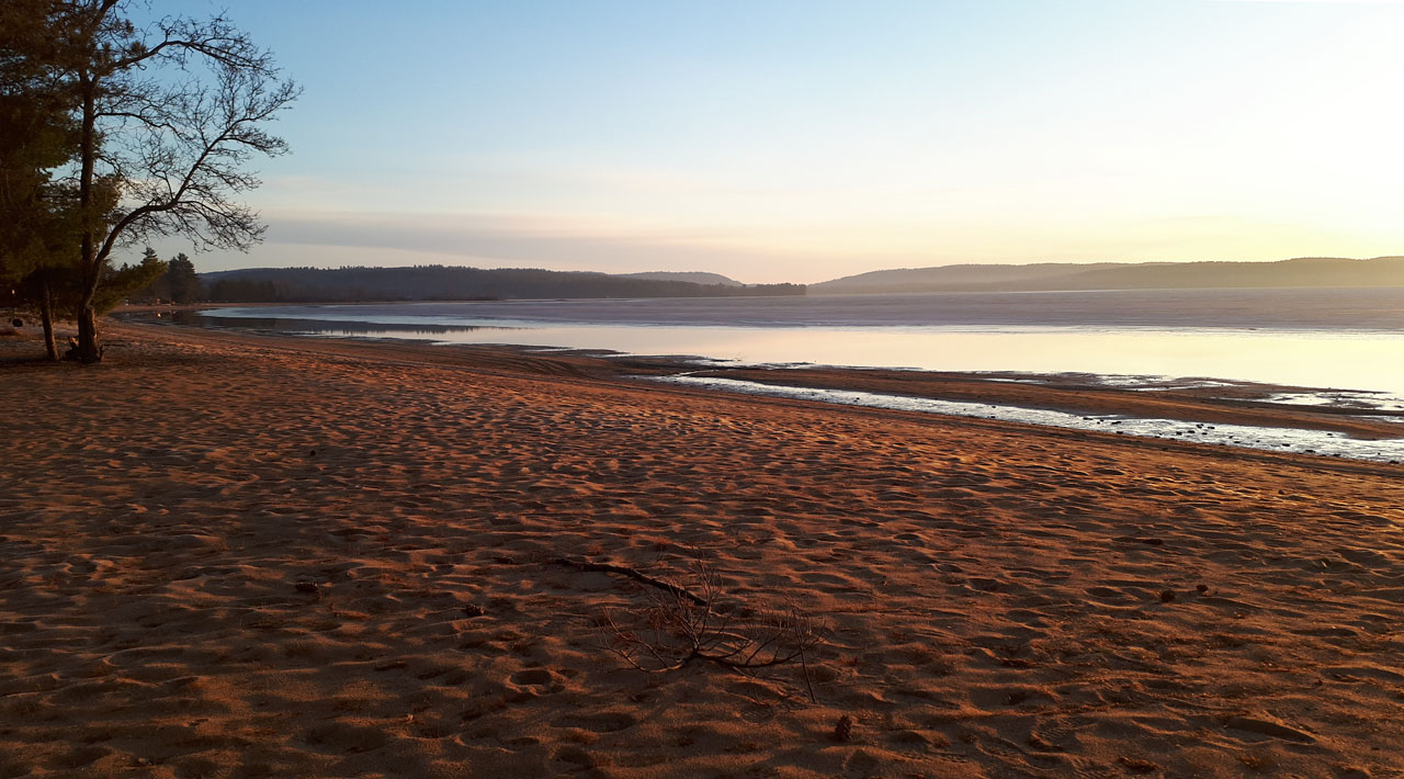 Early morning, March 14, on Round Lake looking northeast. Surprisingly, the shoreline was already free of ice. In 2023 this scene did not occur until April 6. We were able to drive along the Bonnechere River on a rough logging road. Fortunately, there had been a heavy frost overnight so the surface was not too soft. We did wonder, though, what the road conditions would be like at the end of the day. Below is a picture of the river. Any of the narrow areas of the river were wide open. The ice that did remain looked very thin.  Bonnechere River – lots of open water We parked the truck in a clearing near the park boundary where logs that had been cut in the winter had been piled, ready for transport later in the spring. It was a short hike to the Park line. 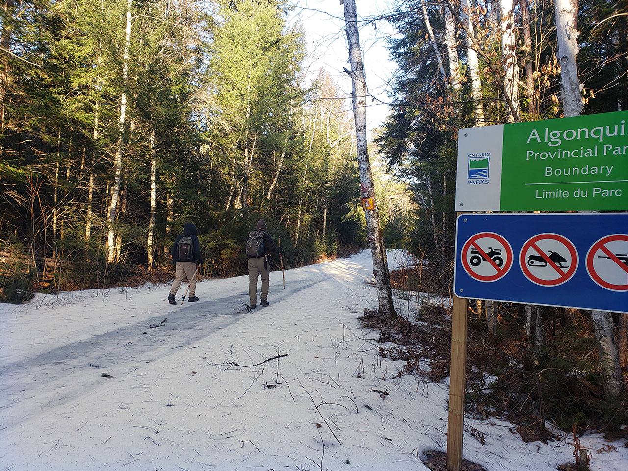 Park boundary The photo above might give the impression that hiking would be impossible given the amount of snow evident in the scene. However, the ground was bare in the bush on both sides of the trail. There had been some use of the trail near the park entrance over the winter, and in that area the snow had been packed down and was icy. From past experience we knew that even though the bush was mostly clear of snow we would still encounter snow and ice in shaded areas. 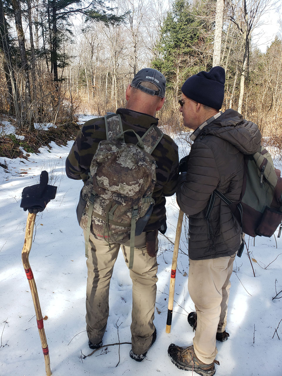 Which route to take? We had examined numerous maps and aerial photos in planning this trek, but as is always the case when hiking in the eastern corner of the park you can expect to encounter old logging roads that are not indicated on the maps or visible on aerial photos. Our plan was to try to do a loop that would take us first to the southwest, avoiding some of the steepest terrain, and then swing west toward Robitaille. The older map (above) showed a trail running along the south shore of Robitaille Creek, and our plan was to hike directly toward the creek at some point, hoping to find signs of that old trail and follow it to the lake. If we did find a trail we hoped that after getting to Lake Robitaille we could follow the creek back down all the way to a logging road that would bring us out to our starting point. With there being no marked trail for the kind of route we had in mind, this meant we would be relying on old logging roads and trails, and bushwhacking when necessary. Without a compass and GPS this would not have been possible. 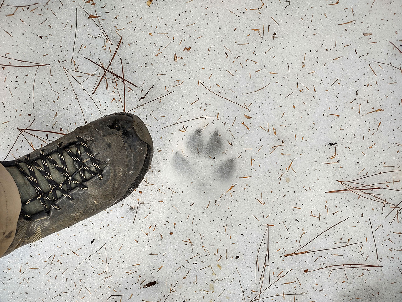 Early on the hike we came across a fresh, large wolf track The first hours of the hike involved a steady climb. After leaving the sandy soil along the Bonnechere River, which is covered primarily with white pine, we entered areas of hemlock and hardwood. Here the forest was less dense and made for easier walking. In these hardwood areas the snow had pretty much melted away completely which made for a more enjoyable hike. In the photo below the beech and oak trees still have their leaves from the previous year. 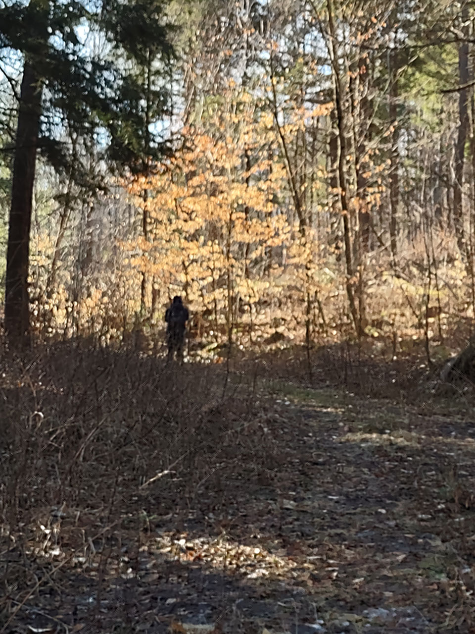 Finding a partially inflated party balloon is not something you would think you would come across deep in Algonquin Park far from any campsites. But this was the fourth time we have seen such balloons in the Park over the years – Happy New Year, Happy St. Patrick’s Day, and now another Happy Birthday balloon. I imagine if they are filled with helium, once airborne, they can be carried a long distance. In any case, we put it in our pack to carry out. 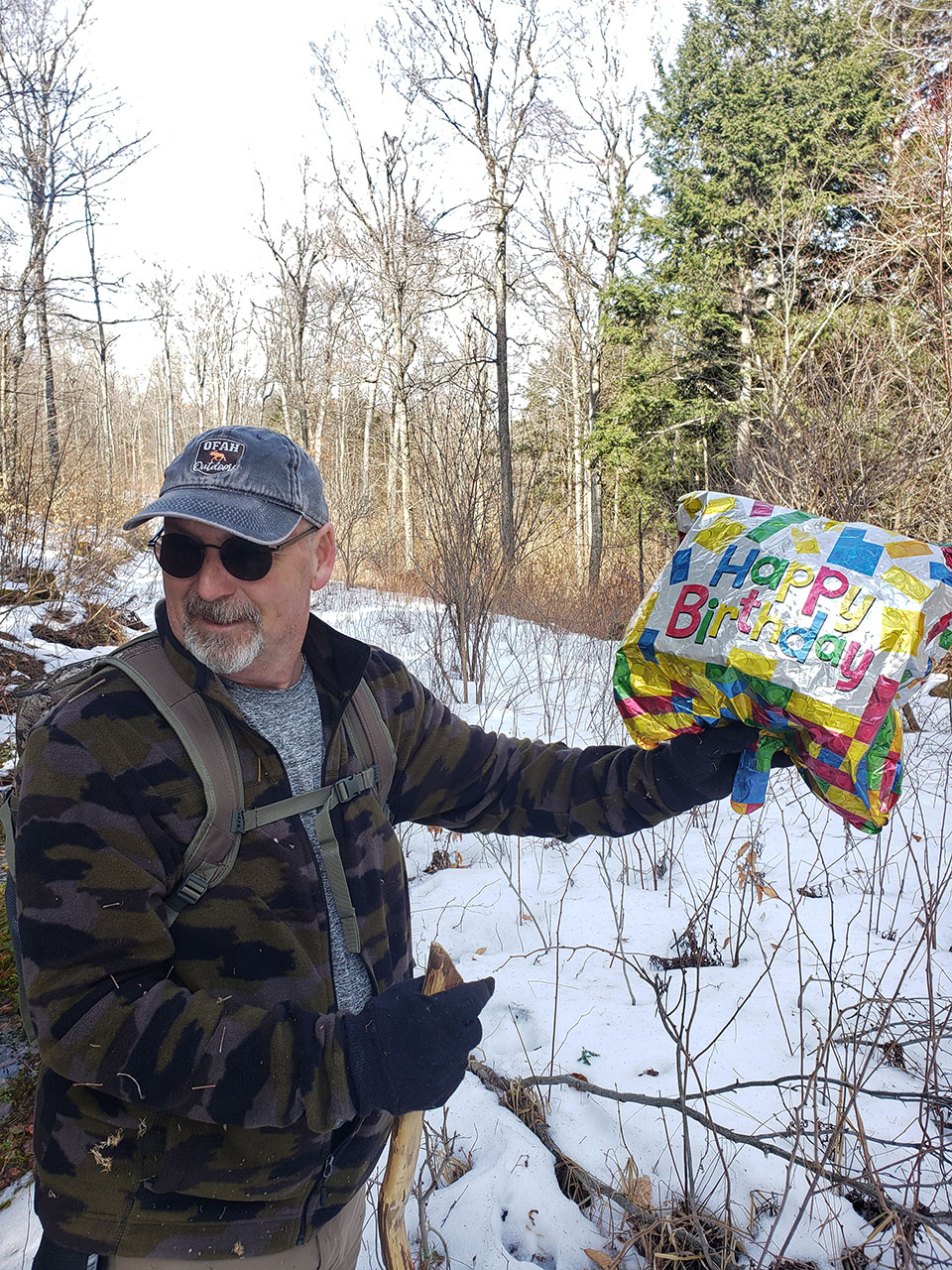 Strange place to find a balloon At 11:00 AM we were on a grown-over logging road / trail that made for very hard walking, so we decided we had best take a compass reading and head directly toward Robitaille Creek. This meant bushwhacking for about 700 meters. It was slow going, and we flagged our route just in case we did not find a trail to the lake, and in coming out would have follow the same route we had come in on. The trek toward the creek involved a steep decline. About half way down we could hear the welcome sound of rapids, so we knew we were getting close to the creek. It was a relief to find signs of a trail running along a ridge above the creek. It was located where the old maps indicated it would be. Though narrow and washed out in places there were indications that it has been used in recent years. 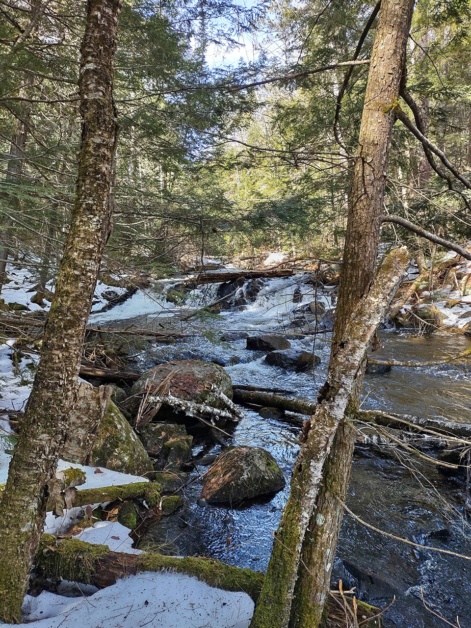 One of many rapids along Robitaille Creek  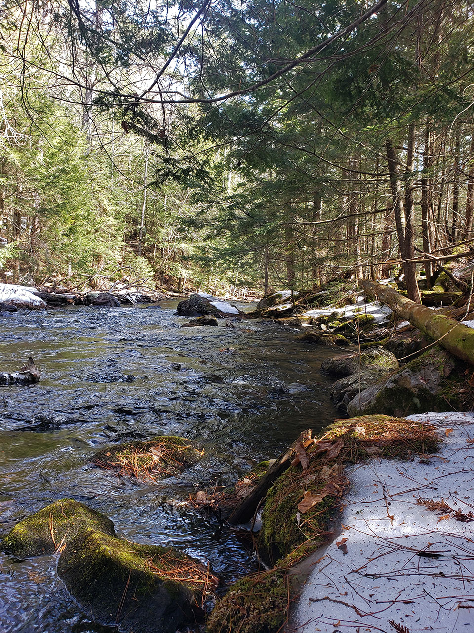 It looked as though the trail kept close to the creek so we assumed it would take us west to the lake. A GPS reading indicated it was about 3 km to the lake from the point where we came onto the trail. The path was very icy in places. The cycle of melting during the day and freezing overnight made for difficult walking, so we didn’t make very good time. But around 12:15 we could see an opening through the trees revealing a wetland which we knew from maps would lead onto Robitaille Lake. 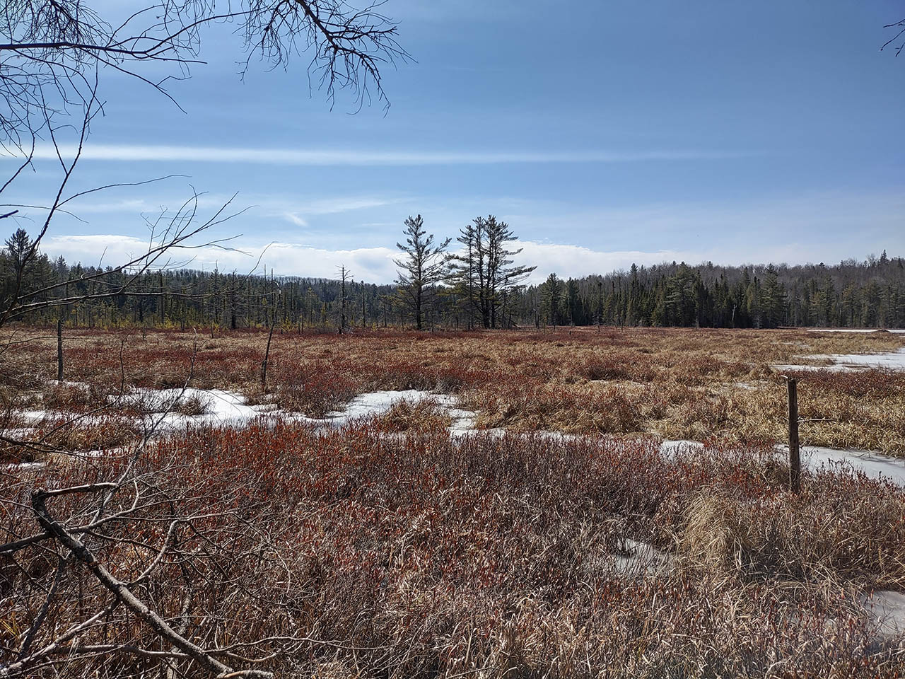 Wetland approaching Robitaille Lake We came out to the lake at the northeast most point of the lake. There were large sections of open water. We had heard geese and other waterfowl on Round Lake at the start of the day, but there was no sign of ducks or geese in the open water here. 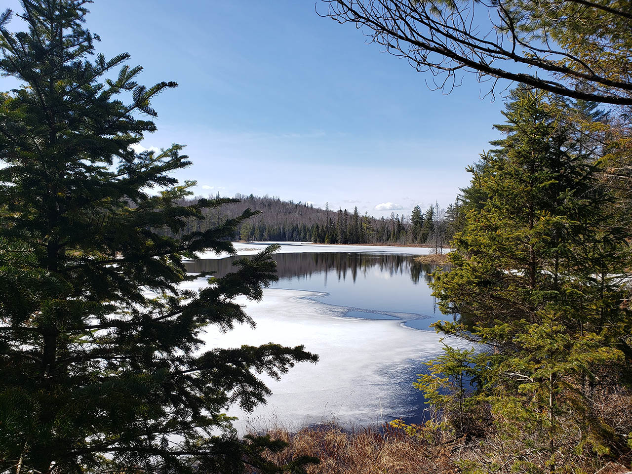 Happy to arrive at Robitaille Lake. 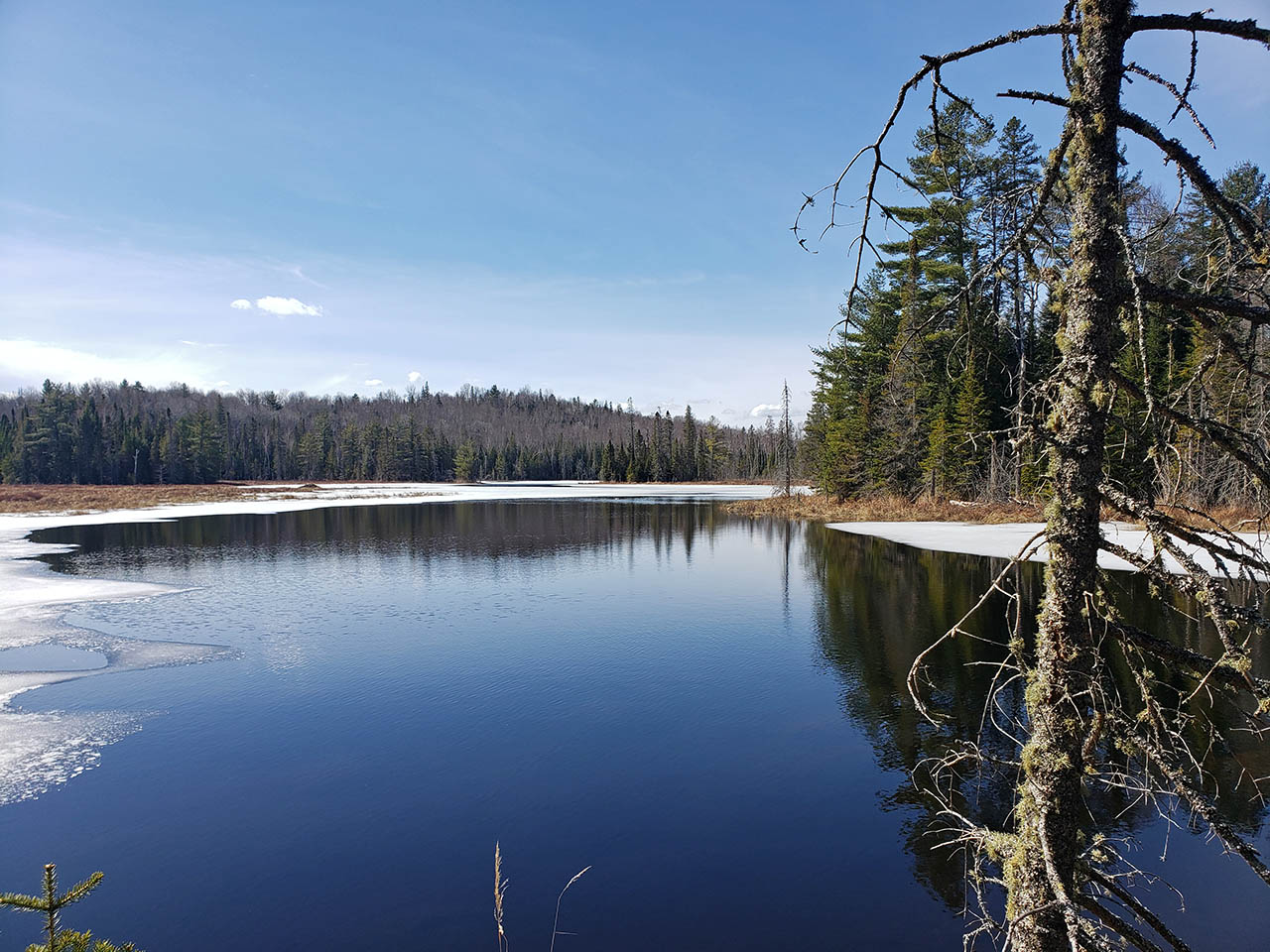 The perfect spot to stop at for lunch. 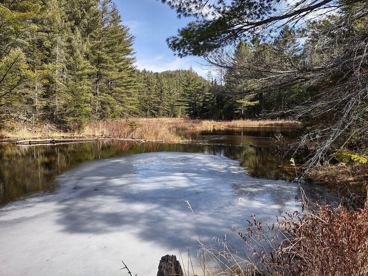 The mouth of the Robitaille Creek where it starts its run to the Bonnechere River. Before the creek meets the Bonnechere River, it flows through densely forested, shaded areas. As a result it still looked very wintry along these sections with a lot more ice– see image below. 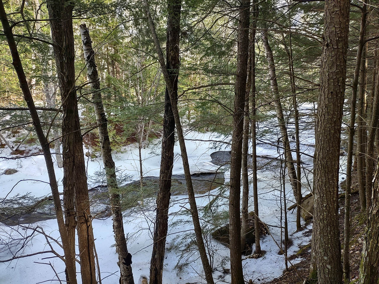 Nearing the point where the creek flows into the Bonnechere. The following map outlines our route. The graphic and a snip from a topographical map provide a sense of how steep the terrain is in this area. We started the hike at 141 m and climbed to 400 m before coming down to the lake which is at 341 m. Distance travelled: 19.2 km. Time: 6 hrs. 54 min. including a short break for lunch. It made for a great day and we were happy to have finally been able to walk the trail as our father did many years ago.
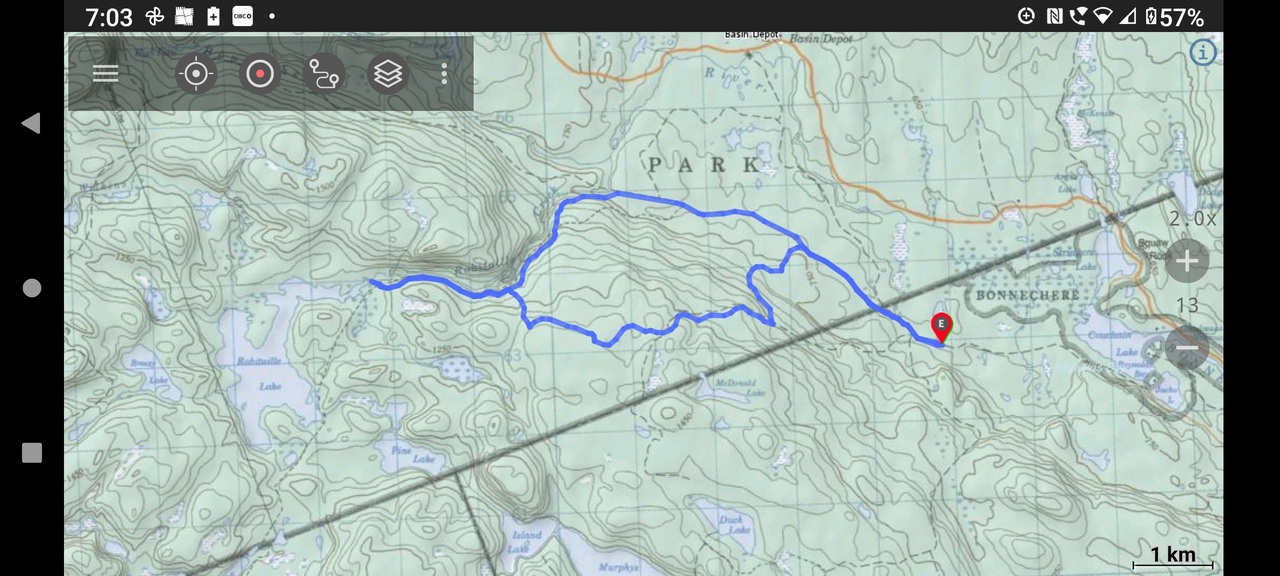 The narrowness of the space between the contour lines indicates how steep the terrain is approaching Robitaille. 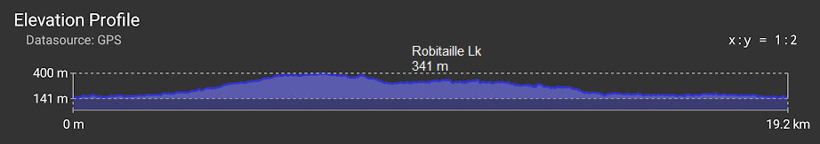 |
