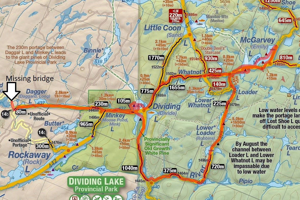
Access 14b: Dagger Lake - Dividing Lake - McGarvey Lake Loop (2 nights)
Why go there?
Access 14 is in the southwest part of Algonquin, one of the closest access points to Toronto. The lakes are smaller, minimizing the effects of wind, making this a good route for solo canoeists. The logging road from access 14 to access 14b is well maintained and navigable for most cars (from May to October only) and allows the visitors to access a very secluded, low maintenance area of Algonquin. Dividing Lake has one of the largest stands of old-growth white pine in Ontario.
Despite its relatively easy access, the canoe routes around access 14 have very few visitors, making this a true wilderness experience within 3 hours' drive of Toronto.
Getting to access 14b
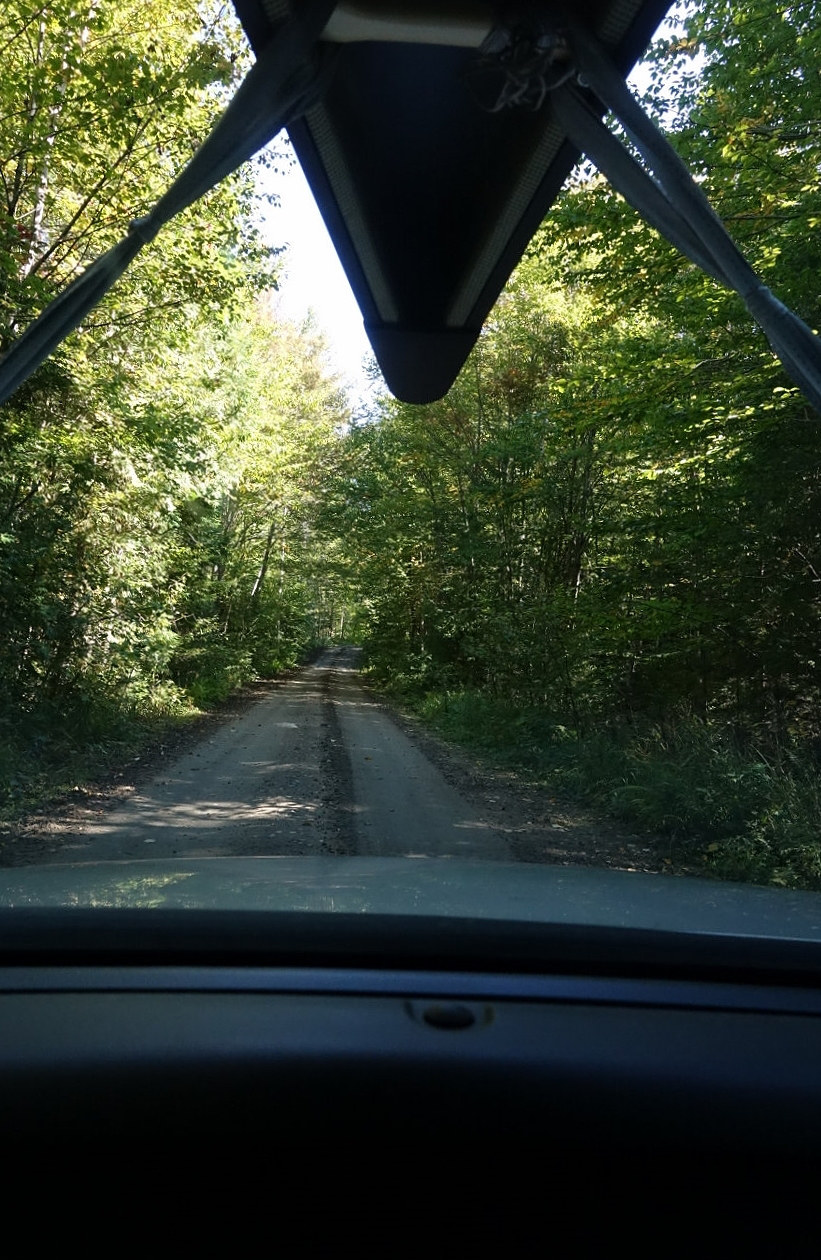
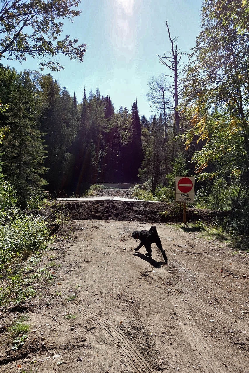
From access 14, take the Dagger Lake Access Road, a well-used logging road. There are a few culverts and some muddy spots, but this is generally a well-maintained logging road (a Toyota Yaris was seen at the end of the road in 2014). There is one important change in 2015 - the government removed the bridge over the last creek before access 14b, making it necessary to park just before the creek and portage an additional 150 meters. This is a very easy portage along a logging road that takes an additional 5 minutes. This access puts you in the middle of a very secluded wilderness.
 |
|
| Map of trip | |
Challenges
There are several low-maintenance portages in this loop. The start and end of portages are still marked with the yellow portage signs, but there are some differences from regular portages: the portage landings are usually more rocky/mucky and generally harder to access, and the first 100 meters at each end is usually rocky/mucky due to proximity to the lake. Expect a few blow-downs on the path, generally you can either go around or try and go over them.
If you have never travelled along a particular low-maintenance portage before, it's usually a good idea first scout the portage (at least the start), and not attempt a single carry with the canoe on your head that limits your vision of the trail. If you If you are ever unsure, always stop and reassess. Signs that you are still following a portage (and not a game trail) include: cut logs and branches; footprints; garbage.
Dagger Lake - Dividing Lake - McGarvey Lake Loop
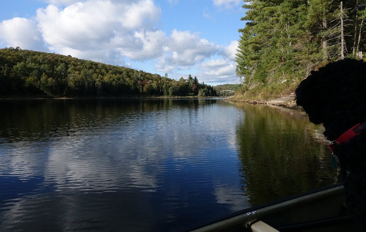
I started the trip by leaving home at 7AM from London with Chewy the golden doodle. We arrived to the missing bridge just before access 14b at 12:45. After some consideration, Chewy decided that we must forge onward. After a 6-minute carry, we arrived to the western end of Dagger Lake.
 |
|
| Logging road in good shape | |
 |
|
| Missing bridge | |
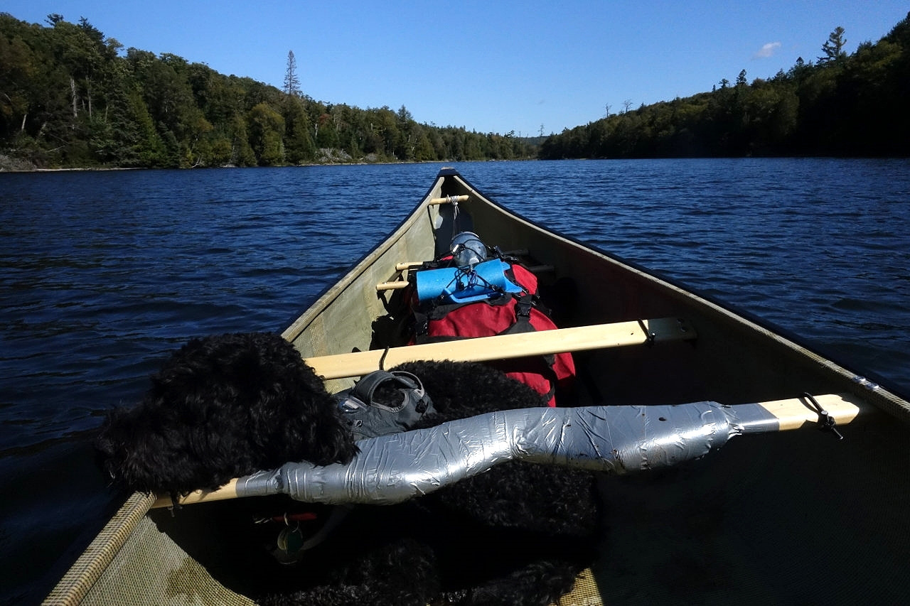
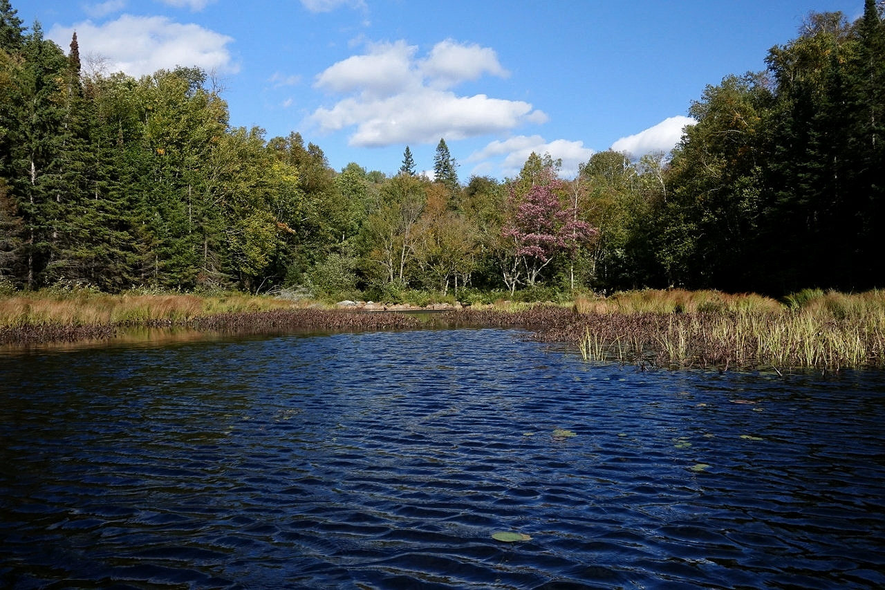
This lake is not a part of Algonquin Park, but is on crown land. However, with no cottages lining the shore, it is a perfect introduction to the solitude of this part of the park. There is an unmaintained campsite with a tent pad and a fire ring at the put in.
 |
|
| Dagger Lake | |
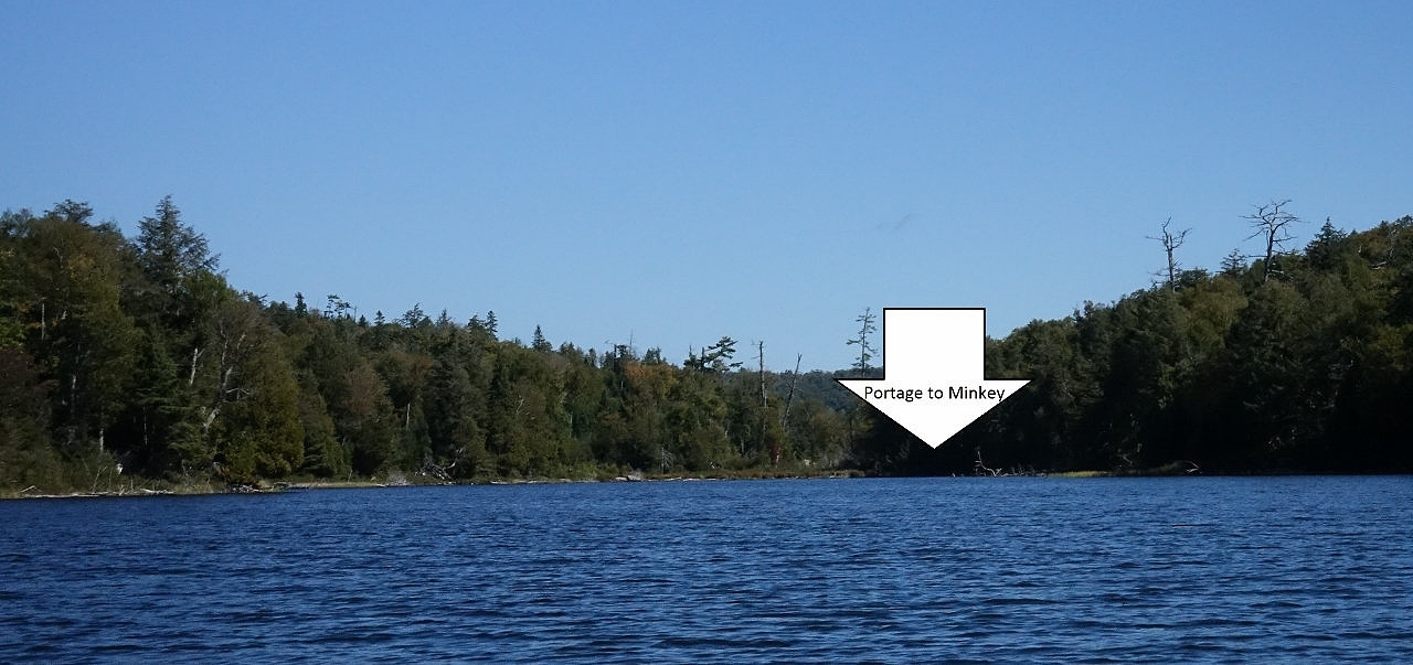
After a 30-minute paddle with the wind at our back, we arrived to the eastern end. Jeff's Map incorrectly marks the portage as starting on the north side of the lake, and to add to the confusion there is a portage landing on this side. However, this is the wrong portage. The portage into Minkey Lake is on the south side of the creek, hidden in the shadows.
 |
|
| Minkey Lake standing dead wood | |
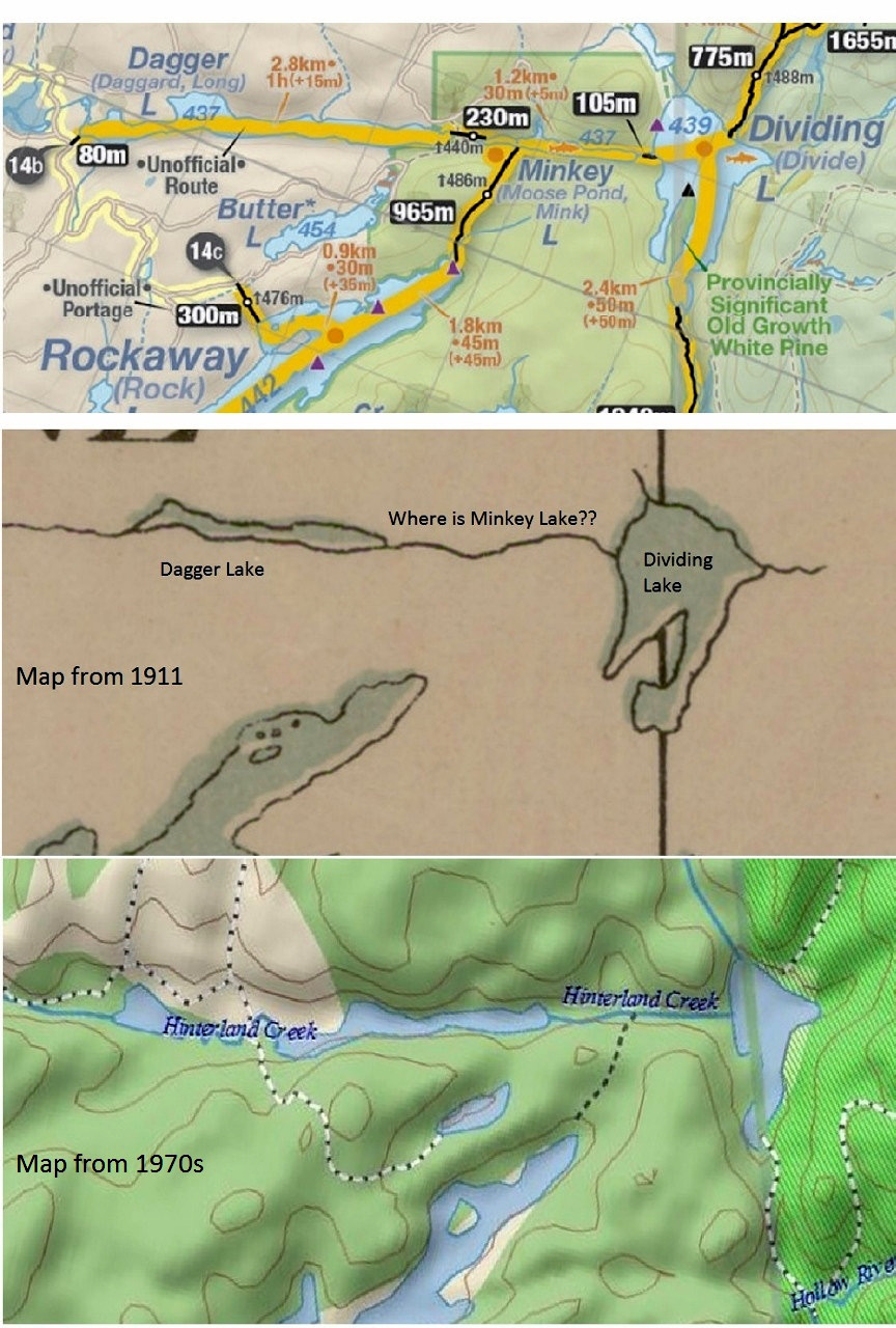
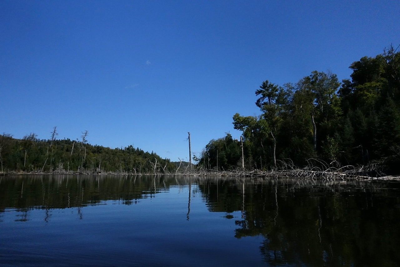
The 230-m portage into Minkey Lake passes an abandoned dock, ending at the large beaver dam on the west shore of Minkey Lake. The lake itself is lined with standing deadfall, and is labelled as Hinterland Creek on older maps. I suspect that the beaver dam is no more than 30-40 years old, resulting in the relatively recent creation of Minkey Lake.
 |
|
| Maps of Minkey Lake from 1911, 1970s and 2015. Those crazy beavers! | |
 |
|
| Minkey Lake standing dead wood. Thanks for the new lake, beavers! | |
A quick 15-minute paddle takes us to the 100-m portage into Dividing Lake. The portage is steep, but reasonably well maintained. The landings are a bit tricky with several fallen logs on both sides. Dividing Lake got its name from the large peninsula that� divides the lake into east and west parts. There are two campsites, the campsite on the peninsula is quite large with a good landing and a view of the sunset, while the campsite on the northern shore is smaller with a tricky landing and morning sun. I continued past the peninsula to the 1040m portage into Hollow River. This portage is very flat and travels along a bog, and is very buggy in the summer. There is quite a bit of muck on the first third part of the portage, and Chewy fell into the bog up to his belly at some parts. I was able to hop and skip along the logs and bogs� until I slipped, fell into the muck and sprained my ankle. Somehow, I managed to keep the canoe on my shoulders, and scrambled out of the muck. I was so high on adrenaline that I finished the 1-km portage at a record-setting pace of 15 minutes.
 |
|
| Hollow River | |
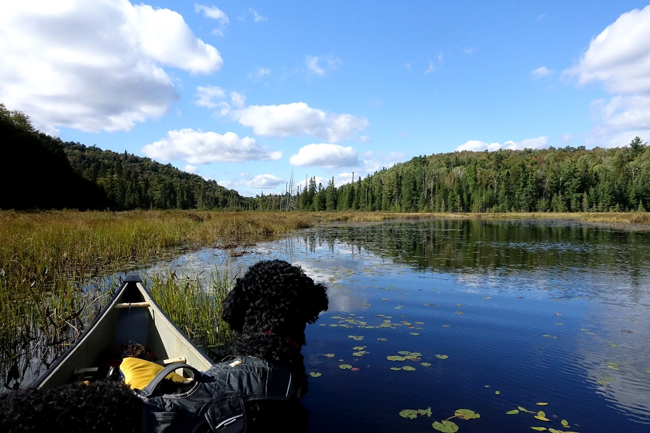
The portage ends at Hollow River that meanders slowly until a 375-m low maintenance portage into an unnamed pond. This leads to another low maintenance portage, this one measuring 720 meters. In my opinion, this is one of the most difficult portages in Algonquin Park. The north end of the portage is incorrectly mapped on Jeff's Map (version 5), and actually ends in the southernmost point of the lake. The portage itself is very poorly marked, and if coming from the north end it's easy to get lost by taking one of the game trails (that are used far more than the portage). By the time I reached the portage the adrenaline wore off, and the ankle sprain was starting to hurt. I couldn't single-carry my pack and canoe together. After about 45 minutes, I was on my way to the Lower Loader Lake.
 |
|
| Maple tree at the beginning of the 720-m portage. | |
 |
|
| Continuing on Hollow River. | |
There are two campsites on the Lower Loader Lake, the south site being the better of the two. The north site backs onto a bog and I can imagine a hot, humid nightmare of an August evening. The water levels are generally fine until you close to the portage at the north end of the lakes - at this point the water level was quite low and required some poling of the canoe.
The 225-m portage from Lower Loader into Loader Lake was the last of the day, and the ankle was the size of a grapefruit. Thankfully this was the last portage, also poorly marked (especially in the middle section through the forest. This portage also took about 45 minutes as I triple-carried (Chewy helped out by carrying his share - the RuffWear doggie backpack really came in handy). By this point it was about 4PM, and I was keen to get to my site. There was a quick paddle through Loader Lake that led to the creek that cut across a bog. The water level was low, and I had to push along rather than paddle - but this was late in the season and I was happy that I didn't have to get out of the canoe and gimp along.
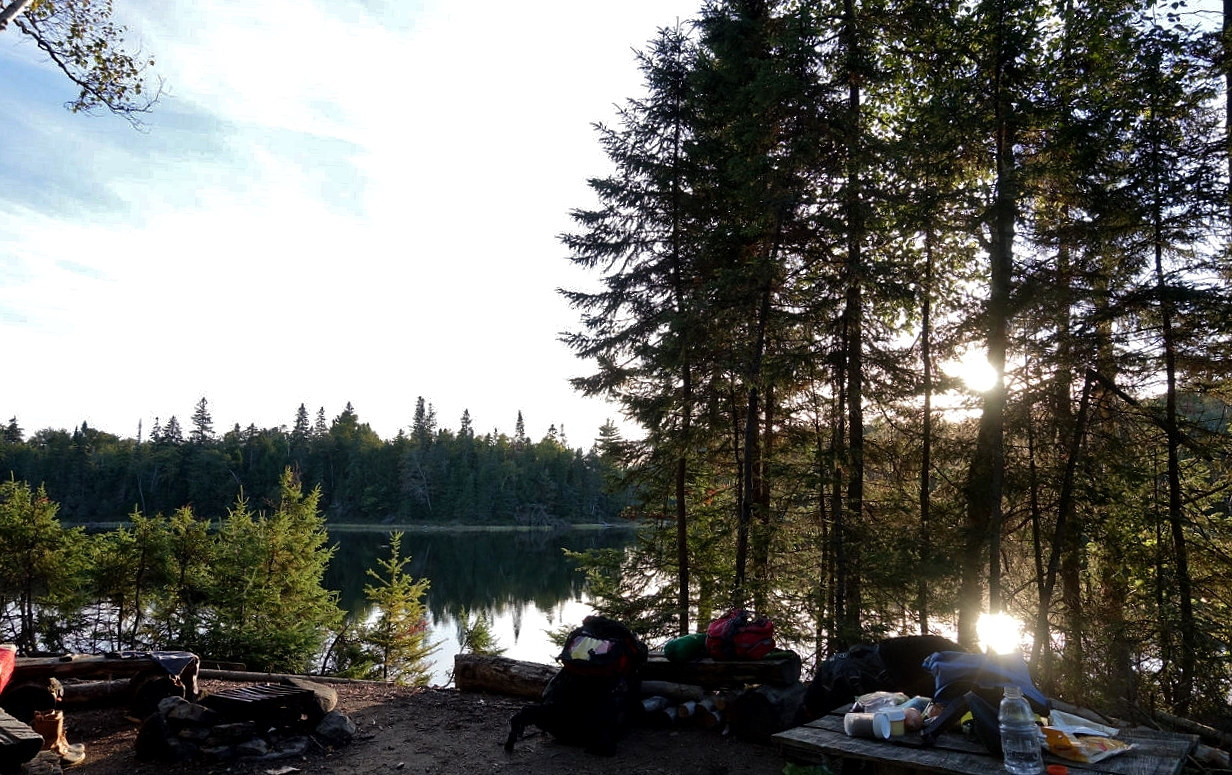
McGarvey Lake opens up from west to east, and I took the first campsite on the west end of the lake. It had a lovely beach landing, and a massive tent area. Overall, this is a well-used site, and I suspect that the popular route to access this part of the park leads from Little Coon Lake. At this point, I was hopping on one foot, so I quickly unloaded the canoe and inspected the campsite. The weather was beautiful and it was clear that there was no chance of rain. I got the fire going and made dinner.
 |
|
| Sunset on McGarvey. | |
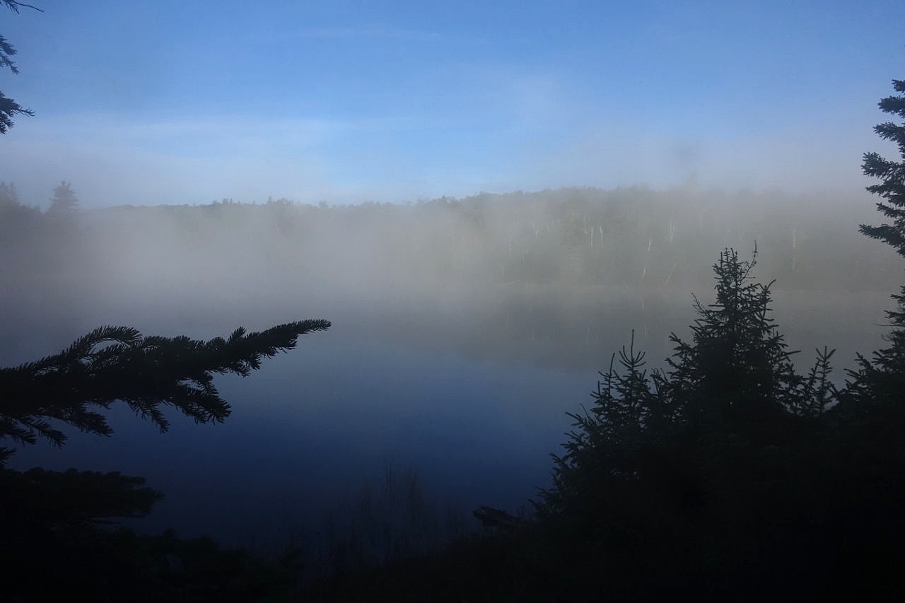
Inspired by the gorgeous weather, I decided to sleep under the stars in the middle of the 30-foot open tent area. The temperature dropped to 5oC overnight, but my sleeping system of inflatable pad and quilt kept me toasty (I did wear a toque and the down sweater). I woke up a couple of times overnight due to the pain in the ankle and my anxiety about the remainder of the trip. The only way back home was to backtrack (over the brutal 720-m portage) or continue forward (over a 2400-m portage over easier terrain). I had nightmares of getting an SAR evac for a sprained ankle. The nice thing about my restless sleep was that I was able to look up at the millions of stars from my sleeping bag, it was quite a sight. The fog rolled in around 5AM, and the sleeping bag got a bit damp, but I was still warm.
 |
|
| Sunrise | |
I finally decided to get out of bed at 7AM, made some tea and had three granola bars. The cold breakfast really speeds up the packing process in the morning, allowing for a quick start before the winds pick up. The ankle hurt, but not as badly as the night before. I decided that to keep going. I took out the duct tape that came with the First Aid kit and discovered it was of very poor quality (not very sticky). I taped the ankle and chased my breakfast with 800 mg of Advil and 1g of Tylenol (I paid for the high Advil dose with awful heartburn for the next three days). The sun was just coming up around 8:30, so Chewy and I set off.
 |
|
| Island site on McGarvey. | |
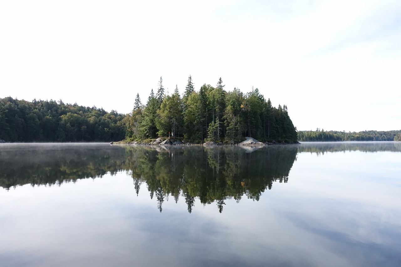
We explored McGarvey Lake, and I think it is one of the prettier lakes in the park. There is a lovely island campsite, and a site in the east end that is quite sheltered (and pretty buggy in the summer). We then made our way back west. I was apprehensive about the upcoming portage, but the Advil was starting to work. I was able to bear the weight of the pack and the canoe, and we completed the portage without a problem. A short paddle across Whatnot Lake brought us to the longest portage of the trip: low maintenance and 2430m. The portage landing was poorly maintained and the first 100 meters were rocky, but after that, the portage turned into a beautiful walk in the woods. We stopped twice, after the first 80m, and at the fork with 775m left. The entire portage took 85 minutes, and by the end the ankle was warmed up and almost didn't hurt at all.
 |
|
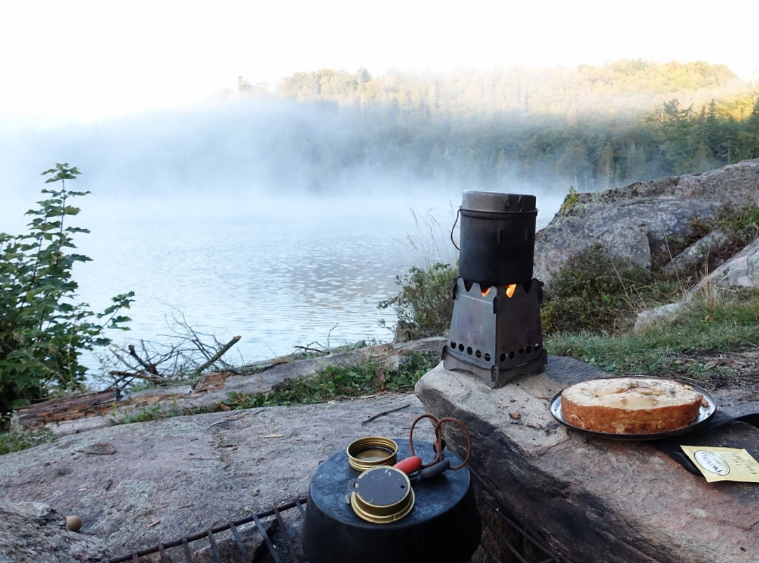
| Baking a cake with Frybake. | |
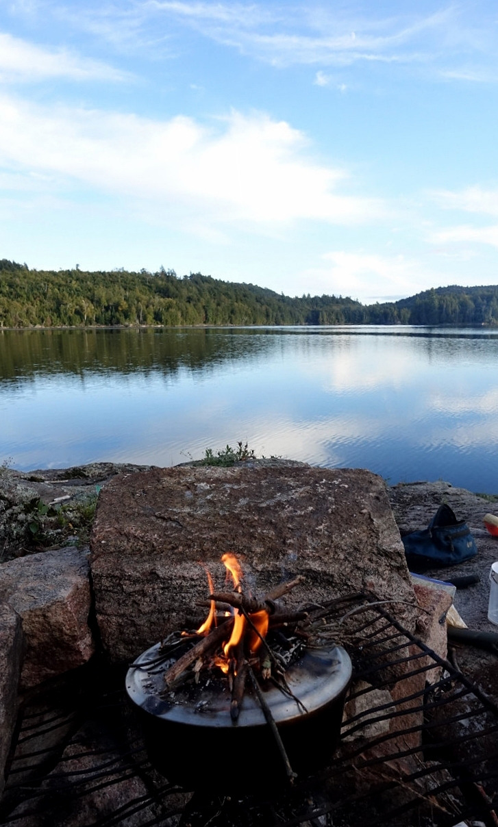
Feeling refreshed, I made soup at the end of the portage while lounging on the rocky shore of Dividing Lake. My anxiety about the ankle was gone - the hard part of the trip was over, and I could crawl back to the car if I had to. We set up camp on the north campsite, which is quite small but has a nice view of the lake. The rest of the afternoon was spent baking a cake and reading. In the morning, I packed up by 8AM and was back at the car by 10AM.
 |
|
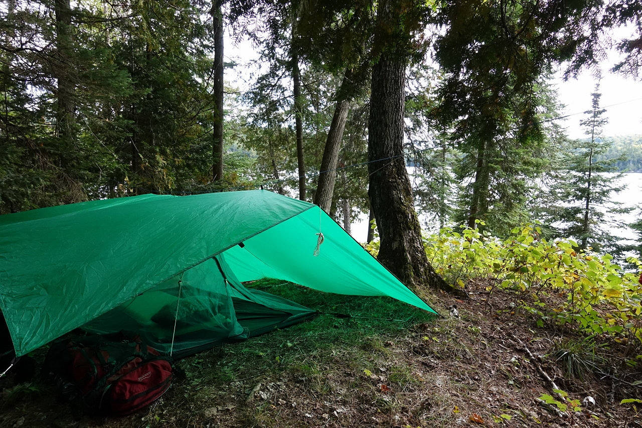
| Tarp setup with bug shelter. | |
 |
|
| Leftover cake for breakfast anyone? | |
The ankle sprain was a bit of a challenge, but it was good to see that Advil and Tylenol can allow me to function well enough to get out of a jam. The weather was beautiful and I did not see a single person the entire time. Great trip, and next year I'll make it a bigger loop by visiting Lake Louisa.
 |
|
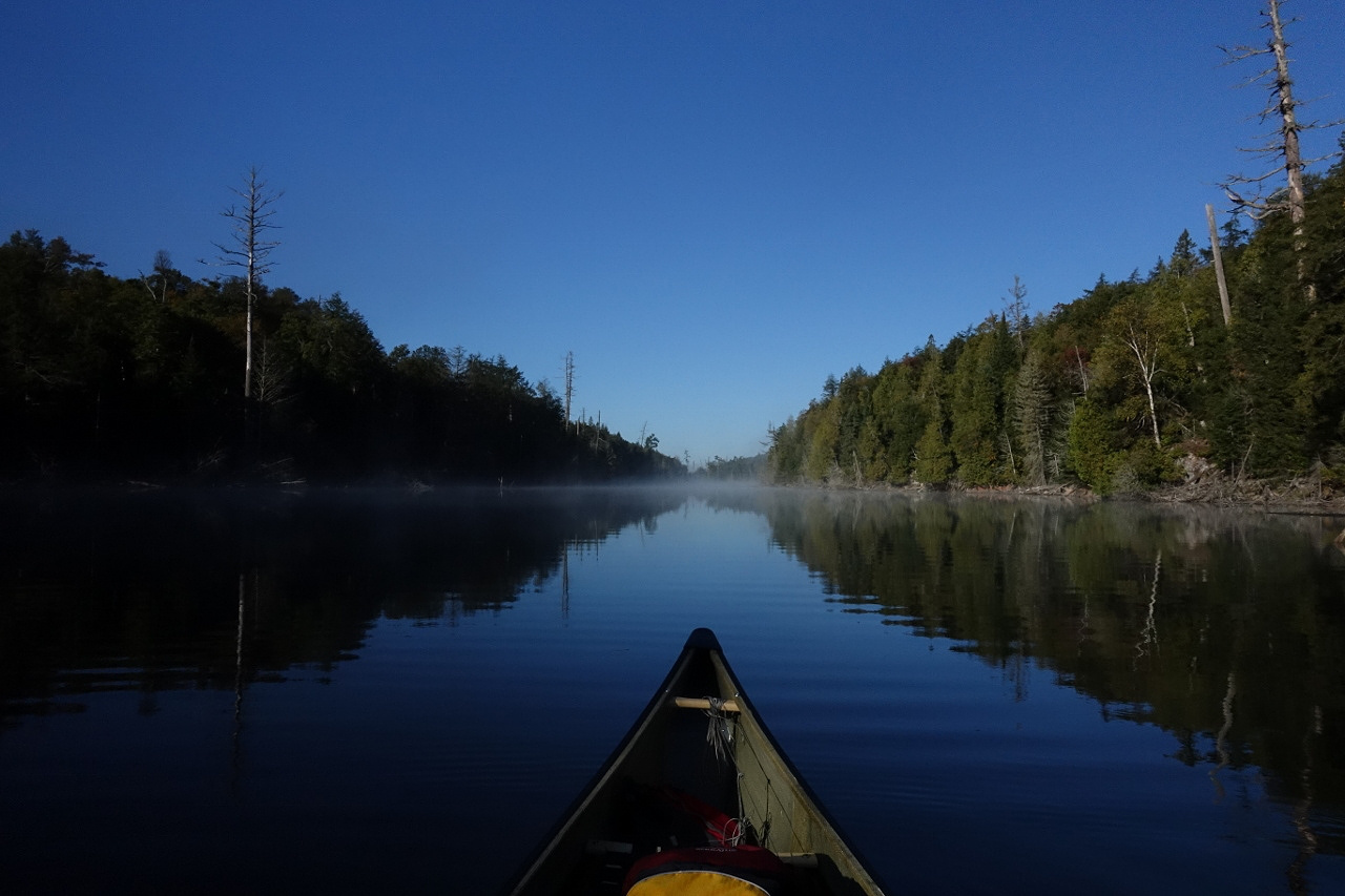
| Back on Dagger Lake | |
| Editor's Comments: Backcountry tripping with one's canine friend can be a very positive and rewarding experience. For some precautionary information about caring for one's dog in the backcountry, please refer to the park's own Pets In Algonquin Park. |