 Ragged Lake Campsite #11
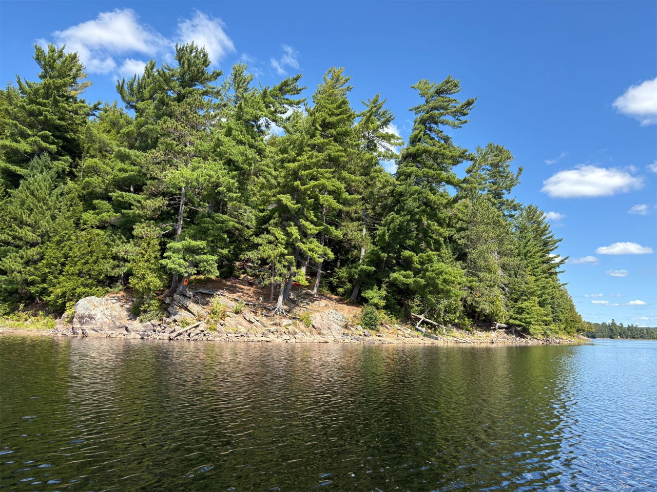
Landing
Topography of under-water approach: Rocky, but deep to avoid concern.
Impediments to disembarking from and/or unloading a canoe: Navigate and balance around rocky shore.
Topography to tent sites: Coming up from the landing, there is about a 10 meter steep elevation leading to the firepit and the main tent site areas. There are several medium tent sites beyond the perimeter of the fire pit, but the terrain is littered with (tripping) roots.
Viewing the site from the south the rock facade gets nice sun exposure with steep access to the core well sheltered ...
![]()
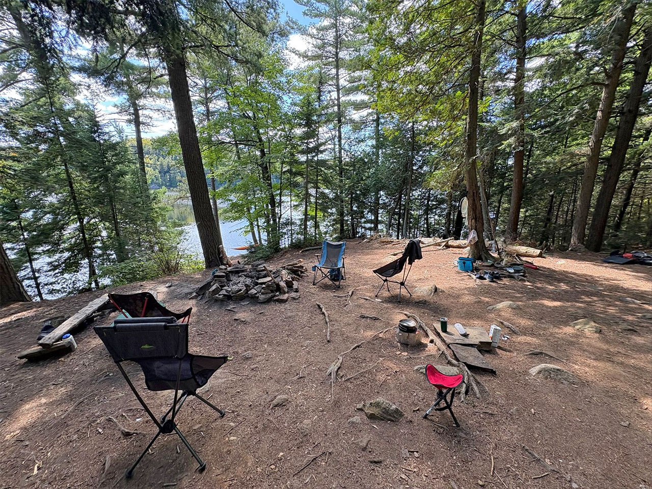
Looking south over the generous firepit the lone bench became our meal prep station.
We brought over some flagstone to act as heat resistant surfaces for camp stoves ...
![]()
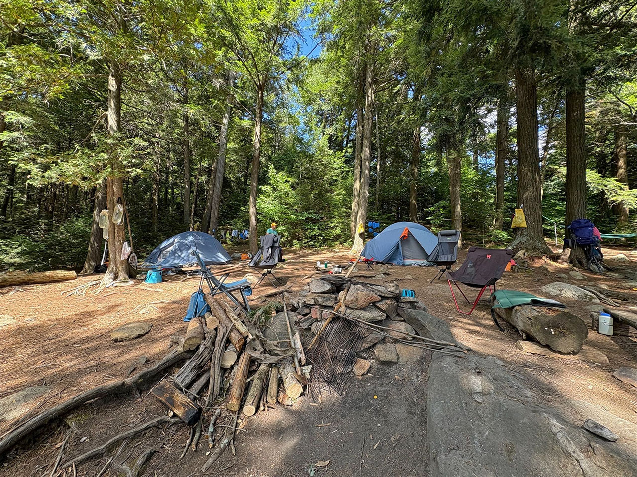
Looking north over the firepit revealing the large tent pads we used.
The thunderbox was in good shape and is located out of sight up the hill to the left of this photo. ...
![]()
Campsite
Regular or low-maintenance: Regular.
Size of open ground area: Very open, large.
Extent of tree cover: Tent sites have reasonable coverage, well sheltered from any major winds.
Degree of levelness: Mostly not level. The couple of tent pads we used were okay.
Number of tent sites: 2 large, plus maybe 2 small.
North exposure: Forest.
East exposure: Trees, and the path that eventually leads to site #12.
South exposure: Obstructed view of the lake.
West exposure: Trees.
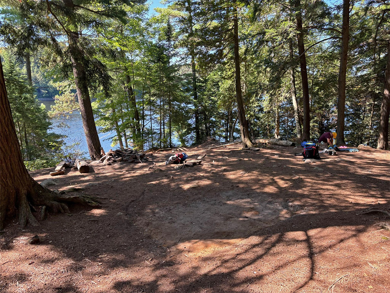
Looking south and showing a better idea of the bare site overlooking the tent pads with the obstructed view of the lake. ...
![]()
General description: Overall a large campsite that is quite open but relatively sheltered to the prevailing winds. Nice deep water right off the shore for swimming, and the southern rock face makes for a nice viewpoint to star gaze. There is a bonus tent pad along the path towards site #12.
Overall accessibility: Landing is simple enough, but the slope up to the firepit and tent sites is a deterrent. Lots of roots throughout and the significant slope down to the rocky shore makes occupying the site a bit of a chore.
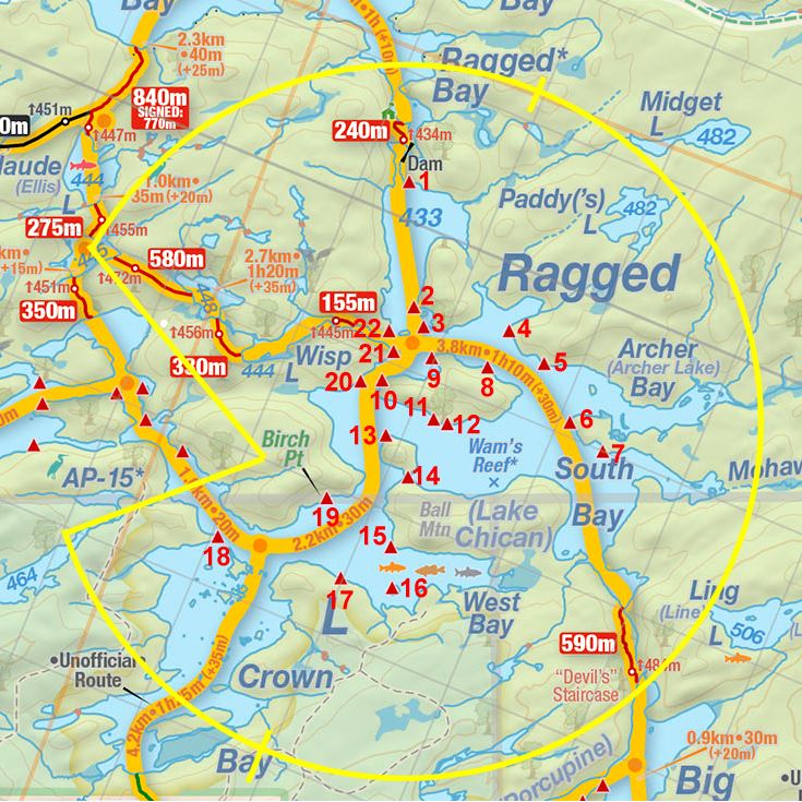
Thanks to Jeffrey McMurtrie of Jeff'sMap for supplying the base-layer map component by Creative Commons licensing.
Submission: June 2026 by Matthew Guenette .. visited September, 2025