 Otterslide Lake Campsite #4
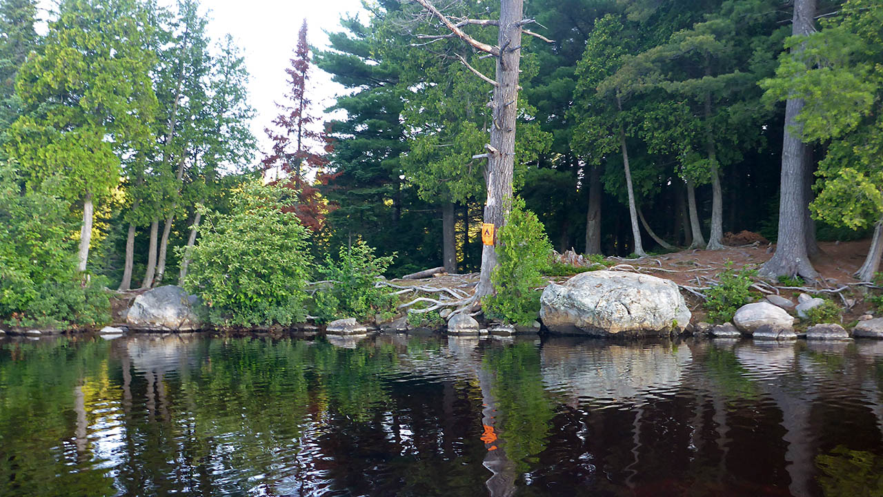
Landing
Topography of under-water approach: Silt, rock, and gravel.
Impediments to disembarking from and/or unloading a canoe: No real landing area, must stand in knee deep water, or reach down from rocky shore to unload.
Topography to tent sites: Unloading puts you on the site.
|
|
| Not much to choose from to use as a landing. | |
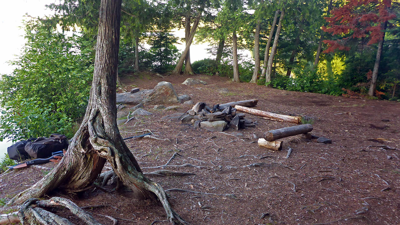
Campsite
Campsite maintenance: Regular.
Size of open area: 10m x 5m.
Extent of tree cover: 20%.
Degree of levelness: Somewhat level.
Number of level tent sites: 1.
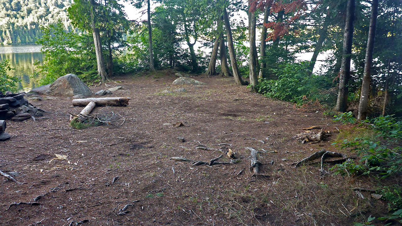
North exposure: Trees.
East exposure: View of lake.
South exposure: View of lake.
West exposure: View of lake.
General description: Small site with 1 flat and level tentpad, though in a pinch a 2nd tent could be squeezed in. Very little protection from the sun or wind.
Overall accessibility: With the rocky eastern shoreline, it is challenging to load/unload a canoe and just as challenging to get in or out of one. Accessing the site from the southern or western shoreling is not an option because of trees..
|
|
| Firepit. | |
|
|
| Looking southwest over the entire site. | |
Thanks to Jeffrey McMurtrie of Jeff'sMap for supplying the base-layer map component by Creative Commons licensing.
Submitted by Chris Taylor .. Visited July, 2017 .. Submission February 16, 2019