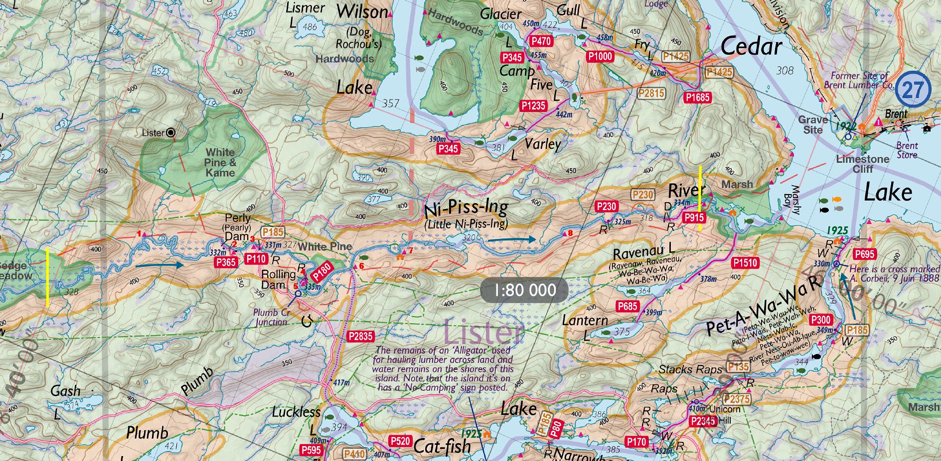
 Portage 2835m Luckless Lake to Nipissing River
Length of portage: 2,835m meters
Portage maintenance regular or low: Regular.
Elevation above Sea Level @ Luckless Lake ~ 394 meters
Elevation above Sea Level @ Nipissing River ~ 320 meters
Difference in elevation: 74 meter drop between Luckless L. and Nipissing R.
Portage Trail general description: This portage has a steep hill at the beginning of the portage (Luckless Lake). Once to the top of the hill, it is all downhill to the Nipissing. The portage peaks at 417m for a total difference in elevation of 97m. A large portion of the portage follows an old logging road so it is wide and flat, but at a downhill slope. Nice portage.
Landing at Luckless Lake
Topography of under-water approach: Rocks and sand
Impediments to disembarking from and/or unloading a canoe: Large rocks
Large rocks ...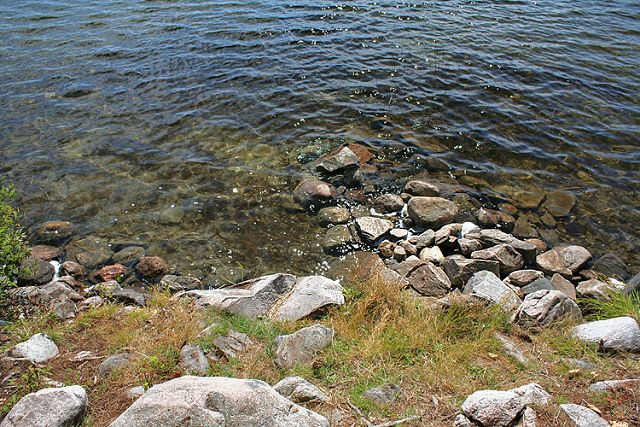
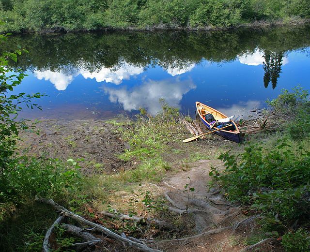
Landing at Nipissing River
Topography of under-water approach: Soft bottom mud
Impediments to disembarking from and/or unloading a canoe: Steep bank between river and portage path. Muddy. You sink if you do not stand on branches laid out on ground.
Steep bank ...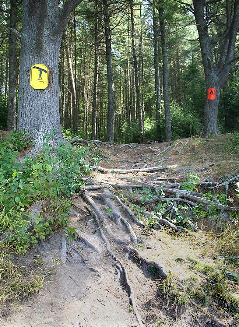
Muddy shoreline ...
Thanks to Jeffrey McMurtrie of Jeff'sMap for base-layer map component by Creative Commons licensing.
Submitted by Sean Rowley, visited 2009, submitted Sept 12, 2009.