 Portage 230 meters - Nipissing R. to Nipissing R. (Upsteam of Cedar L.)
Length of portage: 230m meters
Portage maintenance regular or low: Regular.
Elevation above Sea Level @ Nipissing River upstream ~ 320 meters
Elevation above Sea Level @ Nipissing River downstream ~ 318 meters
Difference in elevation: 2 meter drop between Nipissing and Nipissing
Portage Trail general description: Fairly good portage with some rocks and roots and mild hills. The portage peaks at 325m for a total difference in elevation of 7m.
Topographical impediments to traveling: Rocks and roots
Landing at: Nipissing (upsteam)
Topography of under-water approach: Rocks
Impediments to disembarking from and/or unloading a canoe: Rocks, gravel and hard packed dirt
Upstream landing ...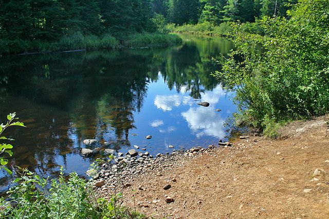
Landing at: Nipissing (downstream)
Topography of under-water approach: Rocks, gravel and hard packed dirt
Downstream landing ...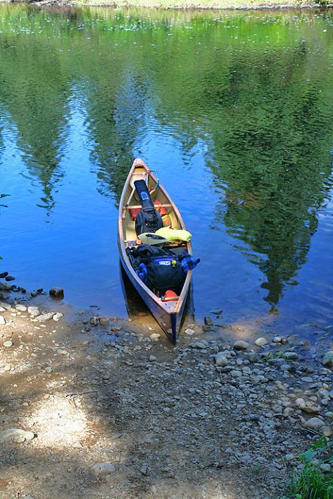
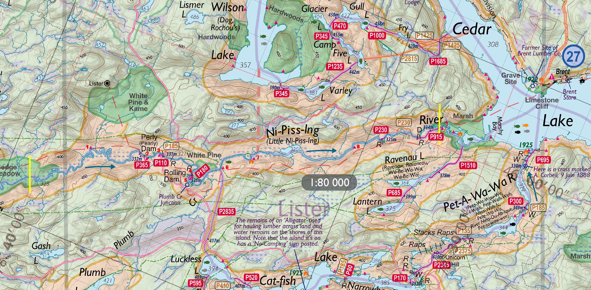
Thanks to Jeffrey McMurtrie of Jeff'sMap for base-layer map component by Creative Commons licensing.
Submitted by Sean Rowley, visited 2009, submitted Sept 12, 2009