 Lake Lavieille Campsite #9
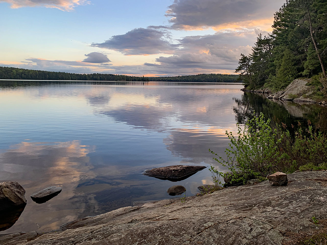
Landing
Topography of under-water approach: The underwater terrain is rocky with a gentle slope.
Impediments to disembarking from and/or unloading a canoe: There is room for many canoes/kayaks. The rocks can sometimes be slippery.
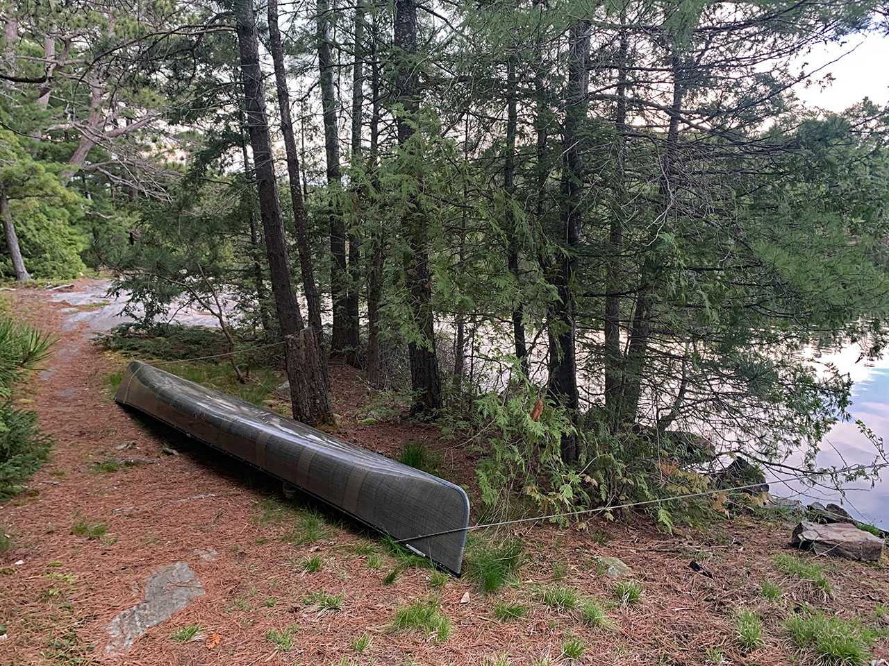
Topography leading to tent site: Well-worn paths over flat rock with a few exposed pine and hemlock roots.
Note: The landing and another island on the south side provide some wind protection.
A canoe take-out/put-in ...
![]()
Looking south, where two distinct canoe take-out areas are separated by trees in front of the canoe ...
![]()
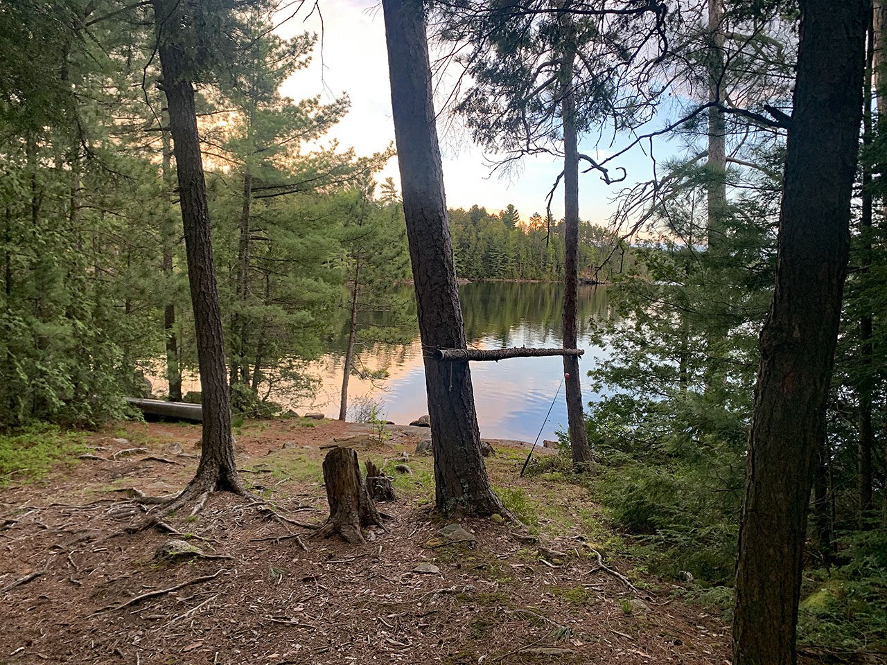
Looking south toward the landing areas on the path to the campfire pit ...
![]()
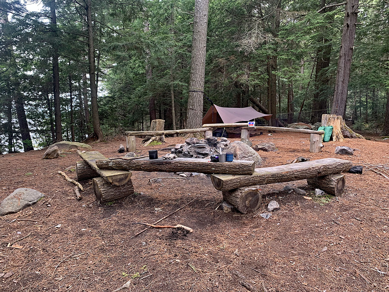
Campsite
Size of open area: This is a large campsite that feels very open, with most of the site covered by large, mature hemlock trees.
Extent of tree cover:ĀSufficient tree cover to protect from the wind. Most of the campsite is dominated by large, mature pine and the more common hemlock trees.
Degree of levelness: Generally pretty flat.
Number of level tent sites:ĀMany flat places for tents. This large campsite can accommodate many tents and/or hammocks.
General description: A large campsite with many flat areas for tents. Due to a campsite shortage on Lavieille over the May long weekend, this shared campsite accommodated 3 tents and a hammock. There are a number of flat areas ideal for tents.
Overall accessibility: The thunderbox is in a pretty private area a distance away from tent pads and the firepit seating area.
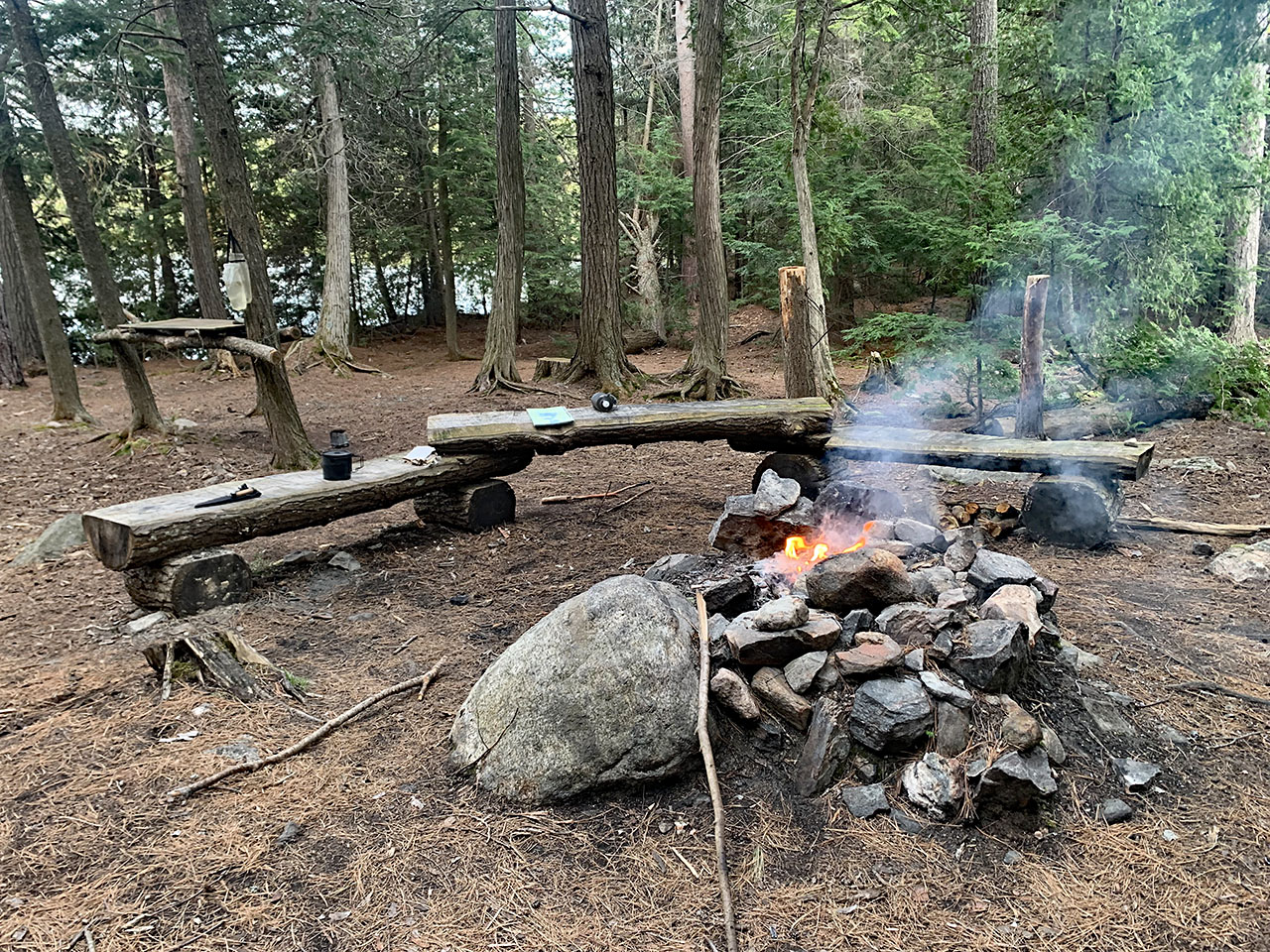
Looking SW toward the firepit ...
![]()
Looking NE toward the firepit ...
![]()

Thanks to Jeffrey McMurtrie of Jeff'sMap for supplying the base-layer map component by Creative Commons licensing.
Submission Feb., 2025 by 'Dwight' .. visited May 24, 2024