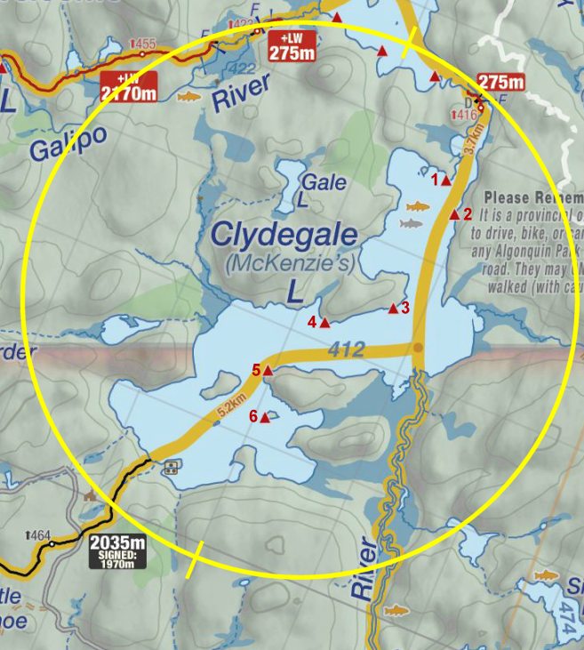
 Clydegale Lake Campsite #4
Landing
Topography of under-water approach: West side is rock and gravel, with a quick drop-off. The smaller eastern landing has one area approximately the size of a canoe with gravel and small rock. The rest of this landing area is not useable because of larger loose rocks.
Impediments to disembarking from and/or unloading a canoe: The whole west side of site is a large rock with ample room to unload. On the eastern side of the point is a smaller landing that makes for an easier carry to site. However, it only has room for one canoe at a time. Multiple canoes can be easily stored on the west side of the point.
Topography to tent sites: The west side is rock with some areas being moss covered, with a steep incline to site. The east landing is a less severe incline with a mossy/grassy/pine needle path transitioning to rock, with an estimated 6m elevation to the site.
The small landing is just visible on the right ...

![]()
Lots of loose rock at shore and in water make small area at left only useable spot ...

![]()
Small landing area on east side of point. ...

![]()
Climb from small landing area is slippery when wet! ...

![]()
Campsite
Regular or low-maintenance: Regular.
Size of open ground area: see sketch.
Extent of tree cover: 70% (mostly open at firepit).
Degree of levelness: Fairly level, if uneven ground.
Number of tent sites: 2 .. possibly 3 three-man tents. More could be set up further back toward thunderbox.
North exposure: trees.
East exposure: trees.
South exposure: trees, with an open view of lake to the southwest.
West exposure: a view of lake from the firepit, and a view of trees from the tent sites
Looking from firepit to back of site. ...

![]()
Looking north from top of rock ...

![]()
The thunderbox is almost this close ...

![]()
General description: Even though this is a fairly level site, there are not many suitable places to set up a tent, as the ground is very rolling and lumpy. The front of the site is open to sunshine, but the back is 90% treed and lets little light in. The thunderbox should be relocated as it is only 30m from the firepit, and is easily visible from anywhere on the site (sketch shows thunderbox closer to site that it actually is). The lid for the thunderbox must have been used for firewood as it could not be located anywhere on or near the site.
Overall accessibility: Not recommended for anyone with accessibility issues, as the climb to the site is quite steep and could be treacherous to all in wet conditions.

Thanks to Jeffrey McMurtrie of Jeff'sMap for supplying the base-layer map component by Creative Commons licensing.
Submission October, 2014 by Chris Taylor .. visited July, 2014
