 Big Trout Lake Campsite #1 . . . . N45 46 00.5 W78 35 54.3
Landing
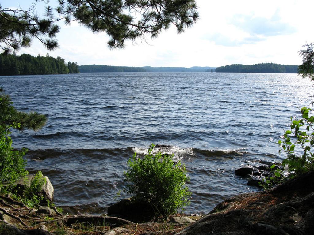
Topography of under-water approach: Primary landing is south facing. A rough north landing is also available where strong (30km/hr) south or west winds are in play. Both landings are over slow tapered fist-sized rocky beaches coming out of 10’ of water (depending on water levels). At high water the landing would be nestled up against boulder-lined shore of island. No obstructions to landing during July water levels. Ineffective ‘man-made’ submergent rocky pier present at south landing – more harm than good.
Impediments to disembarking from and/or unloading a canoe: None at normal water temperatures. High water one would be up against the rocky shoreline – with winds the south landing would require caution (vessel’s proximity to sharp rocks).
Topography to tent sites: Slow taper uphill to firepit and campsite area – 20 meters up from landing. Roughly 1.5 meter in elevation from waterfront.
Southern landing area, view is south ...

![]()
Campsite
Campsite maintenance: regular
Size of open areas: 2 - 50’ x 50’ lots.
Extent of tree cover: 60% canopied over tent/kitchen area.
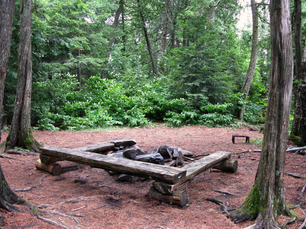
Degree of levelness: Very flat around firepit and tenting areas.
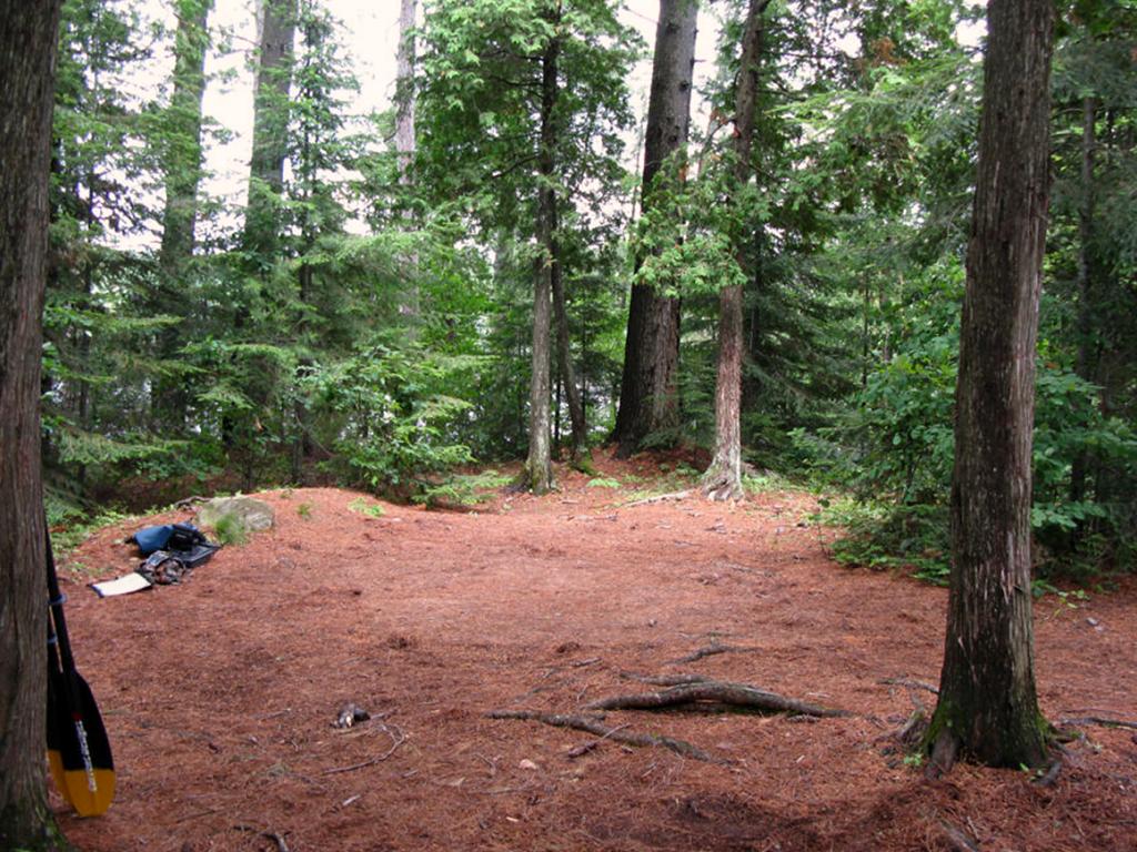
Number of tent sites: At least 2 flat sites adequate for3-4 man sized tents.
North exposure: Protected from the North winds due to proximity to north shore and treeline that backs onto campsite.
East exposure: None - Protected from eastern winds as campsite backs-on to redpine forest, and is located close to eastern shore.
South exposure: Full south exposure from canoe landing, can view the extent of the lake’s southern disposition.
Well protected firepit, seating and tenting area, north of landing ...

![]()
One of the campsite’s 2 tenting/tarping areas north of firepit, looking north-west ...

![]()
General description: Good campsite, well protected tenting and cooking area, adequate seating around firepit. Nice flat tenting and food managing areas. Limited sun exposure at campsite/firepit areas due to being ringed with mature evergreens. Large iron grill present. Good sunset views from south-west shoreline, great sunrise views from island’s south east shore. Thunder box located north east of campsite. Limited firewood opportunities - the small island site appears to be well used. Good proximity (short trip) to shallow marshy eastern extents for low light or daytime moose/wildlife viewing.
Overall accessibility: Good.

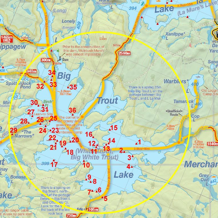
Thanks to Jeffrey McMurtrie of Jeff'sMap for supplying the base-layer map component by Creative Commons licensing.
Submitted by: Stephen Molson .. Visited: July 2009 .. Submission: Jan 28th, 2010