 Big Porcupine Lake Campsite #9
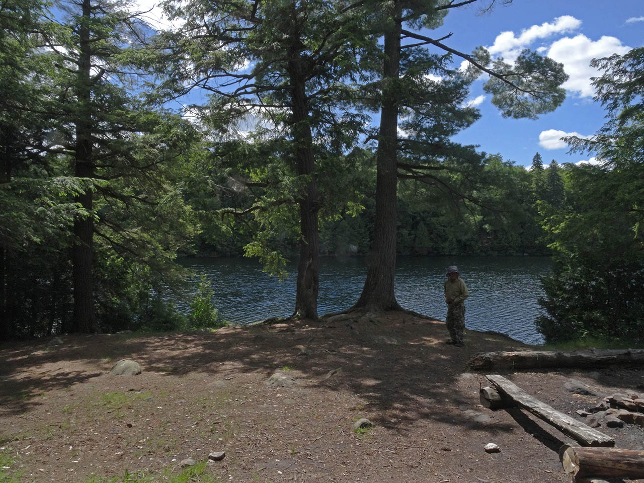
Landing
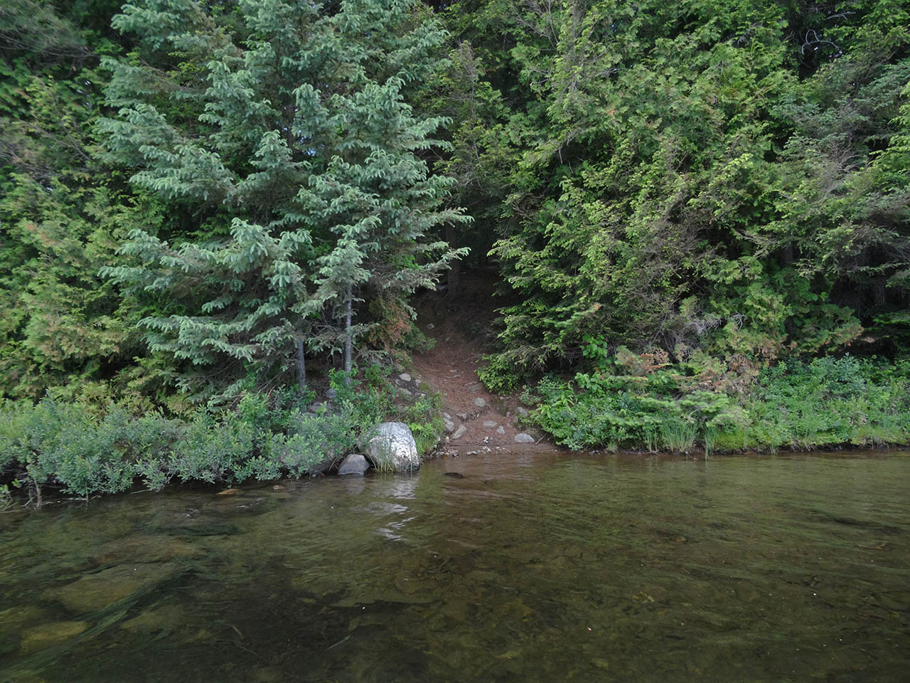
Topography of under-water approach: On the south side of point, the two landings have shallow approaches.
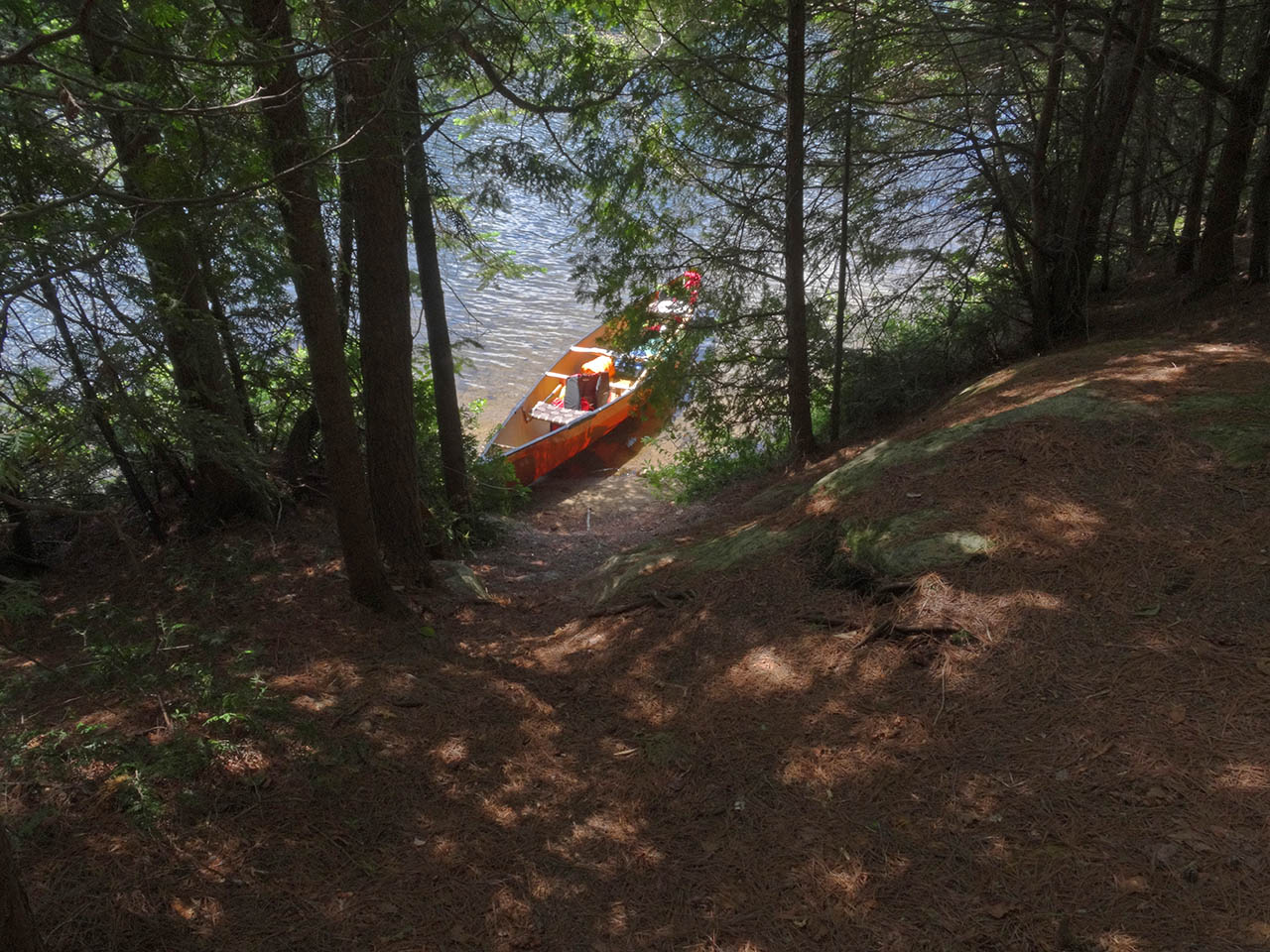
Impediments to disembarking from and/or unloading a canoe: Each landing can handle only one canoe at a time. Canoes have to be brought up a distance for storage or to free the landings for any more use.
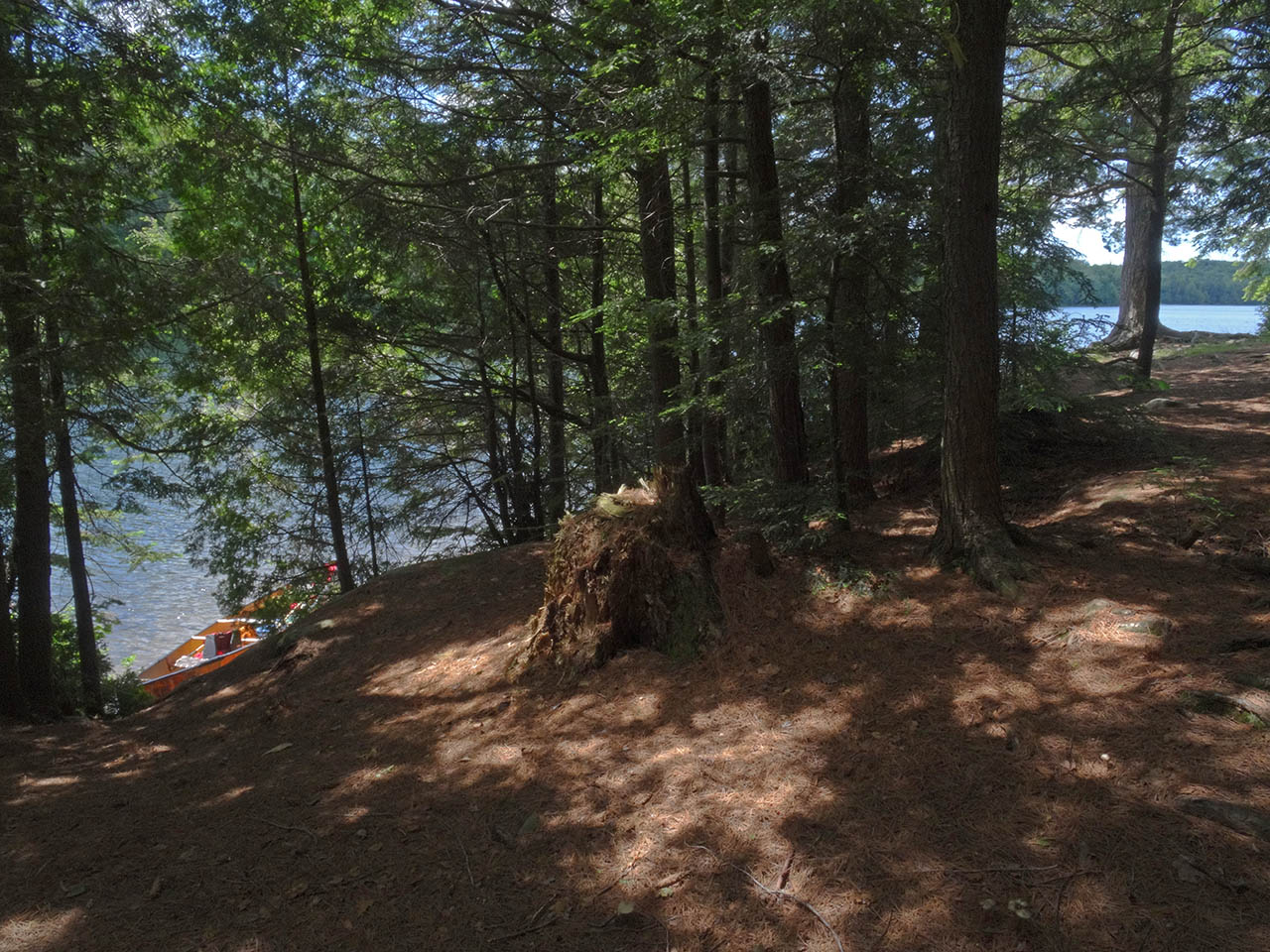
Topography to tent sites: A steep, 20' dirt rise up to the firepit and tentsite area.
 |
|
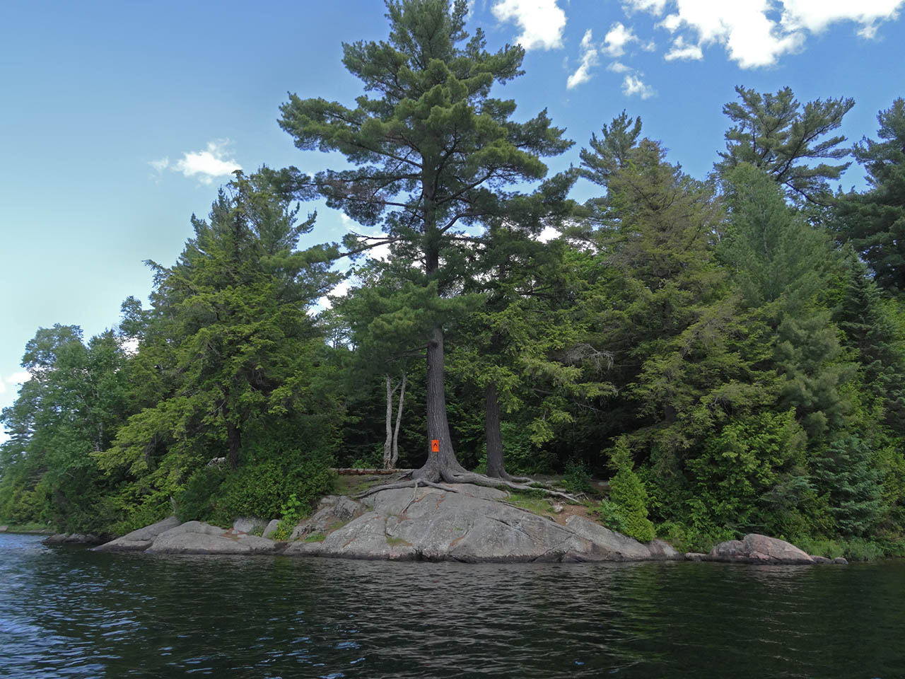
| - Rock point, with landings located to the right amongst the trees. | |
 |
|
| - One of the two narrow landings. | |
 |
|
| - Its a steep and confined rise up from the landing. | |
 |
|
| - Here's the complete grade from the water to the firepit level (far right). | |
Campsite
Campsite maintenance: regular
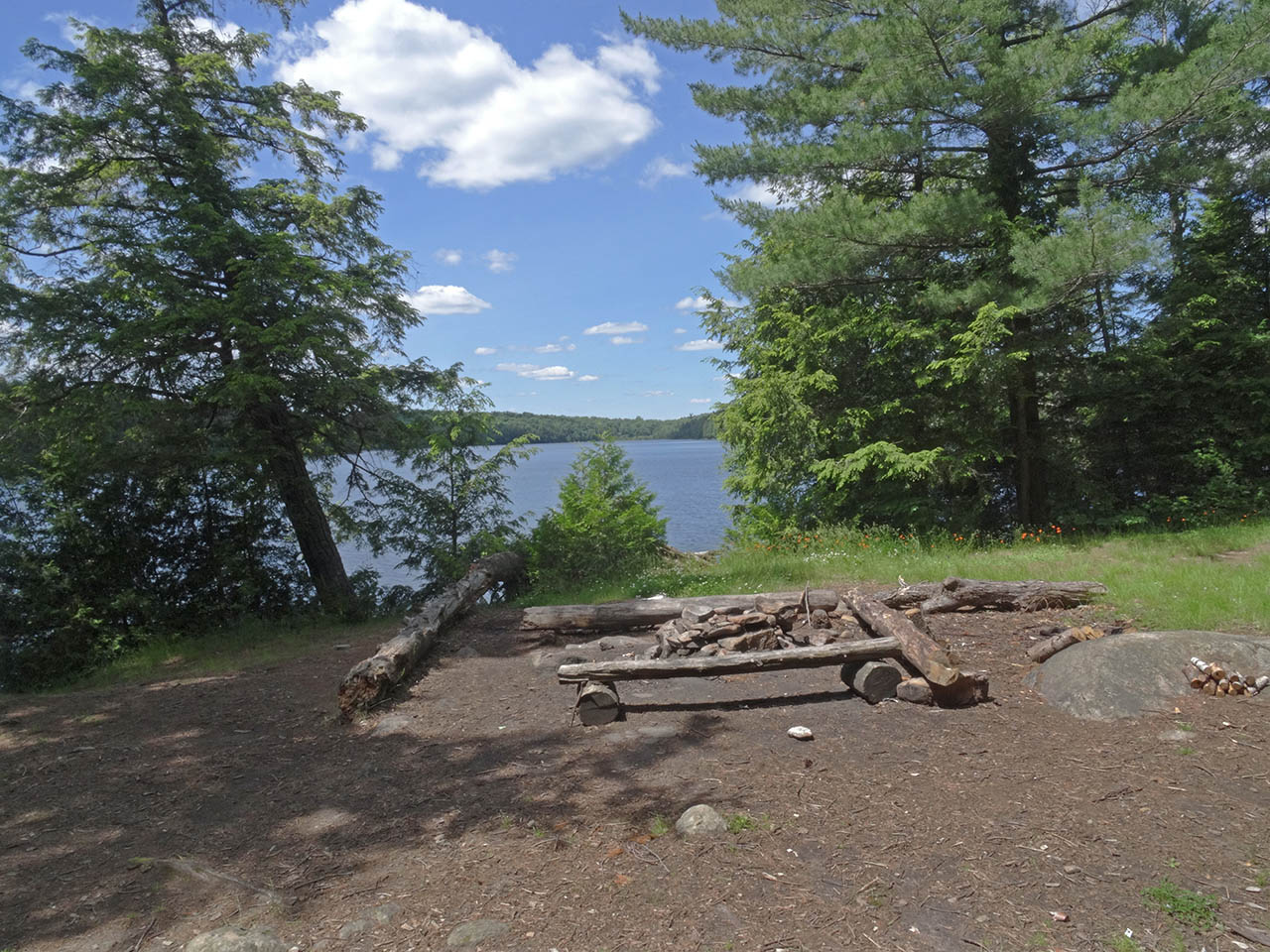
Size of open area: 50' x 50'.
Extent of tree cover: Firepit and tentsite areas are open to the sky.
Degree of levelness: The firepit and tentsite areas are on one level.
Number of level tent sites: Three tents could be erected immediately around the firepit area, but without enough trees for full tarp support.
North exposure: Partially potected from north winds by a few intervening trees.
East exposure: Inland forest blocks the east winds.
South exposure: Substantial protection from south winds.
West exposure: Partially potected from west winds by a few intervening trees. The mainland is so close as to seriously limit the sunset view.
 |
|
| - Due west across to mainland, over open tentsite area south of the firepit. | |
 |
|
| - Looking north up the lake, with another tentsite area to the right. | |
General description: OK. However, without many tarp-tie-down trees, protection is limited.
Overall accessibility: Narrow and steep ascents from the water could be an issue.
Thanks to Jeffrey McMurtrie of Maps By Jeff for supplying the base map.
Submission July 2015 by Barry Bridgeford .. visited June, 2015