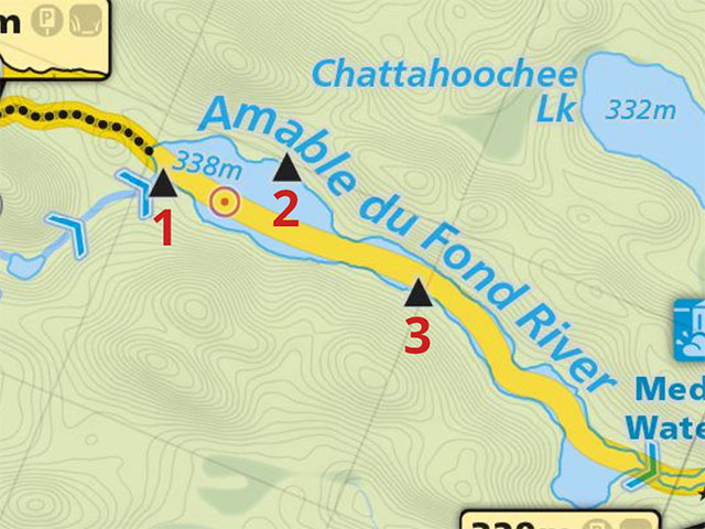
 Portage 1355 meters - On the Amable du Fond River
Length of portage: 1335 meters.
Portage maintenance regular or low: Regular.
Landing on Amable du Fond River, at east (downstream) end
Topography of under-water approach: Mud and silt in knee deep water.
Impediments to disembarking from and/or unloading a canoe: Small, messy landing area requires moving gear from canoe directly to staging area (approx 10m).
Topography of the ascending grade: Gentle grade, with unlevel surfaces, rocks, roots, and boardwalks.
Impediments to moving gear to portage trail: Gear must be carried on boardwalk to staging area, which begins trail.
View from river ...


Portage Trail
General description: This trail can be divided into 3 sections of somewhat equal length. The section from the Amable du Fond River is undulating, rocky, and rooty with little elevation change. There are a number of boardwalks present that indicate the potential for the collection of water. The middle section is a significant grade with rocks and roots along the trail. The section from the apex to Manitou Lake is a slight grade on a smooth dirt path that has a welcoming view of Manitou Lake. There is enough variety on this trail to make it seem much shorter than it actually is.
Many boardwalks on lower portion of trail ...


Landing on Manitou Lake, west (upstream) end
Topography of under-water approach: Sand in shallow water.
Impediments to disembarking from and/or unloading a canoe: None
Topography of the ascending grade: Smooth path with slight incline.
Impediments to moving gear to portage trail: None
Manitou Lake, a welcome sight ...


Thanks to Jeffrey McMurtrie of Maps By Jeff for supplying the base map.
Submitted by Chris Taylor, visited May 2015, submitted September 30, 2019