
Updated Dec. 7, 2024
Please consider yourself part of a new 'Accessibility Reconnaissance Crew', informing challenged people who may consider following in your paddle strokes ... whether they are traveling with young children, are infirmed or are simply older. After all, we all get older!
I'm envisioning the "Portage and Campsite Inventory" as having a definite "community scrapbook" appearance.
Submissions to the PCI aren't required to conform to a strict format. The provided worksheets are intended as "aids" in the gathering of information or as convenient "checklists".
Any qualitative descriptions will be "relative" and predicated on one's own subjective perspective. In order to gather more factual information, I'm hoping people will make good use of both photos and sketches. Photos document a lot of objective information, while sketches provide the opportunity to indicate the quantitative extent and location of documented problem areas (ie. "100 meters of 30 degree rise with loose rocks" or "50 meters of ankle deep muck in May").
We shouldn't try to "grade" a landing or portage. Rather, we should try to objectively quantify their key elements and let readers judge whether they are capable of those described elements.
The number of lakes, portages and campsites in the backcountry of Algonquin Park is extremely high. The scope of this endeavor is larger than the entire content of the AlgonquinAdventures.com website to date. In order to be successful, the readership will have to embrace it with considerable fervor. Otherwise, the 'blank-spots' will outweigh those with data for so long as to doom the project to the realm of the overly ambitious. Are we up to the challenge?
Incidentally, the PCI's numbering of campsites is simply to facilitate readers' identification on the maps as to where the inventoried campsites are located. The numbering process is not based on any existing documentation and is purely arbitrary. Just for the record, I'm not interested in having specific campsites reserved by a numbered system!
Maps, to be used in any finalized version, cannot be scanned sections of the Official Canoe Route Map. The FOA and Ontario Parks have made it quite clear over time, that they don't allow links to or use of either the old PDF file of the Canoe Route Map of Algonquin Park or scans of their hardcopy maps. Therefor, we'll be taking advantage of Jeffrey McMurtrie's generous Creative Commons licensing of his map which allows free non-commercial sharing of the map, as long as creative credit is acknowledged.
Note: Should one find that a particular lake, for which the PCI already has a numbering map established, now has either a new campsite or has one of its campsites removed or 'closed', please don't recreate a new map with the lake's campsite numbering 'resequenced'. Rather, please assign any new campsite an alphabetical suffix to a nearby campsites' original number. For example, if a new campsite is established near to campsite #9, it will be identified as #9a. That way all campsites numbered higher will can retain their original number. Similarly, should a numbered campsite be 'closed' or removed, it can be assigned a lower-case "x" after its number.
And, please check that an earlier submission for a specific campsite or portage hasn't already been included in the PCI, since a 'duplication' would probably be redundant and could be a wasted effort on the camper's part.
Submissions should be emailed to canoe@algonquinadventures.com.
Barry Bridgeford .. AlgonquinAdventures.com
Portages are often only known as red or black lines on a canoe route map, accompanied by their distance in meters. In gathering information for this inventory, we should record their instances of steepness, hardships and tendancies to be rendered additionaly difficult by rain or beaver-dam flooding.
Effectively composed and 'captioned' photos of key elements, coupled together a line-drawing of either the portage's 'cross-section' or 'overview' (with key elements noted), will provide a valuable resource for 'challenged' people when they plan their trip.
A PCI record should contain at the very least 3 photos, which should be at least 1280 pixels in their longest dimensions.
Intregal parts of all portage description are their landings, which share their method of documentation with that of the landings of canoe-in campsites.

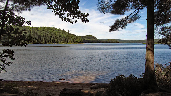
Campsites are usually only shown as location indicators on canoe route maps, sometimes distinguished between 'regular' and 'low maintenance' sites. For this inventory, we should indicate their size, degree of levelness, extent of tree-cover, tent capacity, exposure to points of the compass, surrounding environment, as well as their 'general accessibility'.
A pair of effectively composed and 'captioned' photos (taken from opposite sides of the campsite) should usually capture a campsite's key characteristics. If there are unusual aspects to a campsite, then additional photos and/or a site diagram will certainly help.
An intregal part of a campsite description is its landing, which shares its method of description with that of a portage landing.
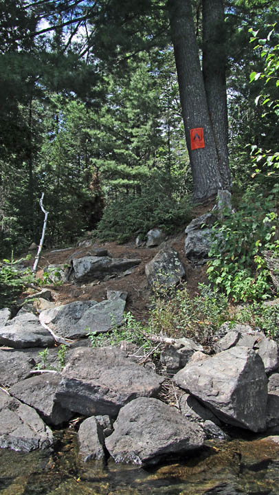
'Landings' are parts of both portages and campsites, where we either 'put-in' at or 'take-out' from. Our descriptions of landings should include the topography of both the shoreline's under-water approach and its above-water ascending grade. We should record how the topography impacts on disembarking from a canoe, unloading a canoe and bringing gear to the actual tentsite or start of the portage.
Photos of a landing should show its entire profile, illustrating both the 'disembarking' and 'haulage' components. Sometimes a single photo will capture all the relevant elements. Sometimes a number of photos may be required to document a landing's elements.
Also, the use of quick 'frontal' and 'profile' sketches, supplemented with key notations, will help you remember the extent of topographical elements. These sketches can even be added to one's final 'report'.