Access #27 - Cedar Lake - August 13-20, 2009 Page One - Page Two - Page Three
![]() Rory Leidecker's Cedar-Nipissing-Nadine-Erables-Kioshkokwi-Little Cauchon Trip
Rory Leidecker's Cedar-Nipissing-Nadine-Erables-Kioshkokwi-Little Cauchon Trip
![]()
At 10:50 we reached the other end of Little Mink, and began the 450m portage to Mink Lake. I pointed out a familiar site on Mink where I had stayed several years ago. But it was not even noon, and we had planned to travel much farther this day. We paddled on, passing what looked like a teen group from one of the camps. Every time we passed a group of kids, they seemed to be going the harder way, into the wind or uphill! Were we wiser or just lazier? I planned the route, so any judgments would fall on me.
Mink Lake is almost four miles long, and even with the wind behind us, we were starting to show signs of fatigue. Bryan, in the solo canoe, tried to use his PFD as a sail. We also spent a few minutes maneuvering the two canoes in a brief water battle. I definitely feel that I lost that battle, but the dousing was refreshing.

Bryan's PFD was not a very effective sail; I advise using a paddle instead (in the water, not as a sail).
We reached the end of Mink in about an hour, finding the 440m to Cauchon Lake easily. We re-loaded the canoes and set out on a narrow stretch of Cauchon. For about a mile, the lake is quite narrow, with high cliffs on either side.

The narrow west end of Cauchon Lake.
We paddled close to the southern shore, intentionally bypassing the string of campsites on the northern peninsula on the main body of Cauchon Lake. We still had plenty of time to find a site on the next lake. The farther we traveled this day, the closer we would be to Cedar Lake, where we would stay for our last night. At the end of Cauchon we passed under a railroad bridge, through a marshy pond full of lilly pads, and under another bridge into Little Cauchon. The second bridge looked to be in excellent condition, and is labeled as a primary logging road on Jeffrey McMurtrie's map.
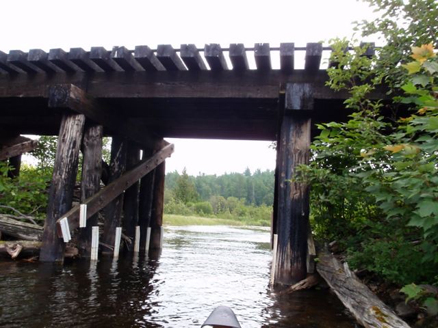
Cauchon rail bridge.
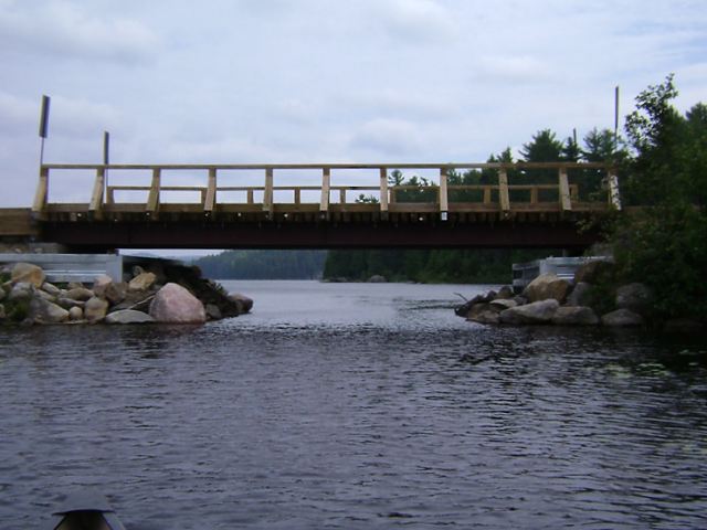
The logging bridge and the west end of Little Cauchon Lake.
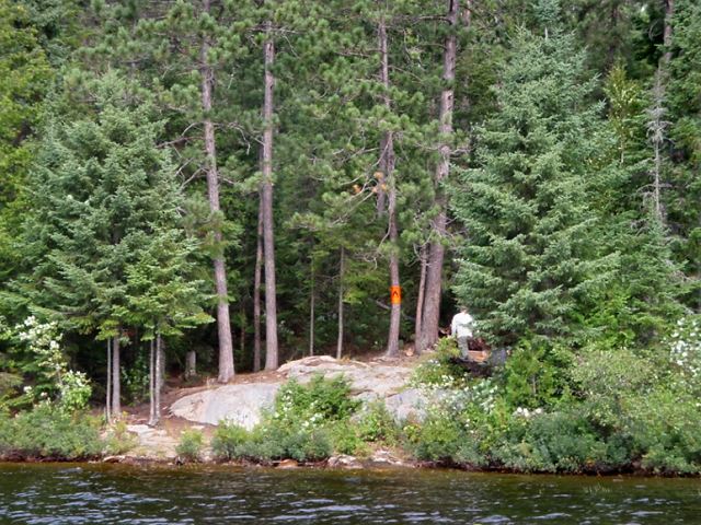
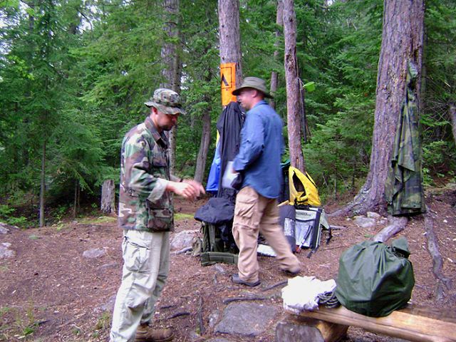
There were six campsites to be found on Little Cauchon. We didn't have a preference for the western, middle, or eastern parts of the lake. We just wanted to find a site that would be comfortable to occupy for a night and a morning. The first site we inspected was nestled into a steep hill/cliff. I thought it was very scenic, and the tent pads seemed nice and level. But the other guys felt that the box was too hard to reach in an emergency, as it was up a steep hill from the site. We thought we could do better, so we continued on.
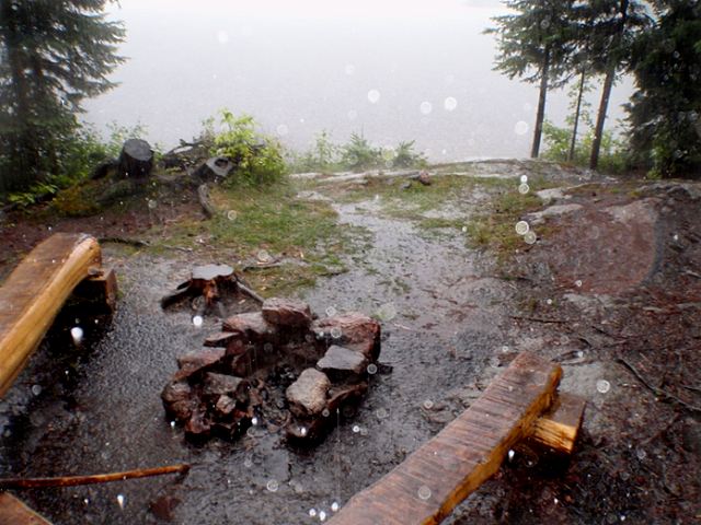
The next three sites all had something wrong with them. Our primary concern was the presence of at least two decent tent pads, and none of the sites met the criteria. We were down to two sites at the far eastern end of the lake. Approaching the eastern shore, we could see only one campsite. Perhaps the missing site was along the portage trail to Carl Wilson Lake, but we did not explore far enough to find out. Bryan landed at the beach of the visible site, and checked out the area. He waved us in, so Brent and I landed our canoe and joined him. A short path led from the beach to the campsite. A new U-shaped bench surrounded the fire pit on three sides. The view was amazing, as one could see nearly the whole length of Little Cauchon Lake from our site. There were two semi-flat spots for tents, and at this point we had run out of options. It was 3:15 p.m., and we were too tired to paddle to another site. Compared to the other sites, this one appeared to be the best on the lake. Next time we'll pick a different lake.
Bryan inspects the last site on Little Cauchon as we await his decision.
The search for a suitable campsite had exhausted us, and my companions had become accustomed to early-afternoon hammock naps. We brought our packs to the site and they immediately began to string up their hammocks. Once again, I was left to occupy the most comfortable spot of ground I could find. I started by sitting against a short rock ledge, but I found it more relaxing to inflate my air mattress and lay it out across the rock. I was able to nap for almost half an hour in relative comfort. Around 4:00, we arose from our power naps and took care of the necessary camp chores. I found a suitable branch deep in the woods behind the site to hang our food bag from, we found some boards (old pre-cut lumber) on the edge of the site to split for firewood, and an evening meal was prepared.
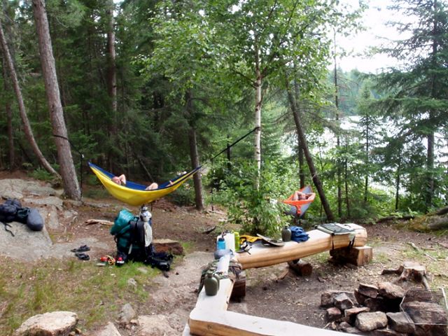
Ahhh, nothing like a nap in a hammock!
We sat around the fire and reflected on our trip to that point. Although I was ready to stay in Algonquin Park for as long as I could, Brent and Bryan seemed to be ready to head home. We discussed travel time and rental fees, both which could be lessened by an early exit. I wanted to stick to the original plan and stay one more night on Cedar Lake, but we finished the evening without a solid decision. We enjoyed a beautiful sunset while finishing what was left of the Kahlua and Buttershots. Perhaps we had a few too many swigs, or took too much time in finishing off the booze, because the dark caught up to us before we had the food bag up. We donned headlamps and headed toward the waiting food line. It wasn't too much trouble for us to heave and pull the bag to a safe height, then tie the rope to a nearby tree. The sun had set around 8:00, but nobody took notice of the exact time when we retired for the night. We were too distracted by the uncomfortable spots our tents occupied. I think the only good tent pads were on the far western site, over three miles away!
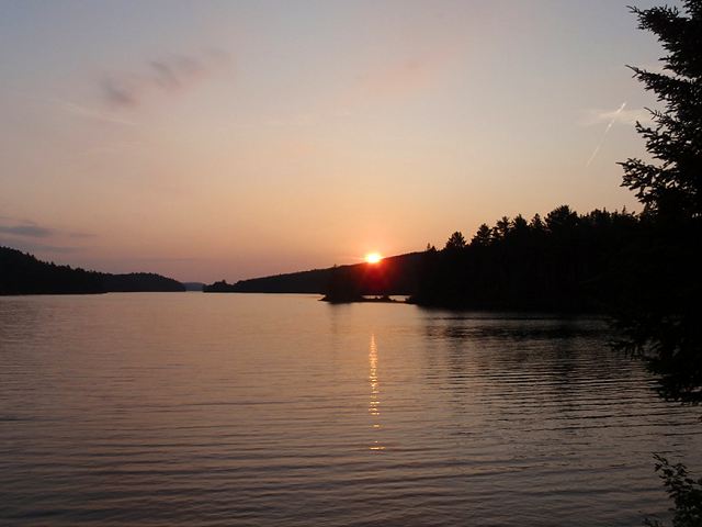
The sun disappears behind the hills on the far side of Little Cauchon Lake.

"I don't know where we're going to put the second tent! How about right here?"
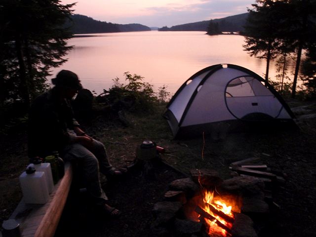
Enjoying a nice fire, a beautiful view, some tasty spirits, and good company (until the mosquitoes came out!)
DAY SIX
Tuesday, August 18th, 6:00 a.m. - Although it was annoying to be awakened by the chattering of the local squirrels, it was helpful that Brent and I were awake enough to hear the rain when it began to fall. We quickly tossed the rain fly over our tent, and Bryan did the same at his end of the campsite. The rain lasted for about half an hour, but the sky remained dark and ominous. We decided to pack and leave as quickly as we could manage. We had packed up most of our gear by 7:30, and were just starting to eat our morning oatmeal when the sky opened up again. This time it was a downpour that lasted for a full hour. We covered our packs with the extra ponchos we had with us, and strung up a tarp to wait out the rain.
Packing up after the first shower.
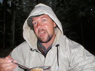
Photo: Not even a downpour will stop me from eating my morning oatmeal. >>
After consuming our breakfast of coffee and oatmeal (which were both heavily watered-down by the clouds while we put up the tarp), we decided it was time to move on, rain or no rain. Our gear was already packed, so it was a simple matter of stowing our breakfast utensils and extra ponchos before setting off in the canoes. There was no sign of thunder or lightning, so we felt safe to hit the water.
The rain didn't last long. It was a short paddle from our campsite, under yet another railroad bridge, to the first portage of the day. This was a 130m to Laurel Lake. It was a fairly steep hill, and even though the rain had stopped, the hill was still shedding water by way of the portage trail on both sides. We walked up and down a waterfall on that short portage.
Laurel was a very pretty lake and had no cabins on its shores. There was an island site in the middle of the lake with a thunderbox at the highest point. A great view from the thunderbox, but one would also be on display for anyone passing by or looking in that direction from the other sites!
I'm glad we packed up the tent before the heavy stuff came down.

Brent and Bryan paddling in the rain, headed to the portage to Laurel.
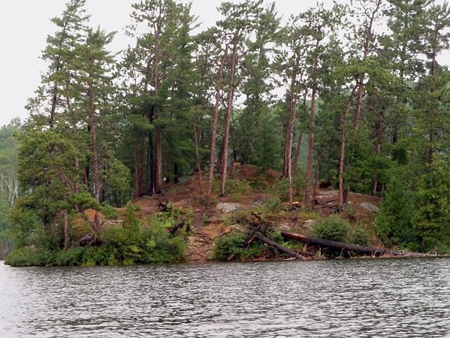
The island site on Laurel Lake, with a very visible thunderbox!
The clouds continued to cover the sky in a dark gray blanket as we crossed the portage into Aura Lee Lake. At the end of Aura Lee there is a creek that leads to Little Cedar Lake. We passed under yet another railroad bridge, but this one was a tunnel like the one on Kioshkokwi. There were two tunnels, but the one on the right was blocked. Fortunately, we picked the left one, but unfortunately nobody took a picture of that cool tunnel.
The issue of staying one more night or leaving a day early came up as we passed from Little Cedar into Cedar. I was outvoted by Brent, Bryan, and the clouds. Grumpily, I paddled the western arm of Cedar Lake, keeping my distance from the other canoe. I was not ready to get in an SUV and drive home just yet. By 11:00 a.m., we came around the final peninsula and saw the dock and beach were our trip had begun.
We carried our canoes and packs to the truck, then I donned my swimsuit one last time and waded out into Cedar Lake's chilly waters one last time. It was a long drive home, and I wanted to rinse off the sweat and dirt from the morning's exertions. We changed into clean clothes before driving off (have to be considerate of the people we might interact with on the way home).
Our last stop in Algonquin Park was the Brent Crater observation tower. We looked out upon the crater for a few minutes, then returned to the truck. It rained again pretty heavily while we were driving west on Highway 17, proof to Brent and Bryan that we had made the right choice. A few hours later, we pulled into the lot behind Algonquin Outfitters in Huntsville. After settling the bill, we talked to Randy Mitson about our trip. He was a wealth of information, and we would have talked to him for hours if we weren't so hungry! We went right next door and had a nice meal with a few beers. That really hit the spot! We set out for the long drive back to Detroit, and arrived that evening. It was another successful Algonquin trip, Bryan's first, Brent's third, and my ninth. We all plan on adding to our totals, perhaps with a repeat of this route, but in reverse with a few slight changes.

Looking out from the Brent Crater observation tower, located on the road to Cedar Lake.