Trip Report: Cedar-Pet-Burntroot-Nip-Cedar
September 2012 by - MartinG
September 2012 by - MartinG
|
|
Trip Report: Cedar-Pet-Burntroot-Nip-Cedar
September 2012 by - MartinG |
|
A trip to the north side of Algonquin often starts with a very early departure and high hopes. Add nearly a year's worth of anticipation and this describes my state at 4:00am one Thursday morning in early September. That was the start of my first trip out of Brent. This was to be a double solo, each of us paddling a solo canoe. My friend paddles a Swift Osprey while I splash along in my Hemlock Kestrel. This is my favorite way to travel. We get to pack and paddle our own canoes during the day and share good company along with a drink around the fire at night. 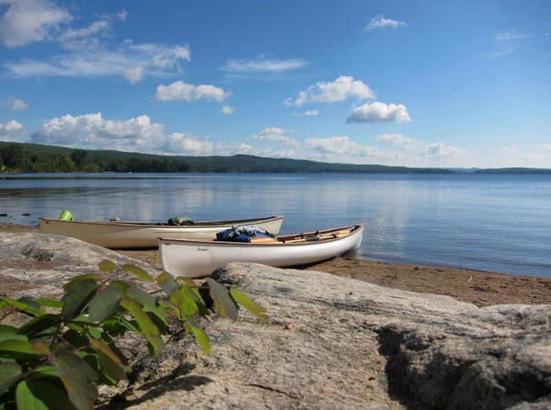 On the Beach at Brent. Our plan was a three night looping trip up the Petawawa River to Burntroot Lake and back down the Nipissing River. I wish it could have been at least one night longer. This would have allowed a slower pace and given us the time to explore the bottom end of Burntroot Lake and Redpine Bay. Sadly, busy schedules and other obligations forced us to cram the 70 or so kilometers into 4 days. The drive to Brent from Kingston takes roughly 5 hours. If you are coming this way make sure you fill up with gas in Deep River as there are no gas stations between Deep River and the launch at Brent. A 220km round trip! There, you’ve been warned. We were not warned and arrived at the Park office with only a quarter tank of gas left. So, we had to carry on to Matawa to fill up before heading back into the park. This is a waste of an hour. More important it meant we got on to Cedar Lake one hour later. 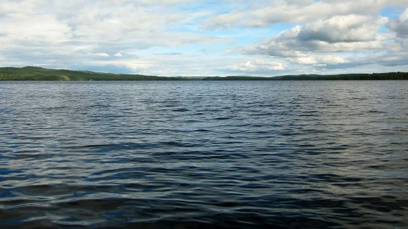 Cedar Lake I did not enjoy Cedar Lake. It is gorgeous, deceiving and scary. We launched at 11:00am on a seemingly beautiful day with mild north westerly winds. 15 minutes into the 2km paddle towards the Petawawa River, you are exposed to wicked winds and waves as they funnel down Cedar's long north arm and hit your canoe broadside. Don’t make the mistake of assuming that it is calm based on the Brent boat launch. From Brent you cannot see the waves in the middle of the lake. Once out in it, there is nowhere to hide. No islands to seek shelter behind. We made the crossing without any real trouble, but it required concentration and effort to manage the weather cocking and frequent white caps that would splash over the gunwales. Half an hour later we arrived at the take out for the 715 metre portage up into the Petawawa River. This was the first of 5 portages for the day. We had decided ahead of time to single carry on this trip. Something I had never really considered before. But if we didn’t, the days 3.6 kilometres of portaging would triple and turn into 11K of hiking. We just didn’t have the time for this. So, as my coffee mug says, "Suck it up Princess". The first two portages, 715m and 300m, weren’t so bad. 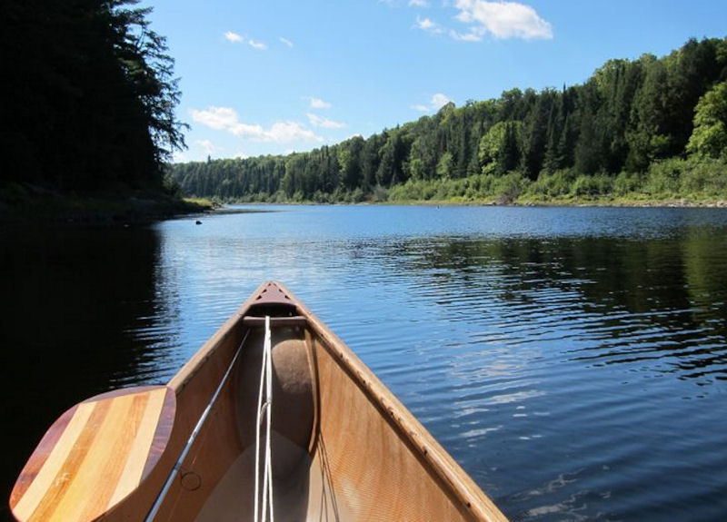 First look at the Petawawa River. 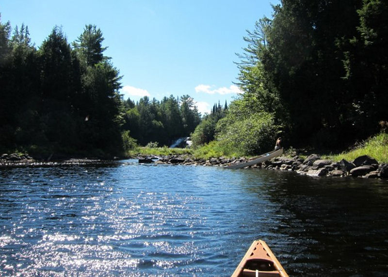 Steep, rocky take out at the 300 metre portage. 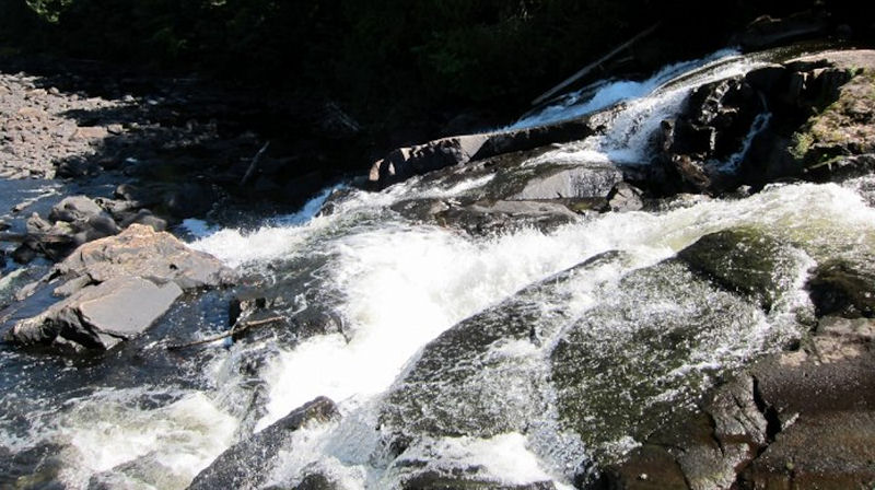 The 300 metre portage takes you around these picturesque falls. Another short paddle along the Petawawa brings you to the Stacks Rapids Portage. 2345 metres with a 70 metre gain in elevation. This was a challenge to single carry. I had heard and read that this is a tough slog. It is! But, perhaps not so steep, or as bad as I had expected. It’s one of those cases where the reality fell just short of my expectations. This time that’s a good thing! 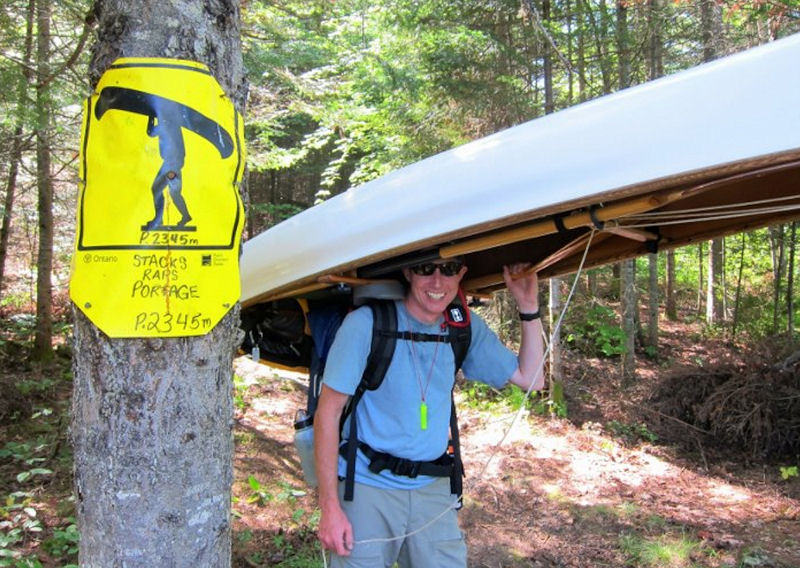 Loaded up for the single carry. 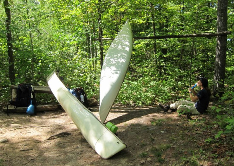 Rest stop at the top of Unicorn Hill. This marks the top of the steep portion, two thirds of the way through the Stacks Rapids portage. It was shortly after this point that I gave up on the single carry and doubled the last portion. We managed to keep up the single carries for most of the portages on this trip. Two more small portages, into and out of Narrowbag Lake, bring you to the top of Catfish Lake. The last 80m portage takes you around what is left of an old logging chute. Not much remains, but it is enough to stir your imagination. It’s also substantial enough to create a nice pool for swimming in after a long, hot afternoon. 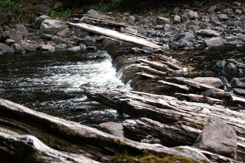 Log Chute remains. 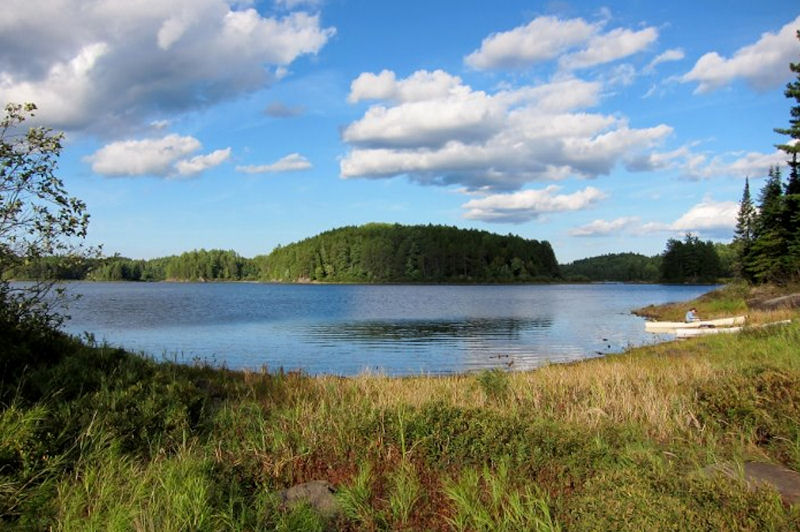 Catfish Lake. Catfish is a beautiful Lake. As you enter the north east arm of the lake you are immediately presented with a view of islands, red pine stands and picturesque bays. 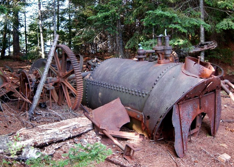 Catfish Lake Alligator remains. One of the first islands near the top end holds the remains of an old Alligator. Once used for pulling huge booms of logs across the park. All that remains now is the rusting metal remnants. An intact replica can be seen on display at the Logging Museum Trail along HWY 60. I have read that there is another abandoned one at the bottom end of Burntroot Lake. Unfortunately, we could not make it that far on this trip. It’s worth noting, up to this point; we had not seen a soul. As we pulled away from the island we saw a tandem canoe pull up to the small island campsite immediately south of the Alligators Island. Damn! The illusion of wilderness was broken! We carried on paddling south through the islands and entered the main body of Catfish Lake. As we passed each island and point we noticed more campsites occupied. Ah well, no matter we were headed further south to the cluster of sites around Shangri La Island. As we paddled we found more sites occupied. What the heck! I hadn't expected crowds! EVERY site was occupied! Disappointed we carried on. Just before the narrows entering Sunfish Lake, there are two sites marked on an unwelcoming marshy island. There were no canoes on the dreary gravel beach so we landed and lugged our first load up a trail looking for somewhere to set up camp. The narrow trail carried on for 30 metres or so before opening up on a large clearing. To our surprise this was a great site! 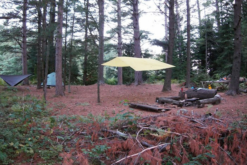 Catfish Lake campsite. It offered everything you could want. Panoramic views of the wetlands, tall pines perfectly spaced for tarps and hammocks, a built up kitchen table, great benches surrounding a nice fire pit complete with stacks of wood. It even had tent pads built up on log foundations filled and leveled with a bed of pine needles to top it off. What a surprise! We quickly set up camp and settled down for the evening. Exhausted and content, we celebrated our journey with cigars while watching the stars come out over the marsh. 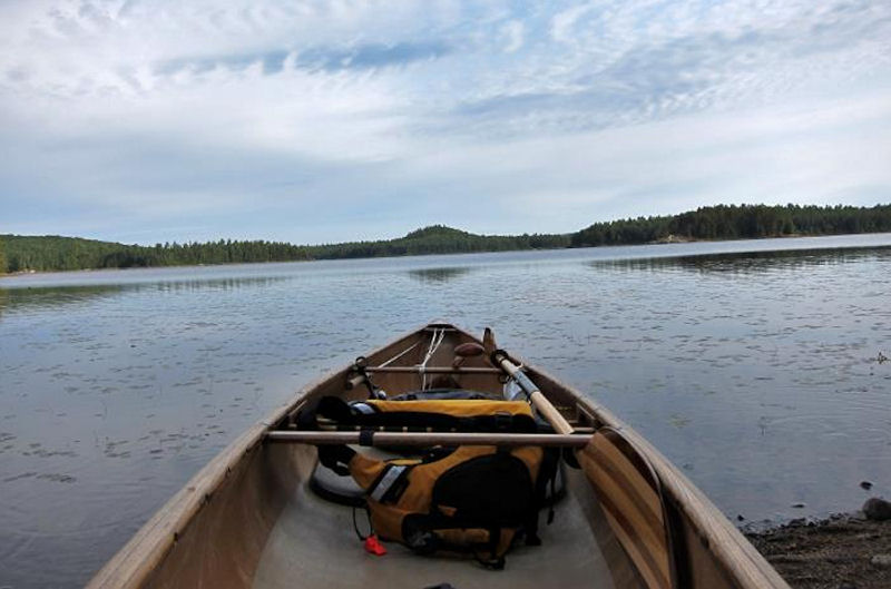 The next day we had breakfast, packed up and got on the water by 9:30. It was a beautiful day to paddle up the Petawawa. 12 kilometres and five short portages to Burntroot Lake. Well actually only 4 portages as we lined up the 85m portage between Snowshoe and Cedar Rapids. 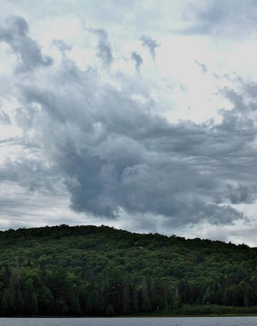 Thunderhead forming south of Perley Lake Roughly half way along Perley Lake, the sky started to show signs of rough weather ahead. At the last portage before Burntroot Lake is another relic of a bygone era. At one time there was a cabin here. This root cellar, used for storing provisions and ice is all that remains. 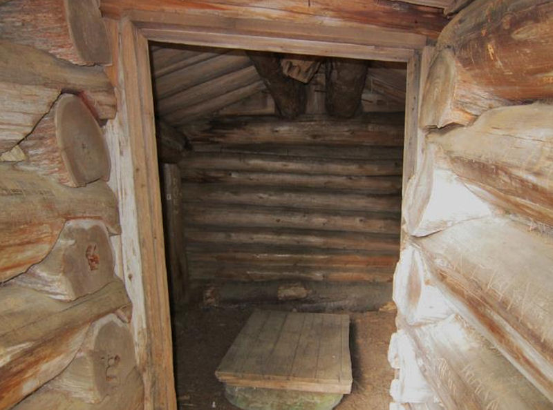 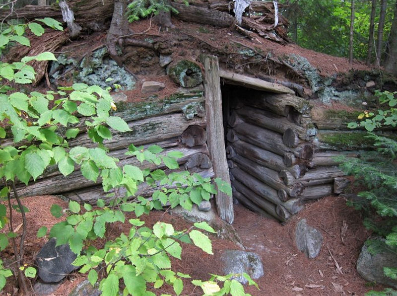 Burntroot Lake Root Cellar. After a quick stop, we paddled across the top of Burntroot Lake. Burntroot is a vast, open lake. The waves were really picking up. Quartering headwinds made for a rough but fun ride along the top of the lake towards the Robinson Lake portage. We had brought kayak paddles to help battle these sorts of winds. The double blade is ideal for covering distance in these conditions. But, I don’t really like it. I think of it as a tool, like a hammer used to pound in a nail. Necessary, but not particularly enjoyable. 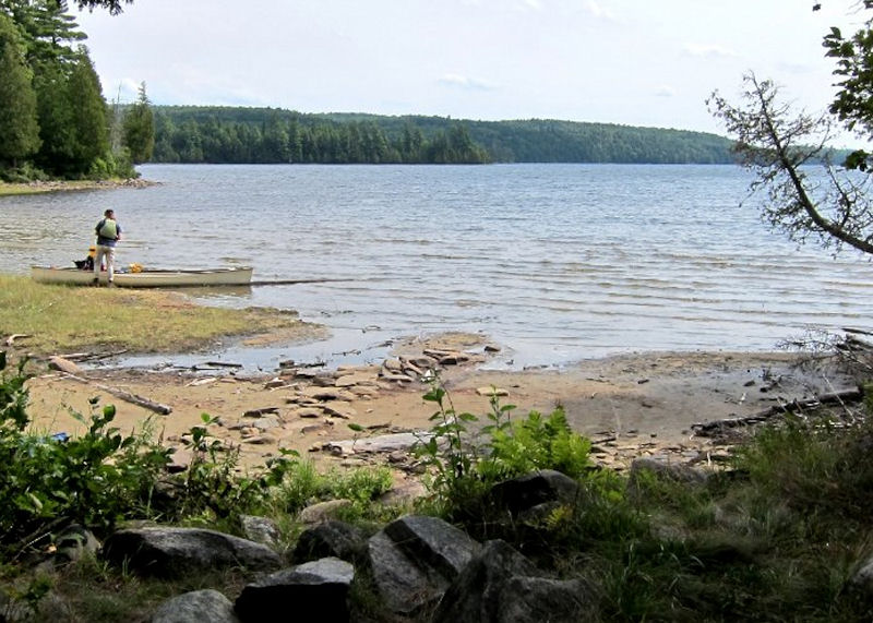 Burntroot Lake from the Robinson Lake portage. The 1250 meter Robinson Lake portage was probably the roughest trail we had passed through so far. That is to say it was an interesting walk in the woods. The trail has a little more variation than the uniform, well-trodden trails we had been on up to now. At one point it traverses the top of a beaver dam. By the time we got to Robinson, the clouds had settled in and a light rain was starting. We set up camp on the east island. It’s a nice site with a great western exposure. But, the grey sky and increasing rain kept us from exploring the lake or enjoying the view. 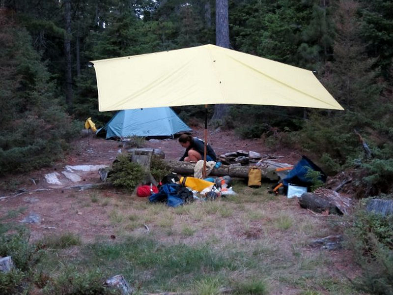 Another use for the kayak paddle. Propping up the tarp!.  My bedroom. At this point in the trip, the weather took a turn for the worse. From 5pm on Friday evening it rained solid for the next 24 hours. We guessed around 50mm of rain. Overnight, I managed to stay dry in my hammock. Unfortunately, everything else including my partner’s tent was thoroughly soaked. In the morning we had a quick breakfast, packed up in the rain and paddled out towards the Nipissing River as it poured. Robinson is a small, pretty lake. It is at the top of its watershed and has very clear green water. I assume it is spring fed. I have also heard that the fishing here is great although I never bothered to wet my line. 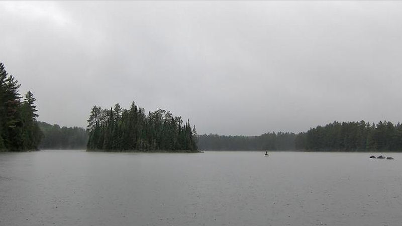 Robinson Lake. A quick hop around a dam brings you in to Whisky Jack Lake, followed immediately by a 435 meter portage into Ramona Lake (more of a pond). This brings us to the last long portage of the trip. A 2km portage downhill from the height of the watershed and into the Nipissing River valley. This is a pretty trail. One down fall of the single carry portage is that you don’t get to appreciate the landscape as you pass through it. Half way through this carry I saw my first moose of the trip. By the time I had taken the canoe of my head and grabbed my camera the moose had disappeared into the bush. 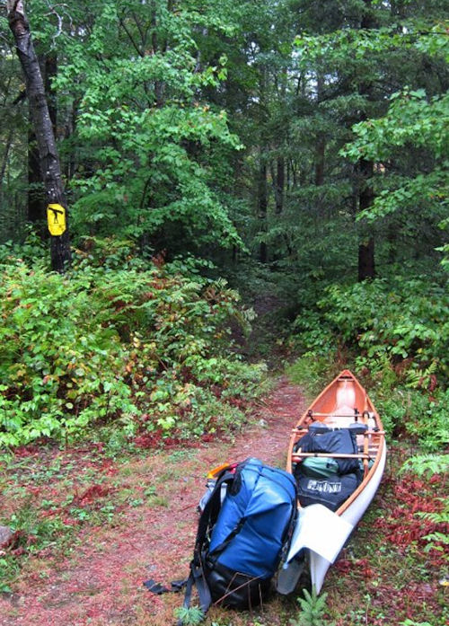 Ramona to Nipissing River Portage. 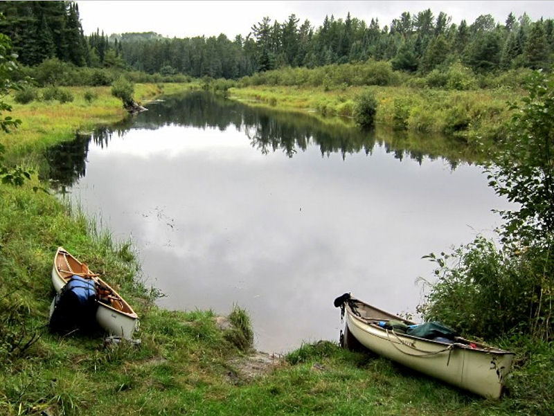 First view of the Nipissing River. The Nipissing presents a very different landscape when compared with the Petawawa. Far more lush with a wilder feel. We started our downstream paddle during a short break in the rain. Drowned shoreline vegetation showed the Nipissing had risen overnight by as much as 8 inches. Our last portage of the day was an 850 metre trail around the picturesque rushing water at Gauthier’s Dam. In spite of the rain, I took the time to cast my line into various ripples and pools along the river. It seldom took more than 3 casts to get a bite. 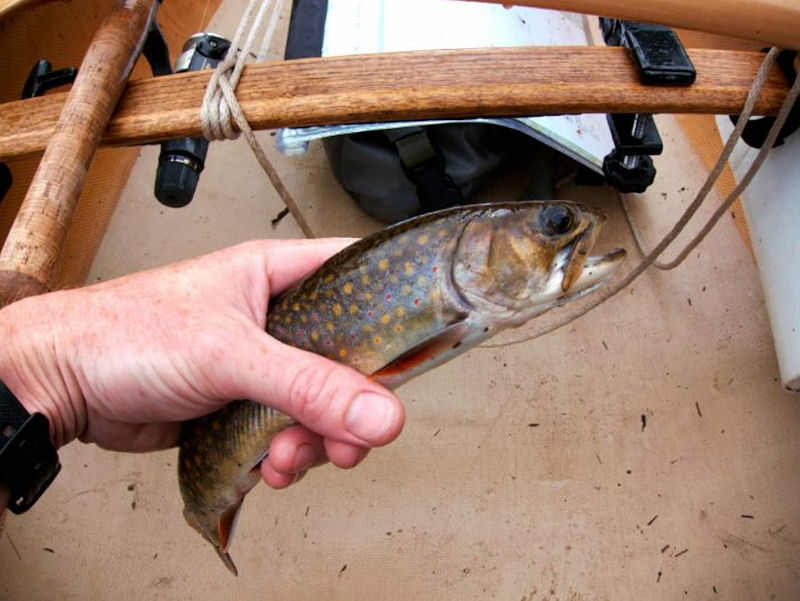 Small Speck along the Nipissing. All Brook Trout were 10 inches and under. All were released. I also caught a few larger Chubs or maybe they were Fallfish. By the time we got to the Nadine Lake portage we were completely soaked through. We needed to stretch our legs and warm up a bit so decided to walk the 1500m trail to Nadine. We saw a picked clean moose skeleton a short distance from the start of the trail. I was pretty cold and miserable at this point and didn’t even bother to pull out the camera. 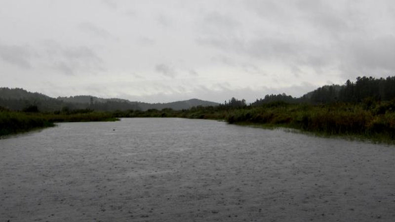 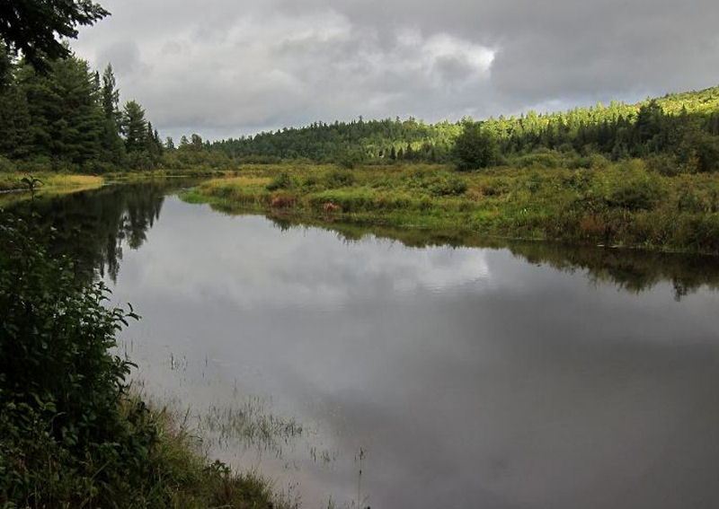 Nipissing River Marsh. The rain finally started to let up as we approached our campsite in the Long Marsh. This was a dark spooky site which gave us an uneasy feeling. Now that I had stopped the exertion of paddling I was showing symptoms of early stage hypothermia. My whole body was shivering uncontrollably. I was dizzy and very pale. My hands were so wet and white they seemed translucent. I kept as active as possible putting up the tarp and hammock then immediately changed into dry clothes and bundled up in my sleeping bag. A half hour of this and I was starting to feel better. Dinner that night was piping hot chilli and tea. At dusk I went down to shore for some fishing. I was only there a few minutes when my companion called to say something was moving behind camp. She watched a dark shape move behind a small rise in the ground and thought it may have been a bear. Of course she was excited! She had been hoping to see a bear on this trip. On the other hand, I am bear phobic and didn’t need to hear this! We watched the small ridge behind the site, back where I had hung the bear rope earlier, but didn’t see any sign of movement. Later that night I went to bed uneasily but was so tired I fell asleep before 10pm. I was startled awake at 3:00am by a bizarre dream that ended with me holding a bear in a headlock while calling to Carolyn for help. Of course, after regaining consciousness there was nothing to be seen or heard in the forest. 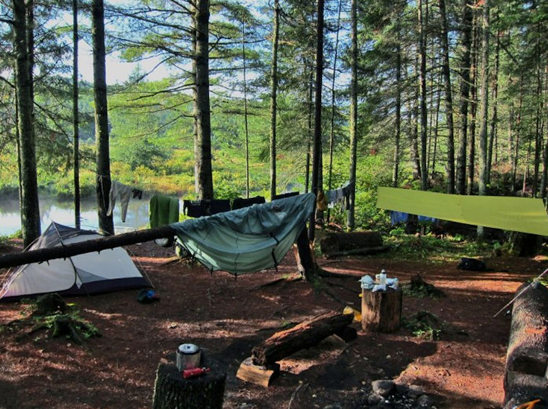 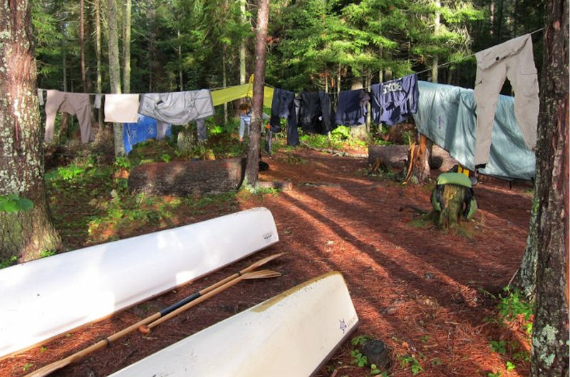 Drying out at the campsite on the Long Marsh. The next morning we awoke with sunshine a high spirits. We had breakfast, fished, read and hung everything out to dry. After enjoying a lazy morning, we departed on our 18km paddle out to Cedar Lake. It was a sunny, fresh perfect day for canoeing. The portages were all short and easy. I fished occasionally without much luck. Highlights included seeing a cow moose and calf bedded down in the Alder along shore and running the rapids at the 230 metre portage. I saw one more moose along 950 metre portage heading out into Marshy Bay on Cedar Lake. 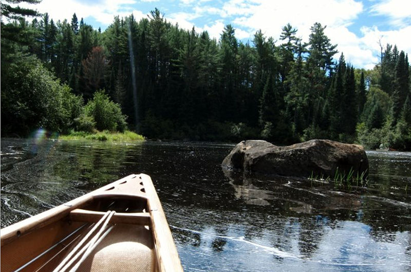 Nipissing River. 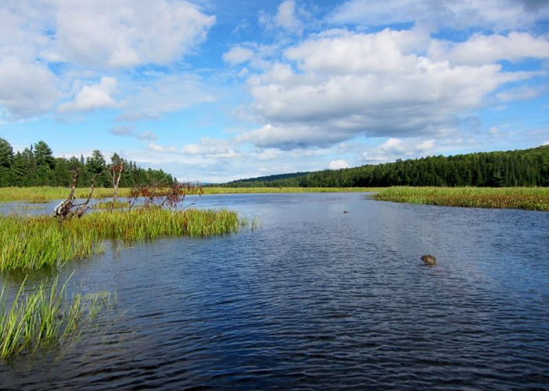 Marshy Bay on Cedar Lake. The paddle across Cedar was another struggle. We had to tack into the wind to avoid being blown sideways down the lake. Again, I am not a fan of paddling across this lake. I would hate to be stuck in it on a windy day! Nonetheless, we crossed without incident. It was a wonderful trip. The first of many I hope to take up at this end of the park. On the way home we stopped for food at the Long Shots Sports Café in Deep River. Doesn’t look like much from the outside but they serve up an awesome burger! - MartinG |