 Tim Lake Campsite #2 (2012)
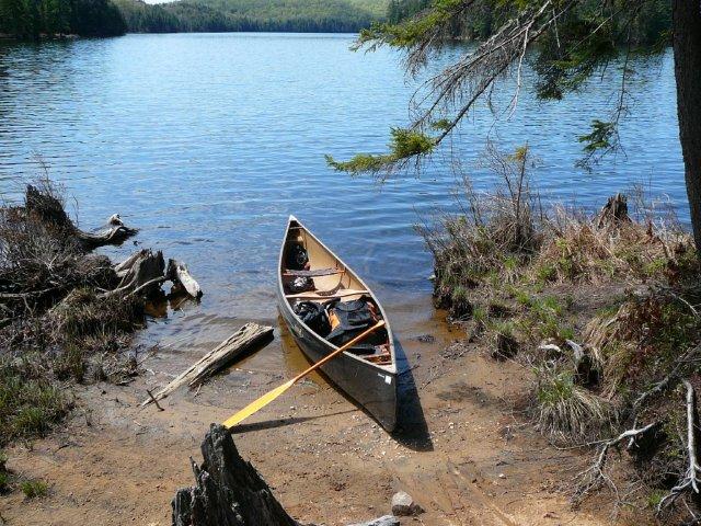
Landing
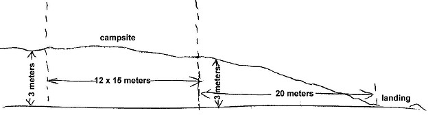
Topography of under-water approach: a sandy beach, and water is knee deep 4 meters from shore.
Impediments to disembarking from and/or unloading a canoe: two canoe-width opening between roots.
Topography to tent sites: 3 meter rise over 20 meter distance.
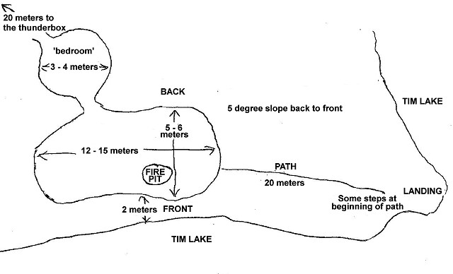
Profile including the slope between the campsite and its landing ...
Sandy landing beach between old stumps ...
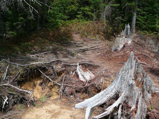
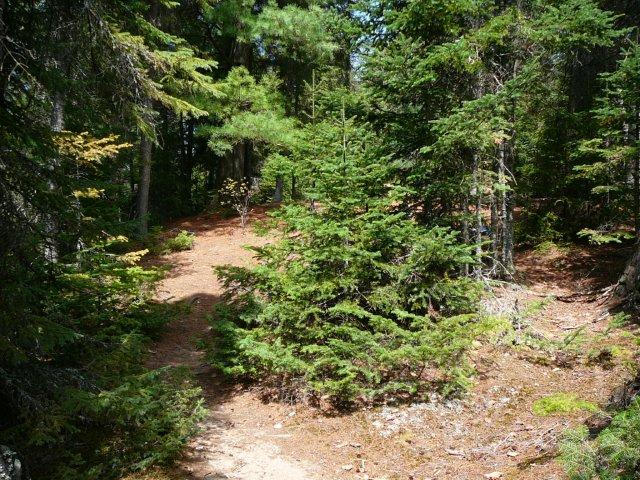
Beginning of ascent by more old stumps ...
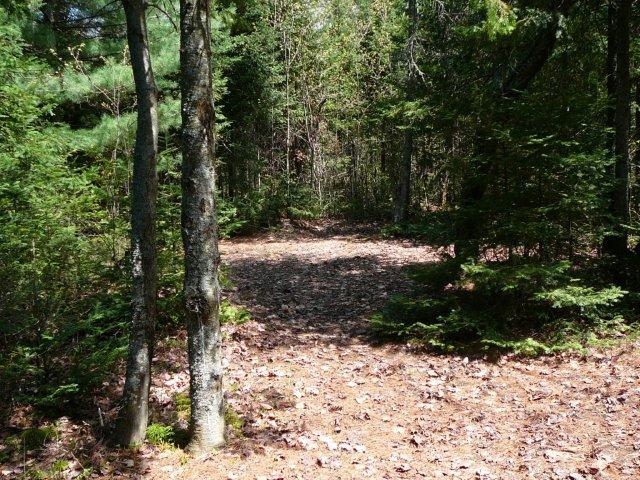
Halfway up the ascent to the actual campsite ...
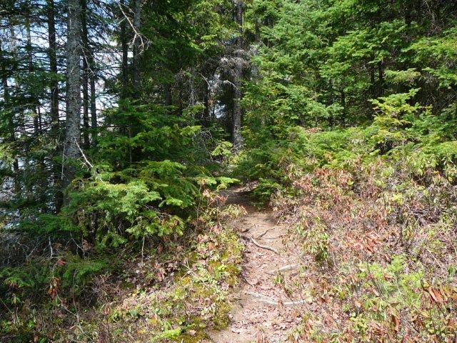
Last part of the ascent to the campsite ...
Campsite
Overview sketch of campsite layout ...
Campsite maintenance: regular.
Size of open area: See overview sketch.
Extent of tree cover: Only open above tentsite areas.
Degree of levelness: Fairly level approx 5 degree slope down back to front.
Number of level tent sites: 3 to 4 (2-3 person) tents.
North exposure: Forest.
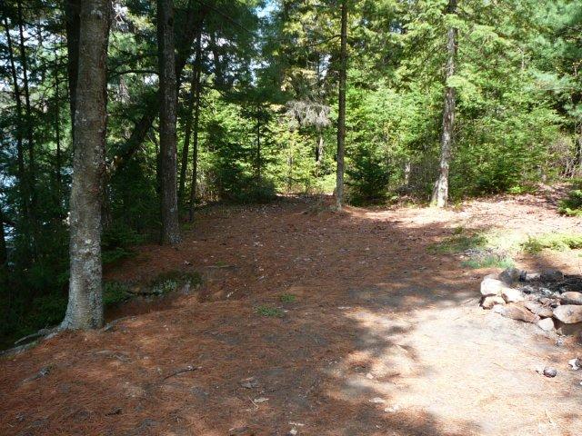
East exposure: Forest, slight view of lake.
South exposure: Forest, bit better view of lake.
West exposure: Trees, obstructed view of lake.
General description: Very nice site, mostly level, good tent pads, good firepit, no morning sun.
Overall accessibility: Moderately easy after first few step-ups.
Area between trail and firepit ...
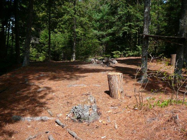
Tentsite area beyond firepit ...
'Bedroom' tentsite area ...
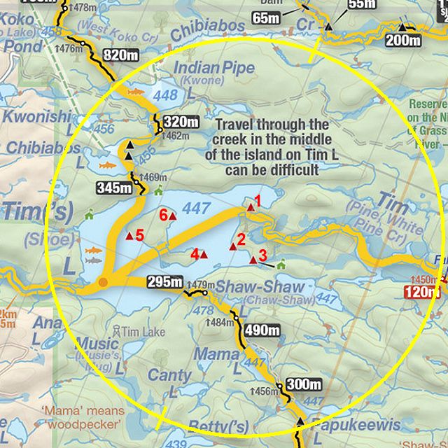
Thanks to Jeffrey McMurtrie of Jeff'sMap for supplying the base-layer map component by Creative Commons licensing.
Submitted by Chris Taylor .. Visited: 2012 .. Submitted: May 19, 2013