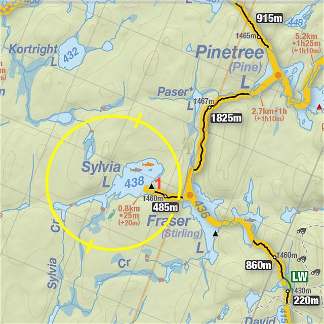
 Sylvia Lake Campsite #1
Landing
Topography of under-water approach: A large rock makes up almost the entirety of the campsite's waterfront. Estimated water depth right of the rock is over 6'.
Impediments to disembarking from and/or unloading a canoe: Fortunately, the eastern end of the rock has a unique formation that functions as a small step very close to the waterline. In practice, identical to loading/embarking from a dock.
 |
|
| Looking west from the firepit. | |
 |
|
| Looking northwest. | |
Campsite
Campsite maintenance: Low
Open ground area: Plenty of open space.
Number of tent sites: Suitable tentsites abound.
General description: The campsite is a peninsula with Sylvia Lake to the west and south and a swampy bay to the east. However, the (aged) thunderbox is front and center, not more than 15M from the firepit and visible from virtually any location on the site. The rock waterfront provides a great view to the west and is a fine platform for a jump (no diving!) into the lake. Of note, the lake has an inordinate quantity of leeches that congregate near this rock.
Overall accessibility: Low to medium - if one dumps while (dis)embarking, one is going for a swim - no wet-foot entry here..
If anyone has additional photographs of this campsite, please submit them so this record can be expanded.
 |
|
| Thanks to Jeffrey McMurtrie of Jeff'sMap for base-layer map component by Creative Commons licensing. | |
Submission by "scratchypants" (forum handle) .. submitted 2019-09-03 .. visited 2019-08-24