 Portage 730m between St. Andrews Lake and Marie Lake
Portage Trail
Length of portage: 730 meters
Portage maintenance regular or low: Regular.
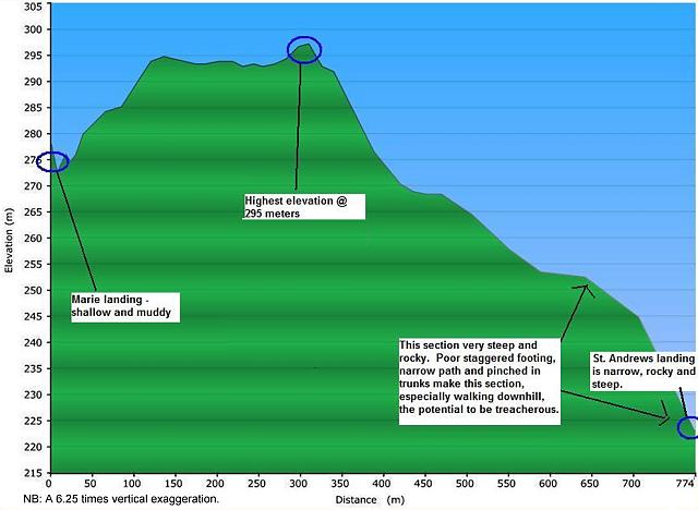
Elevation above Sea Level @ St. Andrews Lake ~ 222 / 228 meters (Jeff McMurtrie, maps / Steve Molson, submitter)
Elevation above Sea Level @ Maria Lake ~ 272 / 275 meters
Difference in elevation: 50 / 47 meters
The portage peaks at 284 / 295 meters, for a total difference in elevation of 62 / 67 meters.
St. Andrews side is very steep towards Marie Lake - a rise of over 75 meters within the first 400 m. The first 100 meters can be treacherous, uneven ground up and even more dangerous down on account of the staggered footing along large boulders and tree trunks pinching in at the narrow spots. The majority of the remaining 100-400 meters leg from St. Andrews to Marie is uphill over smaller boulders, earth and roots. The last 300 meters to Marie lake is an easy downward grade with decent footing.
GPS- generated profile ...
General description: Generally poor on account of the steepness and uneven footing and poor landings on either side.
Topographical impediments to traveling: Steep rocky uphill climb from the St. Andrews side to Marie lake - riskier to navigate on the way down with gear from Marie Lake.
Areas susceptible to impact by periods of rain or beaver flooding: Landing on the Marie side susceptible to spring flooding, otherwise flooding along the trail itself is likely not an issue besides the typical early spring pools which collect in the few depressions along the way.
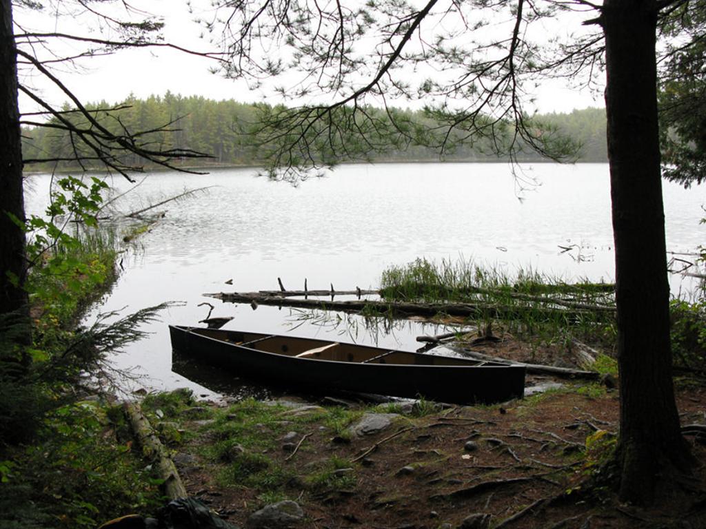
Landing at St. Andrews Lake .. N45 51 10.3 W77 41 11.4
Topography of under-water approach: Depending on water level, large boulders 1-2' below the surface provide decent enough footing to unload-load and launch the boat.
Impediments to disembarking from and/or unloading a canoe: Room for 2 canoes on water at landing, and for gear from 1 stored on shore. Shore is very steep and rocky at landing.
Impediments to moving gear to portage trail: St. Andrews side is very steep and rocky at landing with only a small area off the trail for gear placement right at water's edge. Water depth varied between 2-4' feet deep over large boulders.
Landing on St. Andrews Lake, view is to the west ...
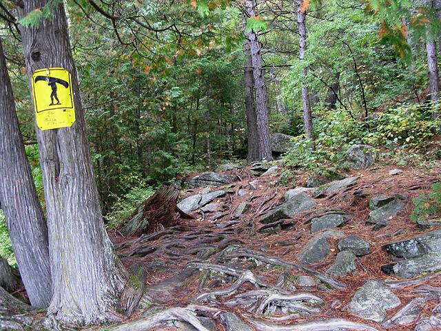
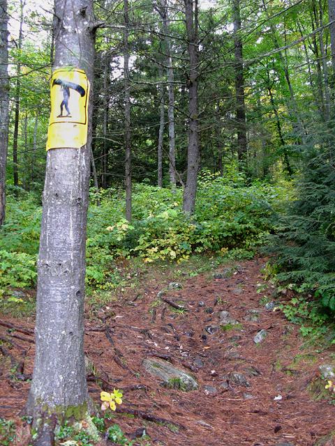
Portage sign to Marie Lake - view is northeast ...
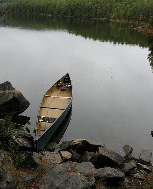
Landing at Maria Lake .. N45 51 19.5 W77 40 41.1
Topography of under-water approach: Depending on water levels, muddy shallow landing at narrow bay - take out at the log pier.
Impediments to disembarking from and/or unloading a canoe: shallow/muddy on the Marie side.
Impediments to moving gear to portage trail: Gear was moved into canoe via the log pier and there was sufficient flat space at the landing for gear storage.
Landing on Marie Lake, looking north ...
![]()
Portage sign to St. Andrews Lake, looking west...
![]()
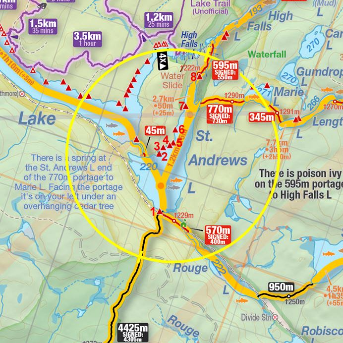
Thanks to Jeffrey McMurtrie of Jeff'sMap for supplying the base-layer map component by Creative Commons licensing.
Submitted by Stephen Molson .. December, 2009