 Smoke Lake to Ragged Lake Portage
Length of portage: 240m
Portage maintenance regular or low: Regular.
Elevation above Sea Level @ Smoke Lake is 417 meters.
Elevation above Sea Level @ Ragged Lake is 433 meters.
Difference in elevation: 16 meters.
Elevation of highest point: 437 meters. Overall rise/fall: 20 meters.
Landing at Smoke Lake
Topography of under-water approach: Shallow grade beach of sand.
Impediments to disembarking from and/or unloading a canoe: None.
Topography of the ascending grade: Sand beach
Impediments to moving gear to portage trail: Ample space to place number of canoes and gear.
Portage landingtake-out ...
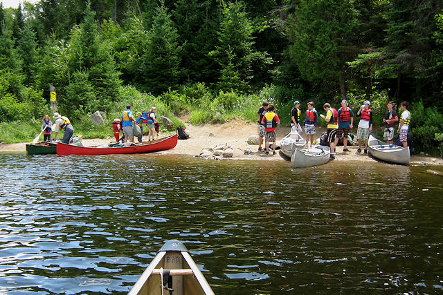
Looking north up Smoke Lake from the landing ...
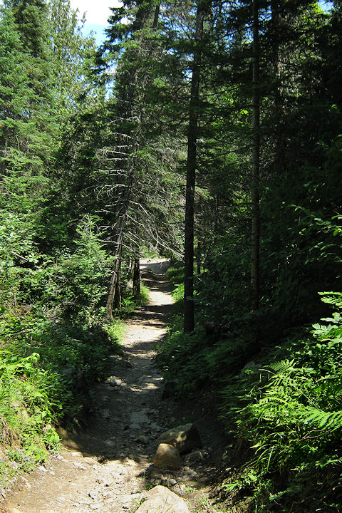
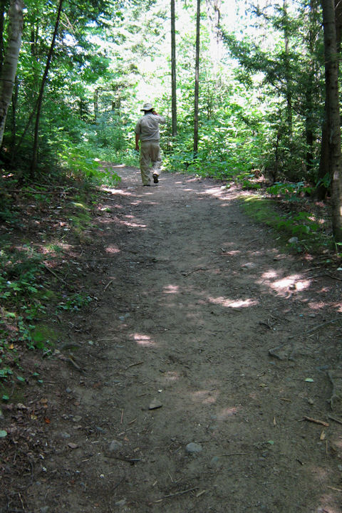
Portage Trail
General description: The portage is moderately sloped at both ends. It is heavily worn to the point of being rough in the odd spot.
Topographical impediments to travelling: If conditions are wet, care should be taken where erosion has sloped rocks.
Eroded start to the portage ...
Looking down back to Smoke Lake. Erosion has exposed a rocky section ...
Looking up, back toward Smoke Lake, from the Ragged Lake end ...
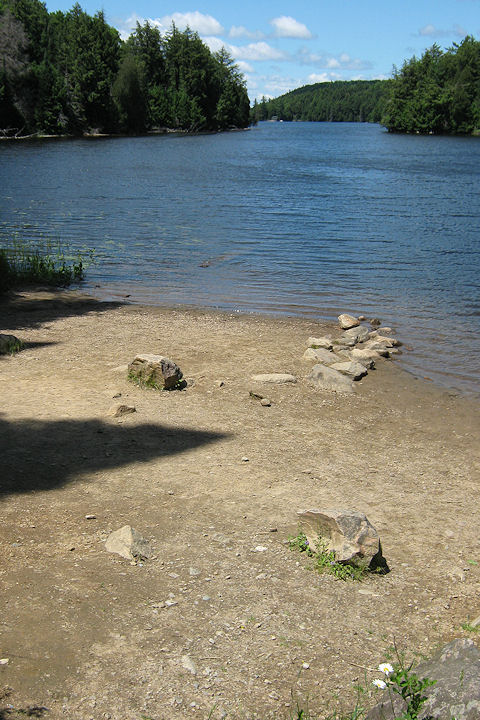
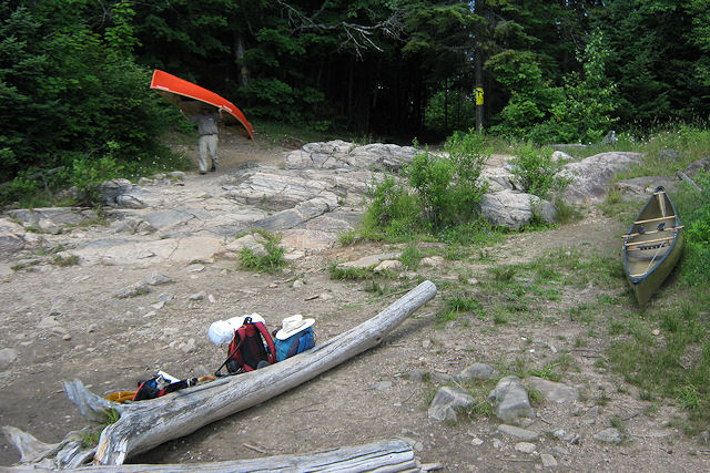
Landing at Ragged Lake
Topography of under-water approach: The actual landing is a shallow-grade sand and rock beach area.
Impediments to disembarking from and/or unloading a canoe: None
Topography of the ascending grade: There's a moderate rise up to the actual portage trail. If water levels are high, the access could be directly to the rise itself.
Impediments to moving gear to portage trail: None. there's ample room ashore, to haul canoes and gear aside and out of the way.
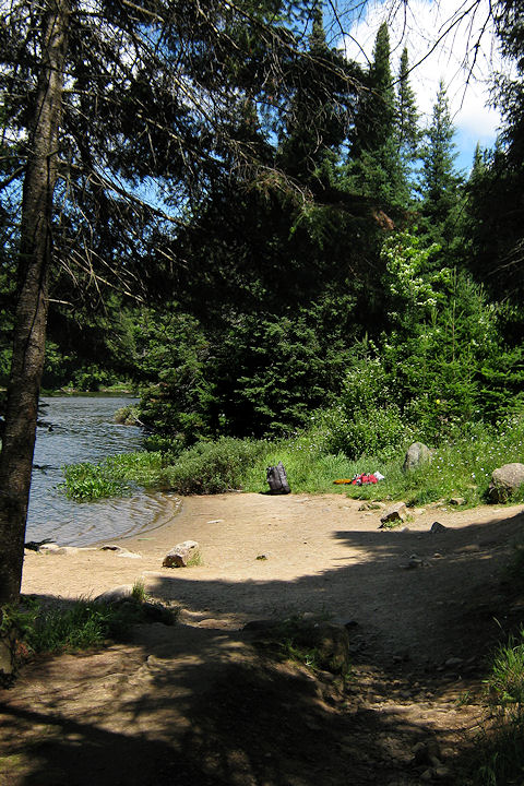
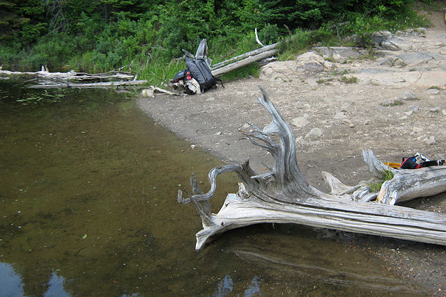
Sloped rocky descent from portage to landing, with ample space to organize ...
Cross-section view of approach and unloading area ...
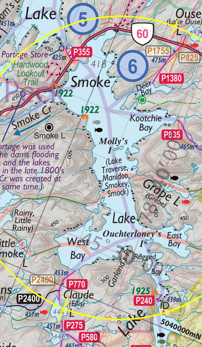
Thanks to Jeffrey McMurtrie of Jeff'sMap for supplying the base-layer map component by Creative Commons licensing.
Submitted by Barry Bridgeford, visited 2011, submitted March, 2012