 Shirley Lake Campsite #9
Landing
Topography of under-water approach: Small shallow sandy beach
Impediments to disembarking from and/or unloading a canoe: None.
Topography to tent sites: Slight rise between bushes.
The small landing beach is hidden away in a small bay ...

![]()
The entire approach is narrow and close to the tentsite ...

![]()
Campsite
Campsite maintenance: regular
Size of open area: No open area.
Extent of tree cover: Trees envelope the entire campsite. .
Degree of levelness: Firepit and tentsites are level with each other.
Number of level tent sites: One behind the firepit and one beside it.
North exposure: Totally blocked from the north wind by a large 'hill' and the forest.
East exposure: Blocked from east wind by forest.
South exposure: Blocked from south wind by forest.
West exposure: Narrow opening across lake to the southwest.
A single canoe can be stored beside the short trail to the firepit ...

![]()
Here's the lake view from the firepit ...

![]()
Extra Feature - Adjacent Vantage Point
This campsite has an amazing 'extra feature'. There's a steep trail up to the northwest. It leads to a large open rock hill top vantage point overlooking the bay infront of the campsite. And, to the northwest. it overlooks Shirley Lake's length to the north. Unfortunately the vantage point's exposed location, rock ground and distance from the thunderbox negate its use for tentsites. However, it does serve admirably as an evening vantage point.
The trail is narrow and somewhat steep ...

![]()
Looking south across the bay infront of the campsite ...

![]()
Looking through the trees to the north, this view is northwest up Shirley Lake ...

![]()
General description: This campsite is has a secluded location, tucked into the forest. Its good for a contemplative solo-escape. Being 'confined' and having a potentially dangerous cliff-top vantage point adjacent to it .. it's definitely not recommended for families with younger children. A main forestry road is located east of the campsite, so the odd logging vehicle may be heard on occasion.
Overall accessibility: The actual campsite is very accessible.
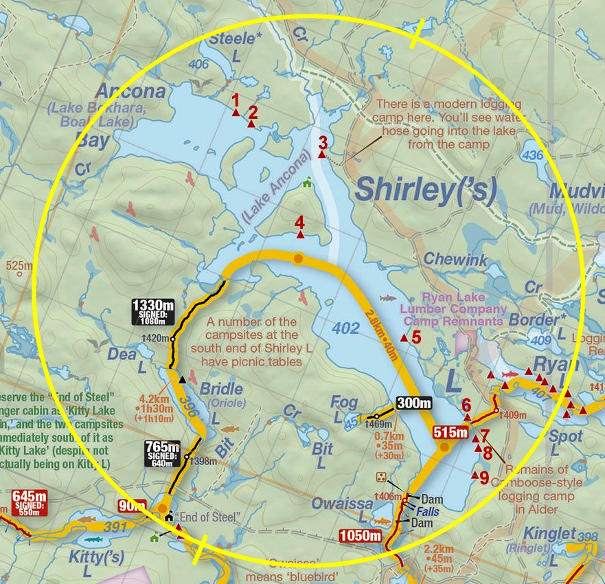
Thanks to Jeffrey McMurtrie of Jeff'sMap for supplying the base-layer map component by Creative Commons licensing.
Submission May, 2013 by Barry Bridgeford .. visited June, 2010