 Shirley Lake Campsite #4
Landing
Topography of under-water approach: Substantial rock rubble.
Impediments to disembarking from and/or unloading a canoe: An opening in the rocks allows one canoe at a time to be unloaded comfortably .
Topography to tent sites: Short grade with rocks amongst roots.
The rocky landing viewed from offshore ...

![]()
Depending on water levels, one canoe at a time ...

![]()
Campsite
Campsite maintenance: regular
Size of open area: medium-size open flat area is all under trees cover.
Extent of tree cover: 100%.
Degree of levelness: All on one flat level.
Number of level tent sites: Room for no more than 3 tents close to firepit and each other.
North exposure: Forested island shelters the campsite from the north.
East exposure: Shoreline's forest.
South exposure: Trees and bushes block some of the view and wind.
West exposure: Shoreline's forest.
Small rocky rise to campsite ...

![]()
Firepit is surrounded by trees, with one tentsite close by to the west (right) ...

![]()
Two tentsites close together east of the firepit ...

![]()
General description: This campsite has a very limited view and a rough shoreline. It is very embedded into the forest and only has very limited mid-day 'sunning' opportunities. In bug season, its lack of bug-clearing breezes could be a real problem.
Overall accessibility: This campsite's accessibility is somewhat hampered by its landing's rocks
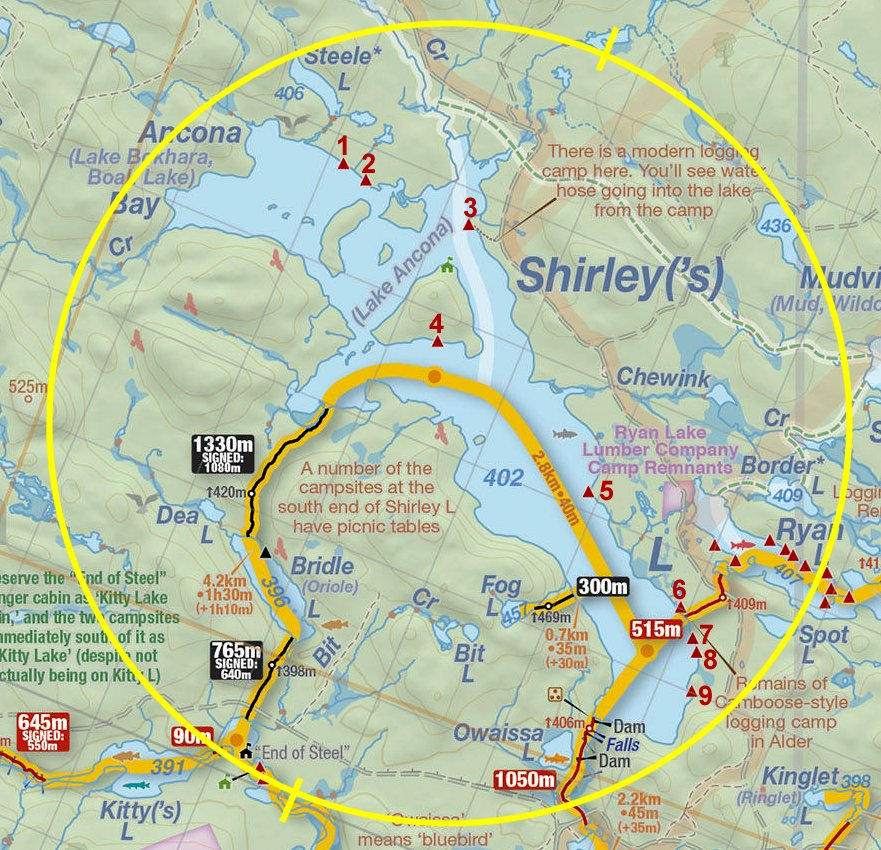
Thanks to Jeffrey McMurtrie of Jeff'sMap for supplying the base-layer map component by Creative Commons licensing.
Submission July 2014 by Barry Bridgeford .. visited 2014