 Rock - Galeairy Portage
Portage
Length: 100 meters
Portage maintenance: regular
Elevation above Sea Level @ Rock Lake: 391 meters
Elevation above Sea Level @ Galeairy: 390 meters
Rise/Fall Overall: 1 meter down to Galeairy Lake.
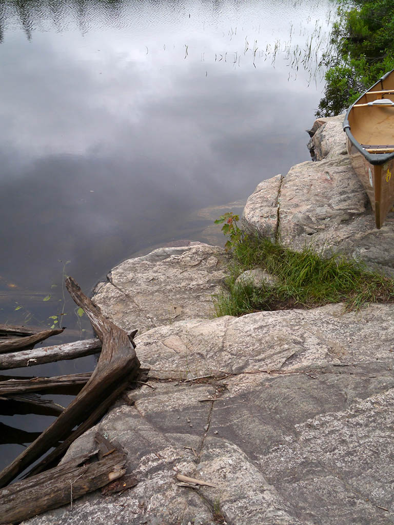
Landing at: Rock Lake
Topography of under-water approach: Deep water with a couple of small rock shelves on shoreline below high water levels.
Available surface area for managing canoes: Room for just 1 canoes at a time at the water's edge.
Impediments to disembarking from and/or unloading a canoe: Initial steep rocks require attention to sure-footedness.
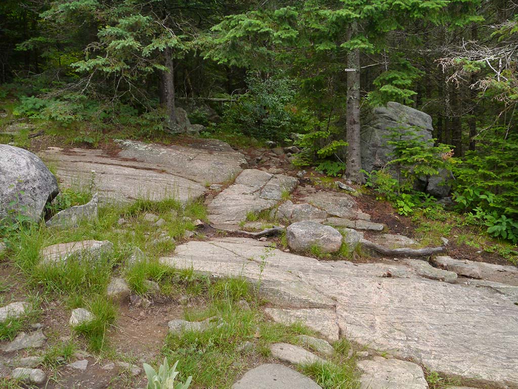
Topography of the ascending grade: Moderate slope of large rocks up to trail.
Impediments to moving gear to portage trail: None. There's ample space to pull canoes out of the water and to organize gear.
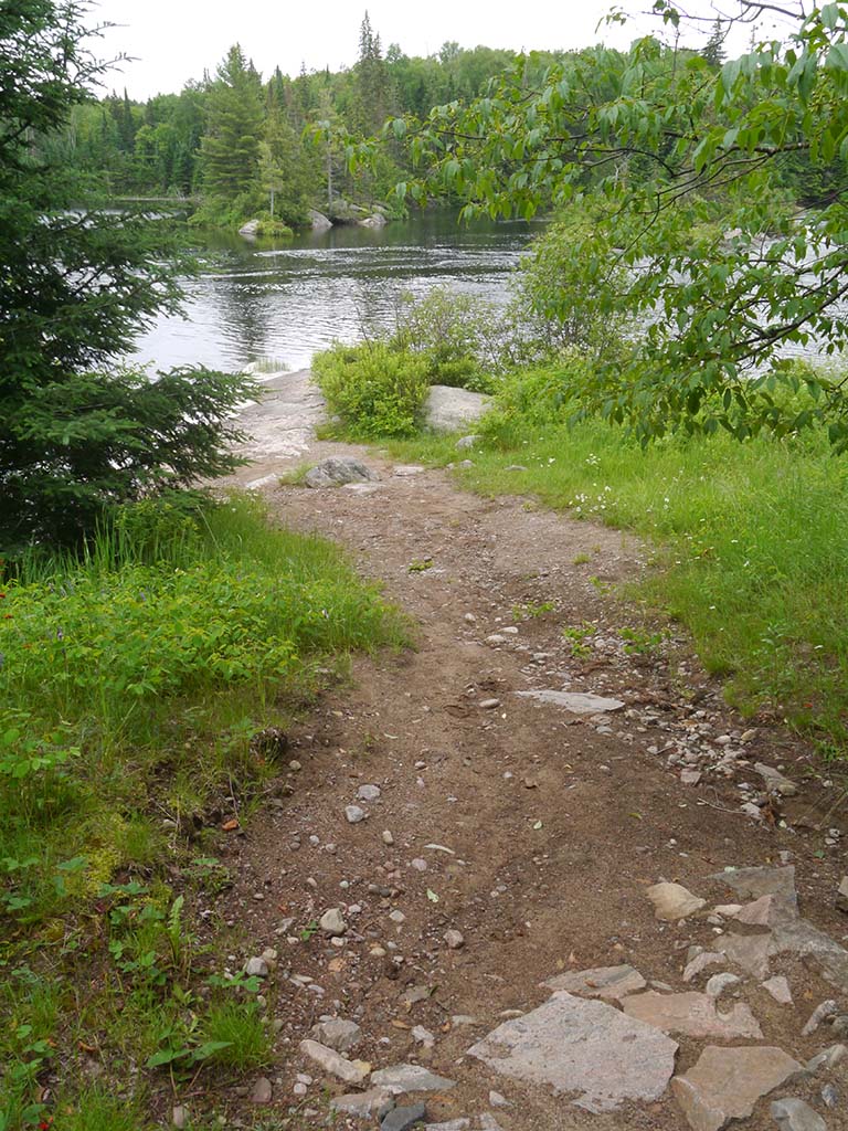
Rock Lake landing's deep water & rock 'step-out' ...
![]()
Ample space in area to left, to park canoes and sort gear ...
![]()
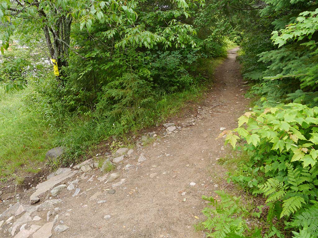
Portage trail is accessed at the right side of rocky slope, via a short irregular stretch ...
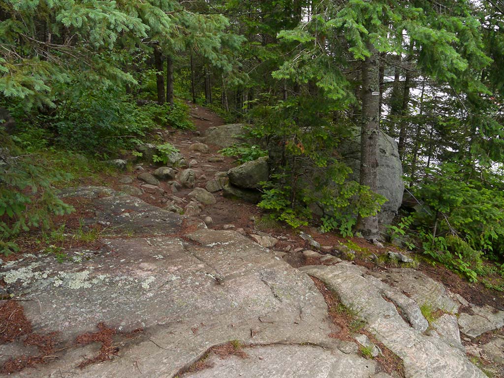
![]()
Portage Trail
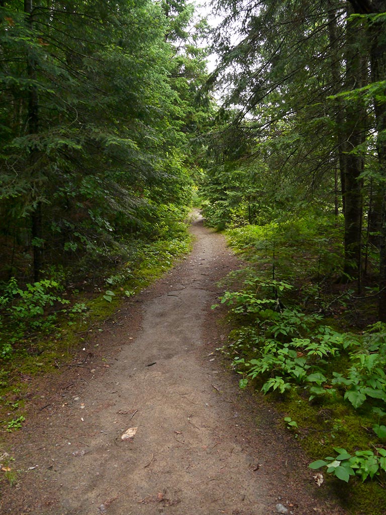
General description: Mostly narrow, smooth, and flat firm ground.
Topographical impediments to traveling: None.
Areas susceptible to impact by periods of rain or beaver flooding: None
Greater part is along an old flat railway bed ...
![]()
The portage finally turns and heads down-grade toward the water ...
![]()
It's just a gentle slope down to the water's edge ...
![]()
Landing at: Galeairy Lake
Topography of under-water approach: Sand and gravel .. up to a gently sloped rock.
Available surface area for managing canoes: Sufficient width to the landing to easily deal with up to three canoes at a time.
Impediments to disembarking from and/or unloading a canoe: Slope of rock is gentle and facilitates sideways loading.
Impediments to moving gear to portage trail: Ample room on rock and nearby grassy area to park canoes and sort gear.
The landing is a shallow sand & gravel beach and a gently sloped rock. (BTW: The foam is a natural phenomenon) ...
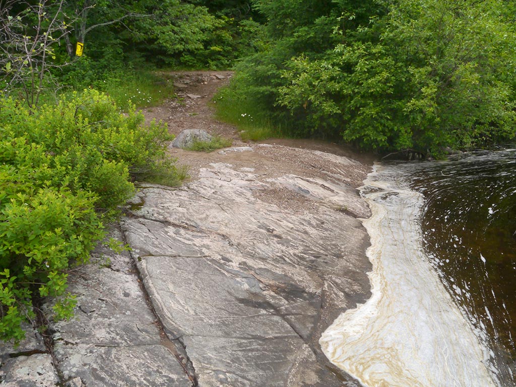
![]()
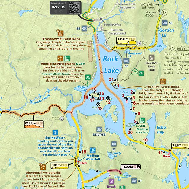
Thanks to Jeffrey McMurtrie of Jeff'sMap for supplying the base-layer map component by Creative Commons licensing.
Submitted by Barry Bridgeford, September 2013 .. visited June 2013