 Portage 40m .. 2nd Upstream Between Red Pine Bay and Longer Lake, on the Petawawa River
Portage
Location:Ā2nd portage upstream between Red Pine bay and Longer Lake, on the Petawawa River.
Length of portage: 40 meters
Portage maintenance regular or low: Regular.
Elevation above Sea Level at Petawawa River Upstream: Ā 396 meters
Elevation above Sea Level at Petawawa River Downstream: Ā 395 meters
Difference in elevation: <1 meter drop between Petawawa River and Petawawa River
Elevation of highest point: 397 meter.
Portage Trail
General description: Short up and over portage. Rocky shoreline for the first 10 meters on the upriver stretch before changing to hardpack earth/rock mix before ending at small landing on the downstream side. Swift was not run or lined during summer conditions ¢ very shallow with emerging rocks. Poison ivy bordering and encroaching on the trail along a 10-15 meter stretch from the upriver landing.
Topographical impediments to traveling: Other than the poison ivy, none.
Areas susceptible to impact by periods of rain or beaver flooding: At landings only .. spring water levels will push both landings further up on shore but landing should still be shallow and an easy grade.
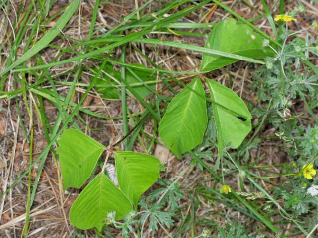
Poison ivy along both sides of this portage ...
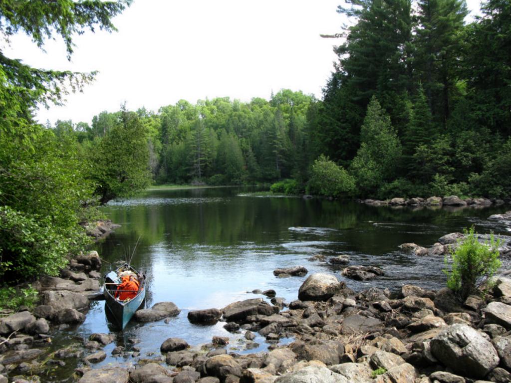
Upstream LandingĀon Petawawa R.
Co-ordinates of location: N45 49 15.4 W78 39 48.9
Topography of under-water approach: Shallow sandy and rocky shoreline. Slight downstream current (<1 km/hr) at landing was not an issue during summer water levels.
Impediments to disembarking from and/or unloading a canoe: None during normal summer water levels, poison ivy not at landing but located further up.
Topography of the ascending grade: A very slight rise of < 2 meters from the landing before the trails drops back down to the river.
Impediments to moving gear to portage trail: Watch for poison ivy, otherwise no issues.
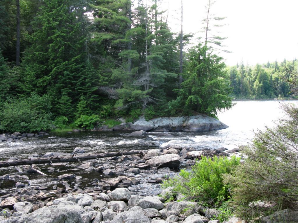
Upstream landing, looking south ...
![]()
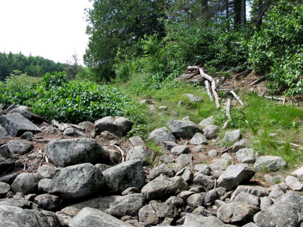
Beginning of portage from the upstream end.
View is north-west. Note the large growth of poison ivy on the left side of trail ...
![]()
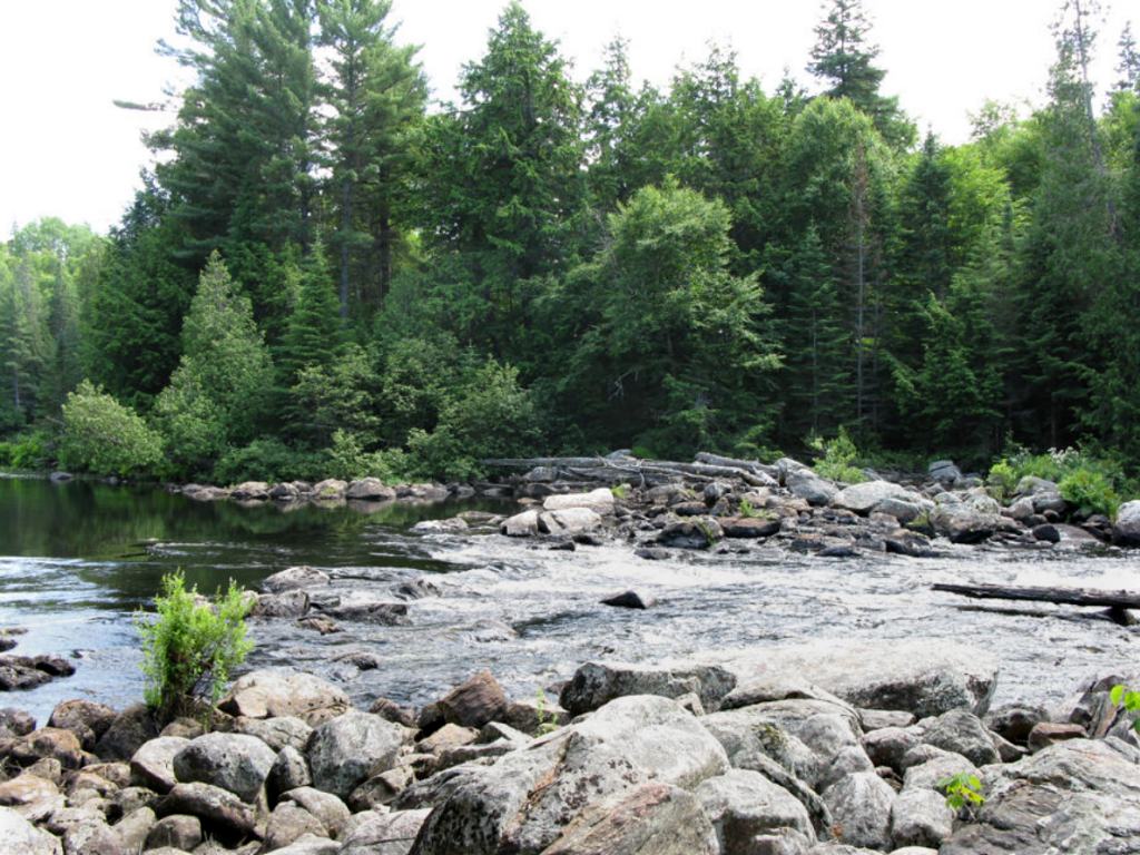
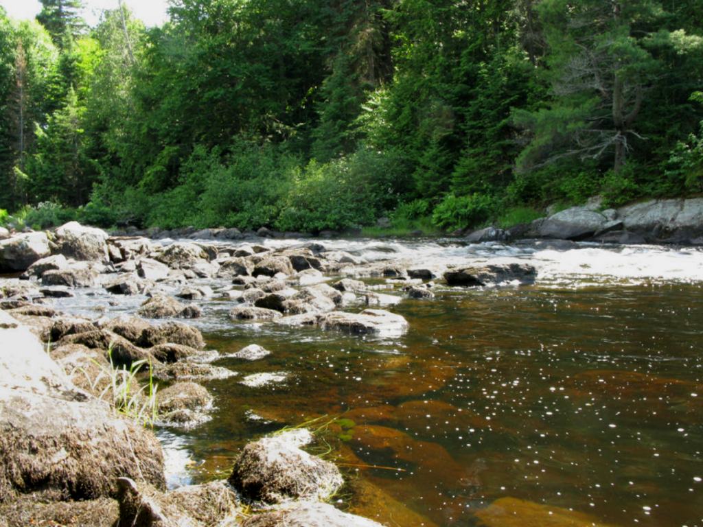
View from portage, top of swift, looking south west ...
![]()
Bottom of the swift, looking west ...
![]()
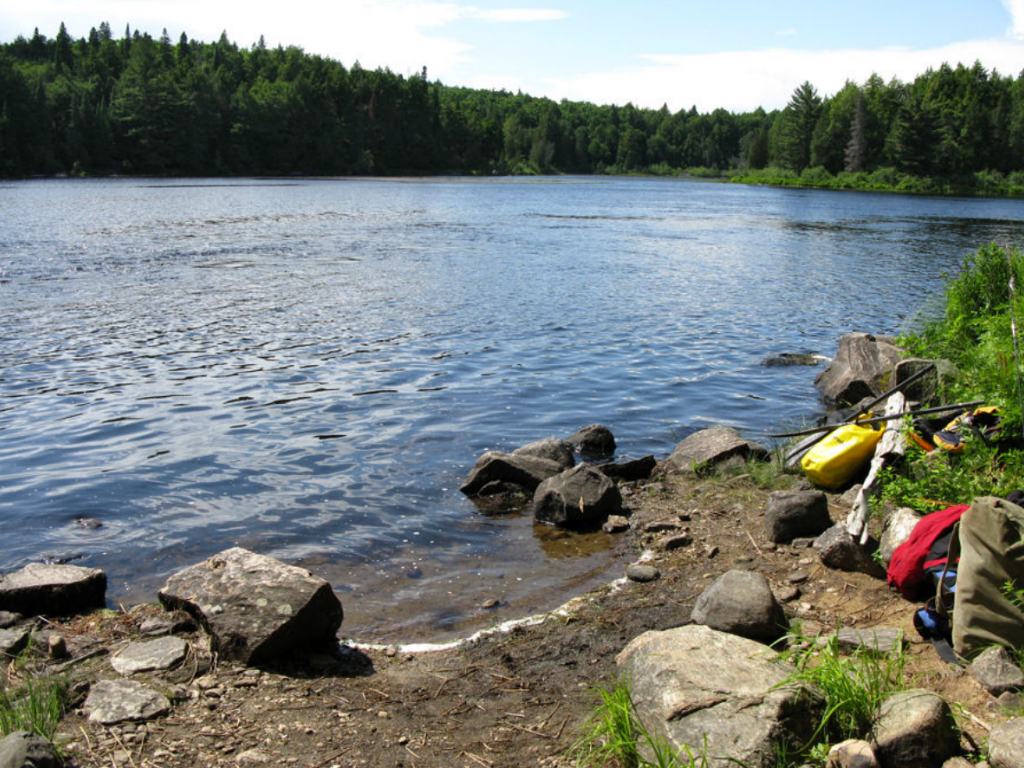
Downstream LandingĀon Petawawa River
Co-ordinates of location: N45 49 15.9 W78 39 50.2
Topography of under-water approach: Shallow and rocky for the first meter, but drops into deeper water < 2 meters off-shore.
Impediments to disembarking from and/or unloading a canoe: None during normal summer water levels. Landing is protected from any current. Sufficient space for 3-4 vessels in the water, at least 1 up on shore.
Topography of the ascending grade: None ¢ relatively flat.
Impediments to moving gear to portage trail: None, but the area for gear management is small. Watch for poison ivy
Downstream landing ...
![]()
Upstream view from the landing ...
![]()
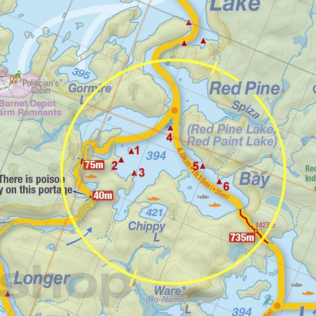
Thanks to Jeffrey McMurtrie of Jeff'sMap for supplying the base-layer map component by Creative Commons licensing.
Submitted by Stephen Molson .. Visited July 2009 .. Submitted March, 2010