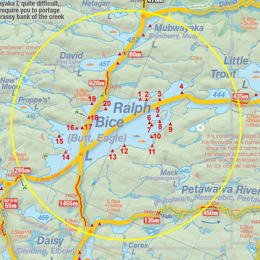
 Ralph Bice To David Lake Portage
Length of portage: 620m
Portage maintenance regular or low: Regular.
Elevation above Sea Level @ Ralph Bice Lake is 444 meters.
Elevation above Sea Level @ David Lake is 457 meters.
Difference in elevation: 13 meters.
Elevation of highest point: 467 meters. Overall rise/fall: 23 meters.
Landing at Ralph Bice Lake
Topography of under-water approach: Smooth sand.
Impediments to disembarking from and/or unloading a canoe: None.
Topography of the ascending grade: Rocky 45 degree slope.
Impediments to moving gear to portage trail: Slope leading to actual portage trail has numerous large rocks.
This landing (with an impeded rise to the trail) is a few meters west of the better 'official' one (photo: Marko Mrkobrada) ...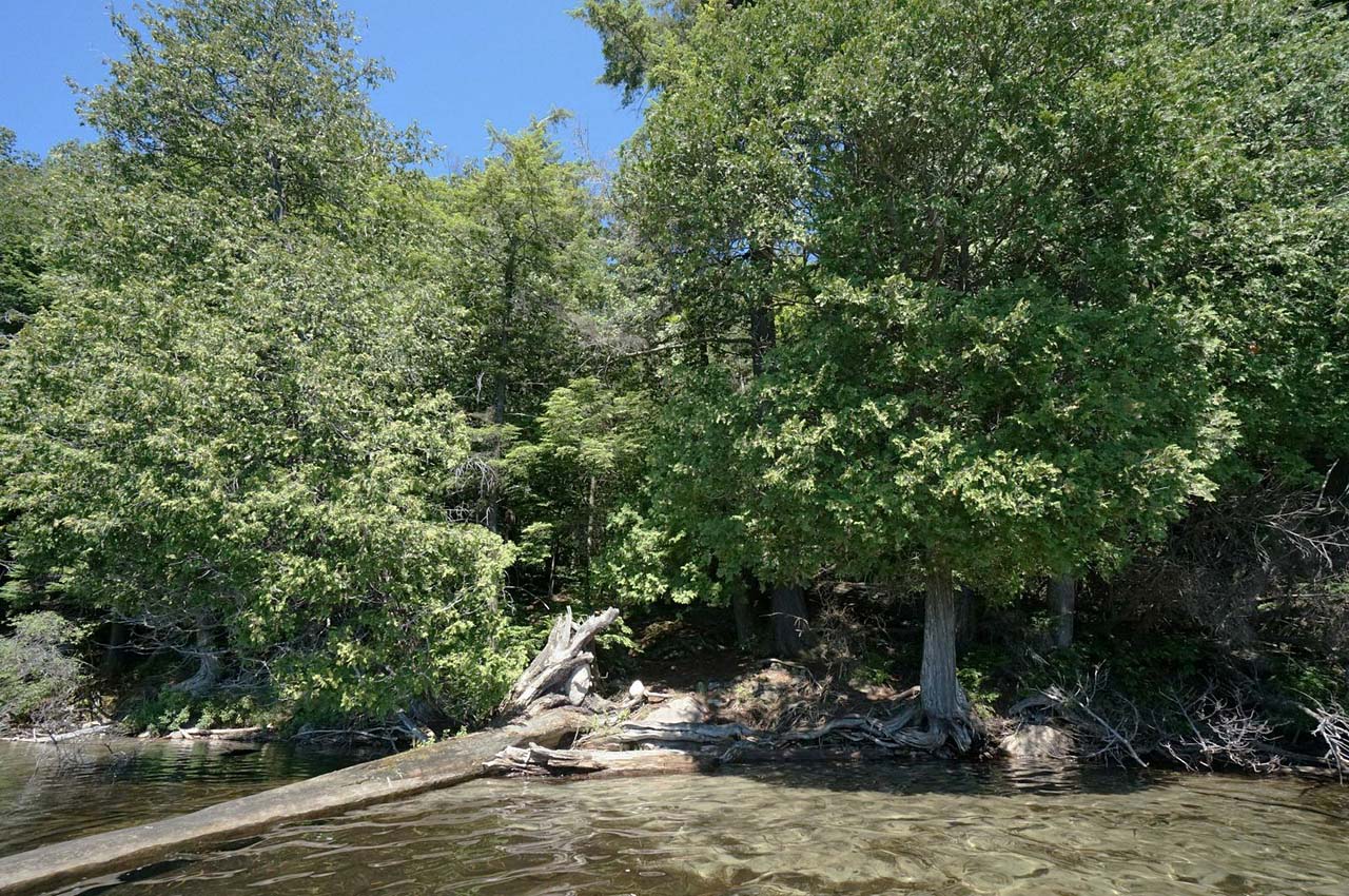
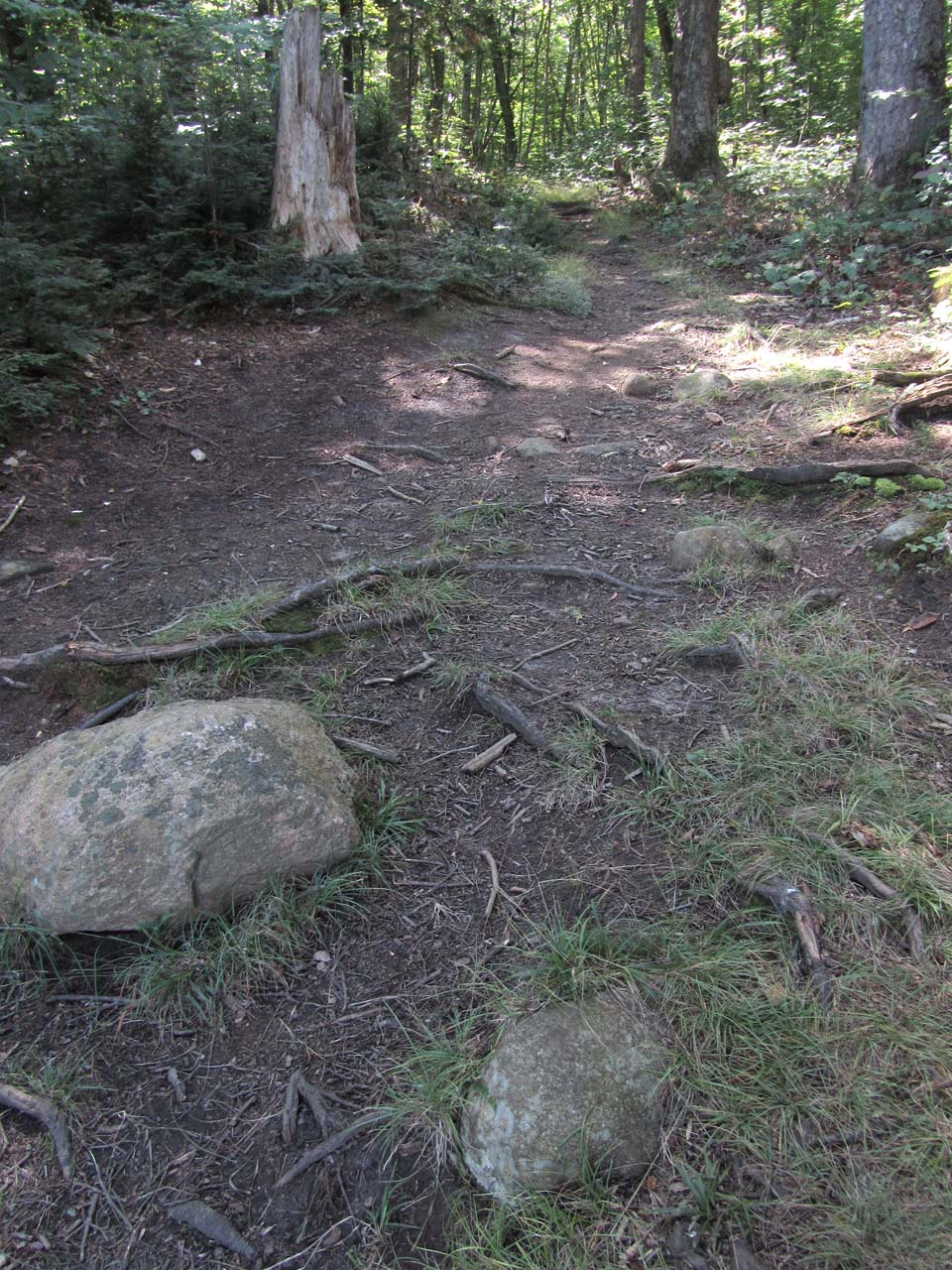
General description: It has rough rocky sections along its length and noticeable ups-and-downs.
Topographical impediments to travelling: None of the rises are impediments. However, one should constantly be checking one's footing.
Areas susceptible to impact by periods of rain or beaver flooding: None.
Section of the portage near Ralph Bice Lake ...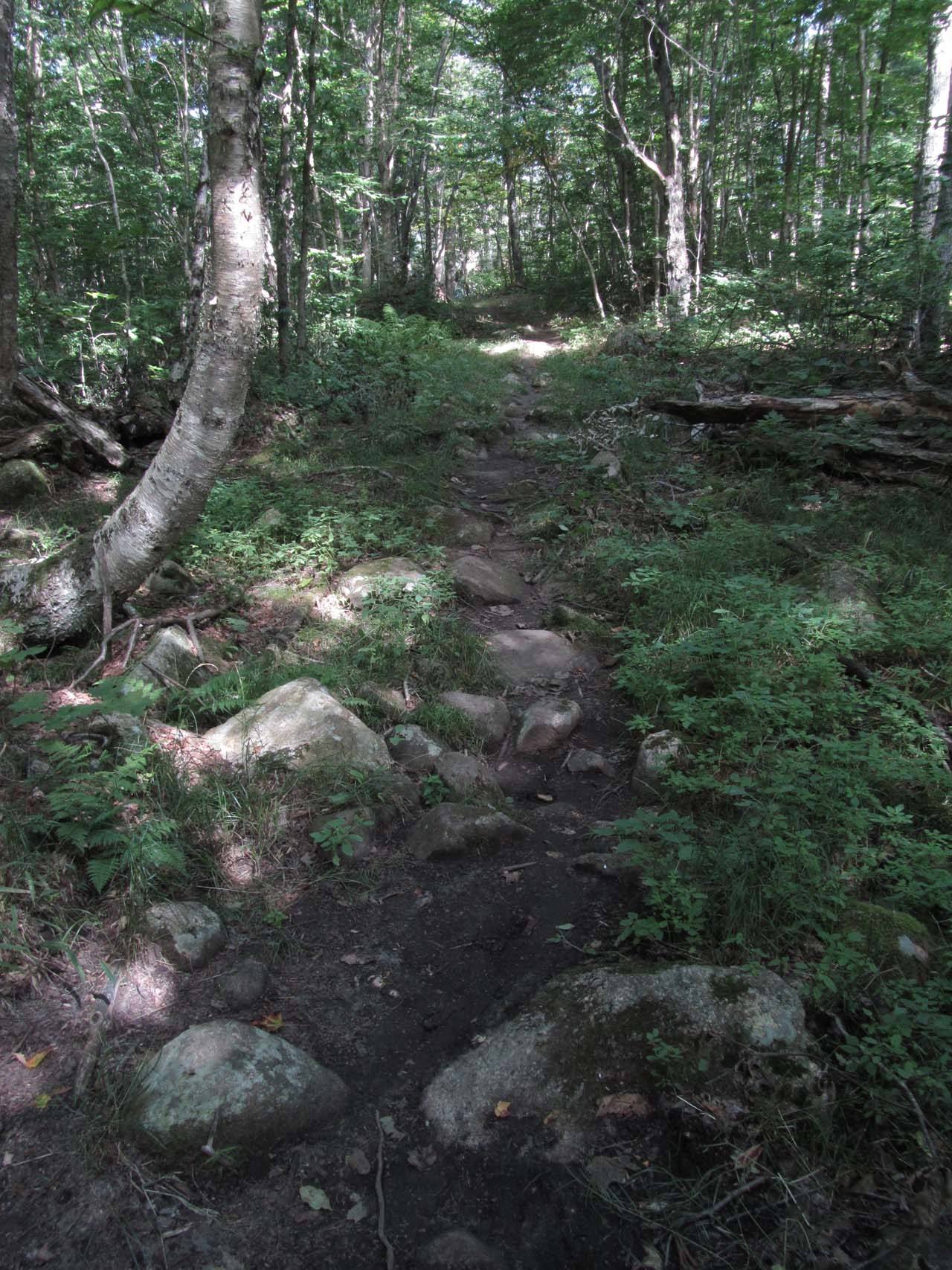
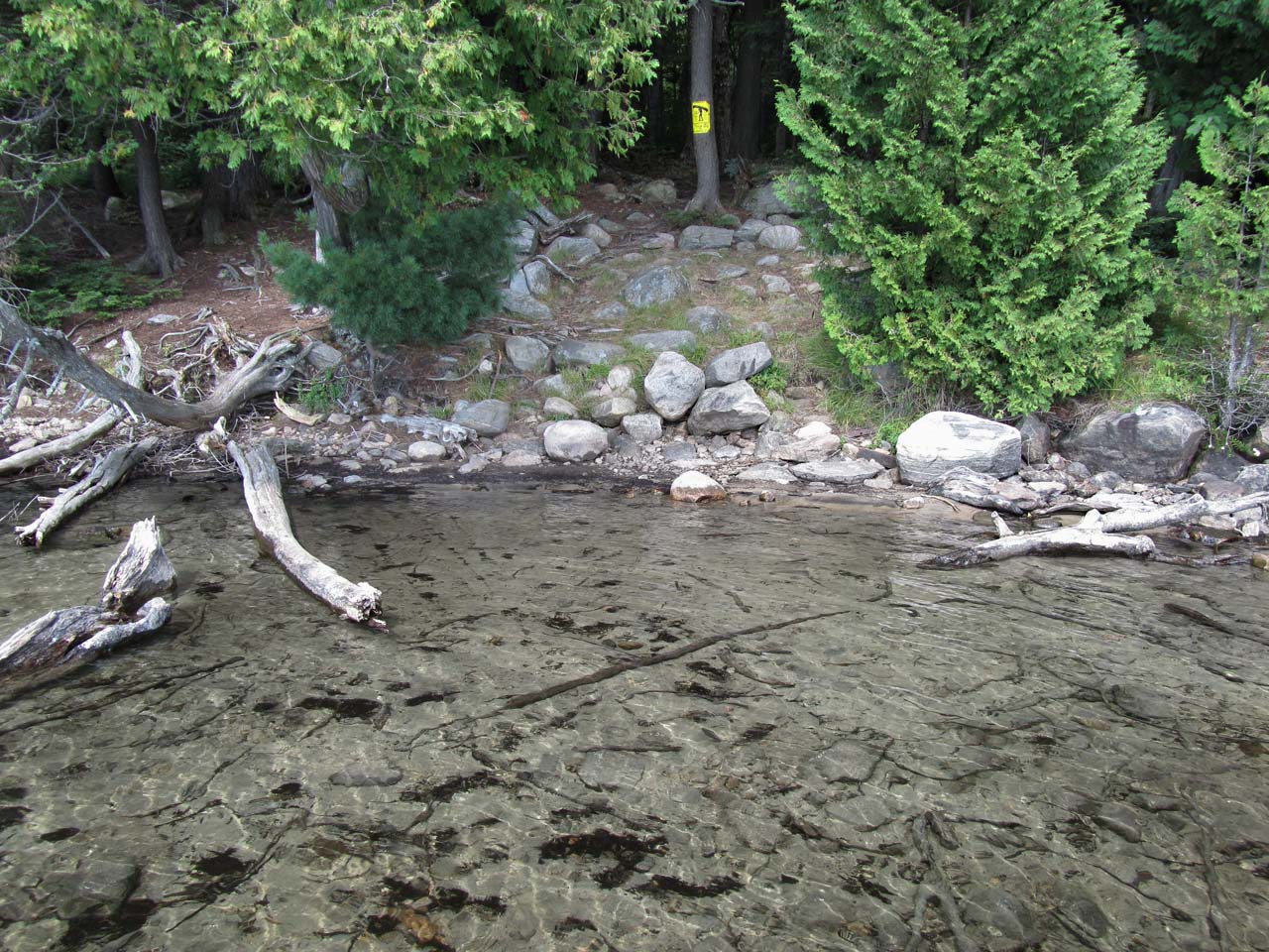
Landing at Ryan Lake
Topography of under-water approach: The actual landing is a shallow dirt and gravel beach area. A few feet further out is somewhat mucky with some small sunken deadwood. Note that when heading out into the main part of Ryan Lake, one has to first paddle across a small inlet or bay.
Impediments to disembarking from and/or unloading a canoe: None
Topography of the ascending grade: There's a small rise up to root and dirt level area. If water levels are high, the access could be directly to the rise itself.
Impediments to moving gear to portage trail: None. there's ample room ashore, to haul canoes and gear aside and out of the way.
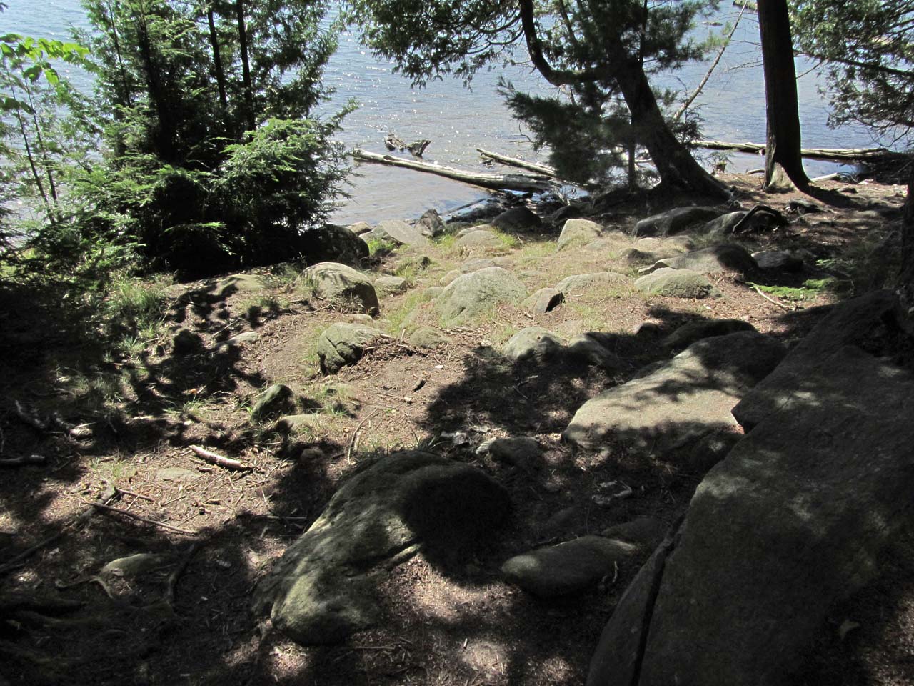
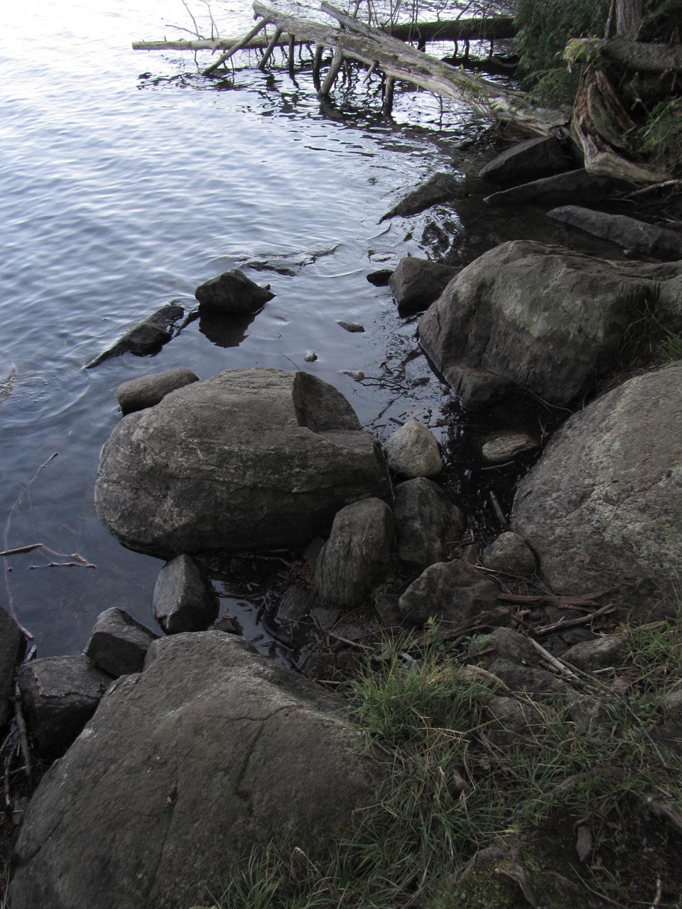
Slight but very rocky slope to the landing at David Lake ...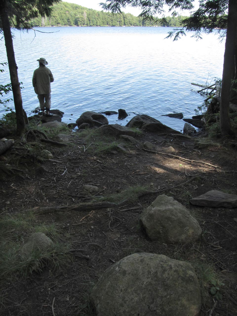
Thanks to Jeffrey McMurtrie of Jeff'sMap for supplying the base-layer map component by Creative Commons licensing.
Submitted by Barry Bridgeford, visited August 2012, submitted August 2013