 Ragged Lake Campsite #9
Landing
Topography of under-water approach: Shallow sand and gravel at summer water levels.
Impediments to disembarking from and/or unloading a canoe: None.
Topography to tent sites: Considerable steep and rocky grade.
Looking down from the firepit level to the landing ...

![]()
Looking up the steep and rough grade to the firepit level ...

![]()
Firepit area, looking across the bay in front of the landing down below (photo by Bill Warren) ...

![]()
Campsite
Regular or low-maintenance: Regular.
Size of open ground area: Firepit area is quite open, with only a thin line of trees on its north side. Tentsite area is to the rear and more sloped.
Extent of tree cover: Tent sites have reasonable coverage and shelter from the prevailing NW wind.
Degree of levelness: Fire pit and tent sites are on separate level areas.
Number of tent sites: 3+.
North exposure: Trees protect the tent sites.
East exposure: Forest.
South exposure: Forest.
West exposure: Open bay.
Looking west across the tentsite area ...

![]()
Tentsite areas. Firepit is in distance, behind center trees (photo by Bill Warren) ...

![]()
Immediately beside the firepit area is this vantage point looking to the northwest (photo by Bill Warren) ...

![]()
General description: A large campsite with an open firepit area, protected tentsite area, a limited view and an unattractive shoreline.
Overall accessibility: While the landing is easy, the steep and rough grade up to the campsite is a definite challenge to access.
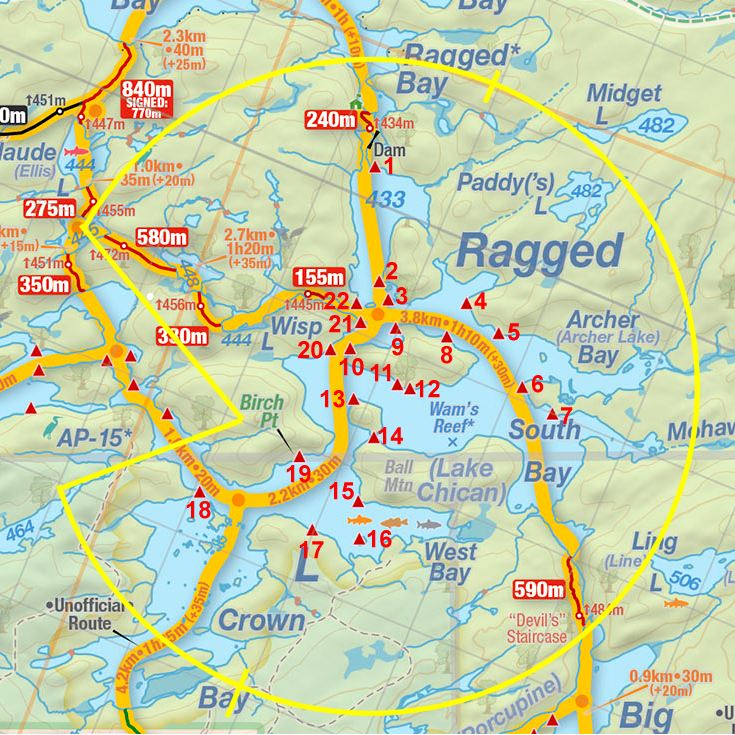
Thanks to Jeffrey McMurtrie of Jeff'sMap for supplying the base-layer map component by Creative Commons licensing.
Submission March, 2015 by Barry Bridgeford .. visited 2011