 Proulx Lake Campsite #3
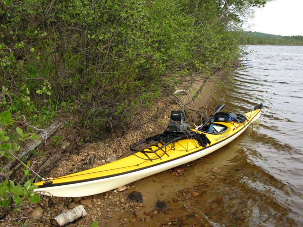
Landing
Topography of under-water approach: South-West facing landing over a nice tapered sandy beach. Spring water levels had little of the sand beach exposed above the water – water was tight to shoreline/shrubs. Into summer, likely have a good 4-6 feet of dry beach. No obstructions to landing.
Impediments to disembarking from and/or unloading a canoe: Watch for low-slung branches 1-2’ above and parallel to water during spring conditions, otherwise none.
Topography to tent sites: Trail follows a steep banked shoreline from the beach up to campsite. Trail is over firm ground starting from < 1.5’ high ledge up from beach, west of campsite. Trail was about 30 m in length
Campsite’s landing area, view is east along shore ...
![]()
South-east from landing area, mouth of Koko river at center in distance ...
![]()
Firepit and tenting/tarping area, looking west ...
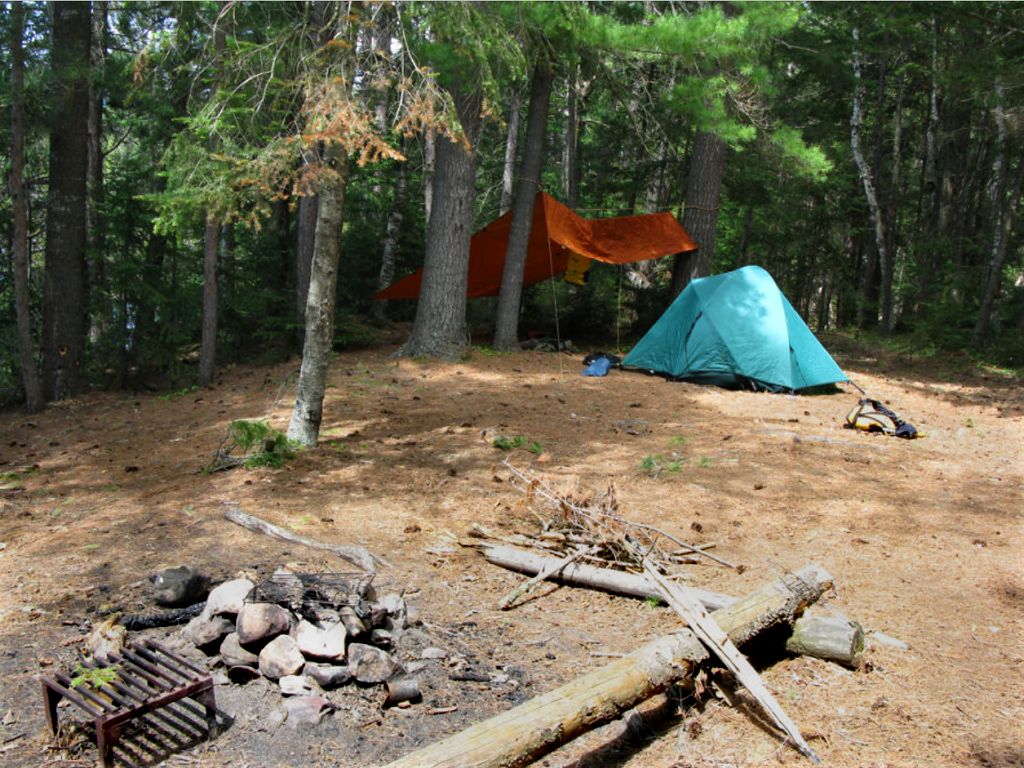
![]()
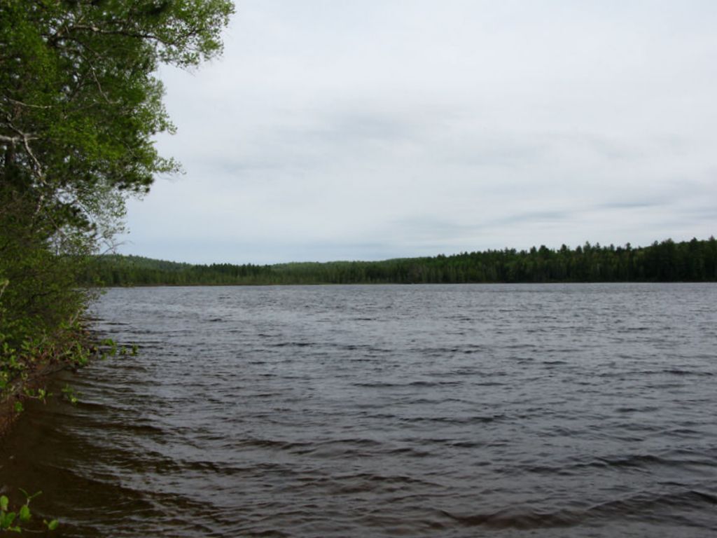
View south down the lake, from the campsite ...
![]()
Campsite maintenance: Regular.
Size of open area: 45' x 45’.
Extent of tree cover: 80% canopied over tent area.
Degree of levelness: Tenting area is flat but the firepit area had an obvious southern slope.
Number of level tent sites: At least 2 flat sites adequate for 3-4 man sized tents.
North exposure: Protected from the north winds, as the campsite backs on to thick evergreen forest.
East exposure: Landing is exposed to the eastern winds, but campsite relatively protected from the east via tree cover.
South exposure: Campsite and landing exposed to southern winds/rains – little tree buffer between water and site.
West exposure: Landing and campsite well protected from the west winds – nestled in protected bay and bordered by forest to the west.
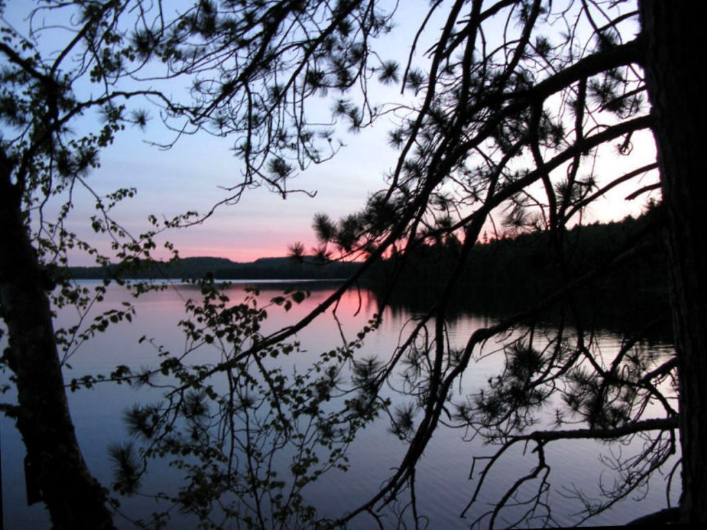
General description: Fair campsite, well protected from strong westerly winds and has a nice landing. Campsite situated up on a hill overlooking the lake, a good 8 meters up from the water. Decent and easy trail to and from the beach. Seating around firepit consisted of 3 logs adequate for 3-5 people. One large cast-iron grate was present. Decent sunset and sunrise views, good sun exposure along shoreline however not much of the beach was exposed during my spring visit (high water). Thunder box located north of campsite. No issues with firewood. Creek west of campsite drains Murdock Lake. No path to Murdock Lake found other than walking up creek valley (many blowdowns through there).
Overall accessibility: Fair

Thanks to Jeffrey McMurtrie of Jeff'sMap for supplying the base-layer map component by Creative Commons licensing.
Submitted by Stephen Molson .. Visited: May, 2009 .. Submission March, 2009