 Portage 300 meters (signed 255m) - Petawawa R. To Petawawa R. (Across Cedar L., south of Brent)
Length of portage: 300m (sign says 255m Portage) meters
Portage maintenance regular or low: Regular.
Elevation above Sea Level @ Petawawa River ~ 329 meters
Elevation above Sea Level @ Petawawa River ~ 344 meters
Difference in elevation: 15 meter drop between Petawawa and Petawawa
Peak portage elevation: ~ 349 meters
Portage Trail general description: Rocky and rooty all along the portage. Steep climb around the Falls. There are a couple small sections where it will be muddy after it rains. The portage peaks at 349m for a total difference in elevation of 20m.
Areas susceptible to impact by periods of rain or beaver flooding: Yes, a couple small sections.
Downstream Take-out Landing at: Petawawa River
Topography of under-water approach: Rocks
Impediments to disembarking from and/or unloading a canoe: Rocks and mud
Portage's downstream take-out ...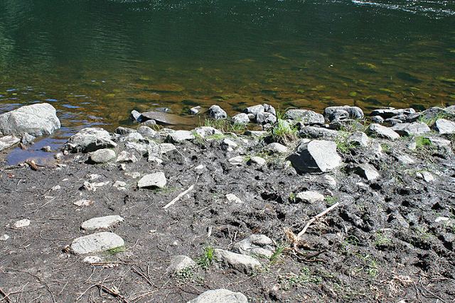
Upstream Put-in at: Petawawa
Topography of under-water approach: Rocks and mud
Impediments to disembarking from and/or unloading a canoe: Rocks
Portage's upstream put-in ...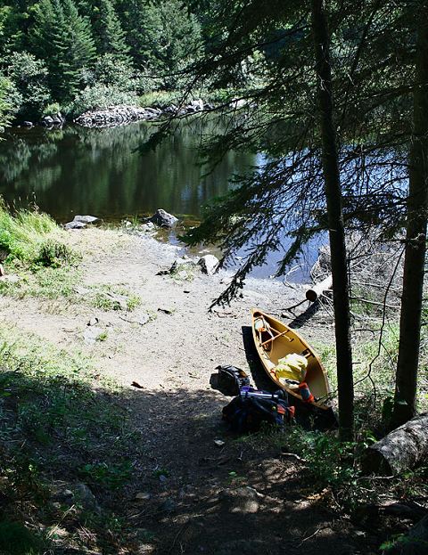
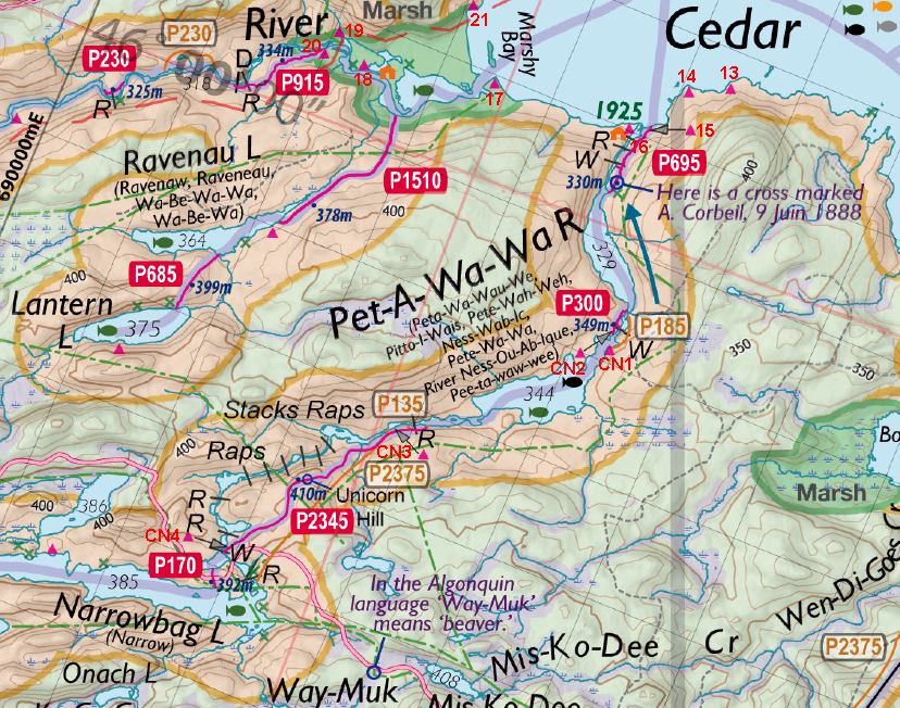
Thanks to Jeffrey McMurtrie of Jeff'sMap for supplying the base-layer map component by Creative Commons licensing.
Submitted by Sean Rowley, visited: 2009, submitted Sept 12, 2009