 Parkside Bay Campsite #9
Landing
Topography of under-water approach: Narrow sand and gravel beach between two rock areas .
Impediments to disembarking from and/or unloading a canoe: None.
Topography to tent sites: Short moderate rocky slope up to campsite.
Looking ashore to the landing and campsitedown ...

![]()
Looking across the landing beach ...

![]()
Looking downgrade to the beach from the campsite ...

![]()
Campsite
Regular or low-maintenance: Regular.
Size of open ground area: Firepit area is somewhat open, being under the tall canopy of large pines.
Extent of tree cover: Front area under pines is open to lake breezes. Part of the tentsite area is more protected by denser trees.
Degree of levelness: General smooth slope down from tent sites to fire-pit.
Number of tent sites: 3+.
North exposure: Trees protect the tent sites.
East exposure: Forest.
South exposure: Open understory of large pines provides a good view of the lake.
West exposure: A few trees through which the late sun penetrates.
Looking inland past the firepit to the north tentsites ...

![]()
Looking south to the fire-pit and the view across the lake ...

![]()
Looking west across the fire-pit to the west tentsite area ... (photo by Bill Warren)

![]()
General description: A large campsite with an open firepit area and protected tentsite area.
Overall accessibility: The landing is easy. The grade up to the campsite is minimal.
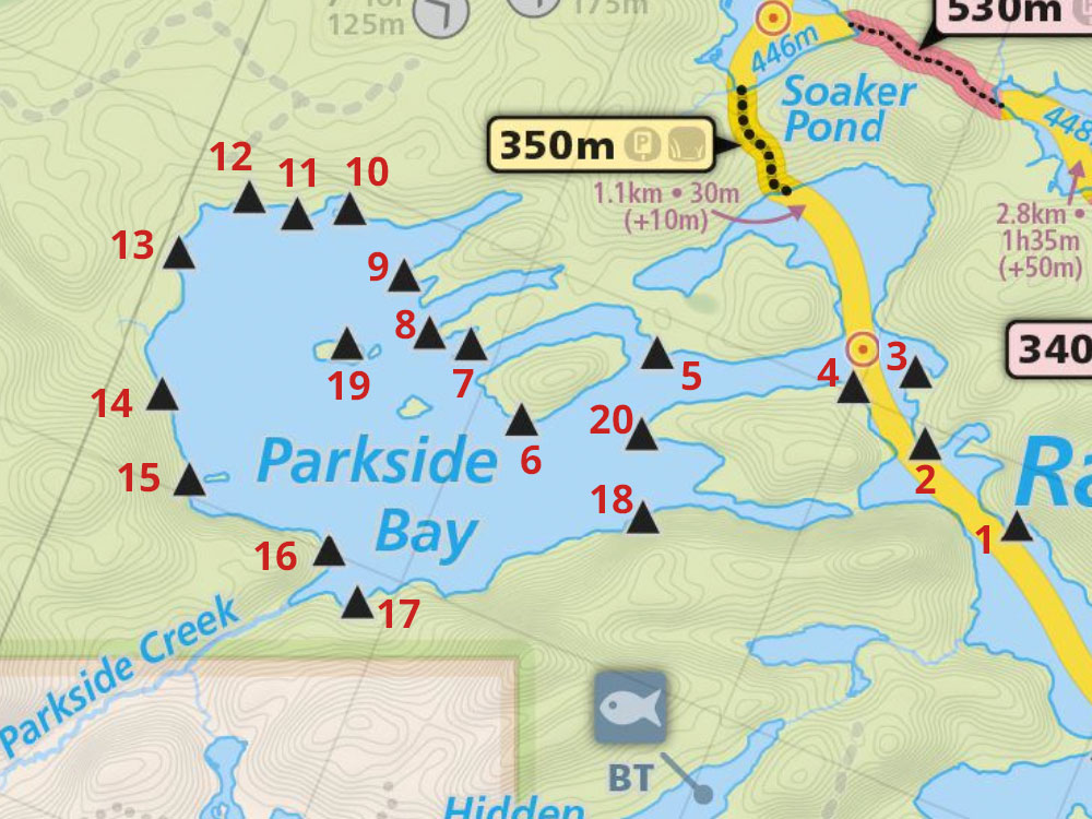
Thanks to Jeffrey McMurtrie of Jeff'sMap for supplying the base-layer map component by Creative Commons licensing.
Submission November 8, 2017 by Barry Bridgeford .. visited June 29, 2015