 Portage 1400 meters - Opeongo Lake To Proulx Lake
Length of portage: 1200 meters .. 1400 meters including the ridge-walk bypass of the midway pond.
Portage maintenance: regular.
Elevation above Sea Level @ Opeongo Lake. ~ 405 meters.
Elevation above Sea Level @ Proulx Lake ~ 390 meters.
Difference in elevation: ~ 15 meters.
Elevation of highest point: 424 meters.
Overall Rise/Fall: ~ 34 meters.
Cross Section of Portage Elevation changes ...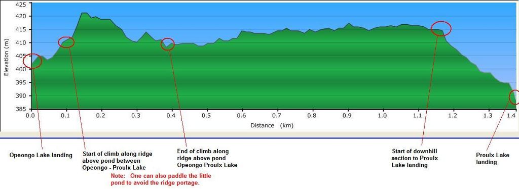
Landing at Opeongo Lake
Co-ordinates of location: N45 45 25.0 W78 25 11.0
Topography of under-water approach: Sandy beach landing.
Impediments to disembarking from and/or unloading a canoe: None. Adequate depth for easy disembarking, landing, loading and unloading, etc. Room for at least 6 canoes + gear at a time, many more if canoes are hauled up on shore.
Impediments to moving gear to portage trail: Adequate pack and other gear-resting layout
Topography of the ascending grade: Gradual slope to the pond.
(Editor's Note: Readers are invited to submit additional photos .. of the Opeongo Lake landing and any features along the portage.)
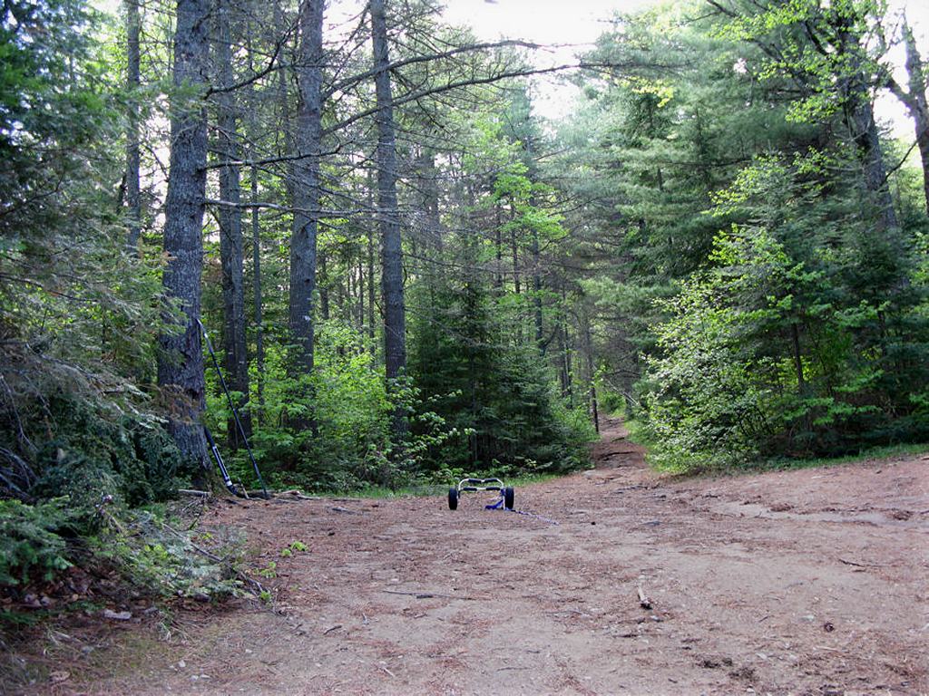
Portage Trail
General description: Portage trail very well maintained, worn and wide. Great footing, flat, hard-bottom (depending on time of year) throughout. May have been built (partially?) on old logging/access road. Very dolly friendly for all but the short hike around the pond (rooty and rocky in places). There’s a small pond 150 meters up from Opeongo Lake that can be paddled to avoid the hike over the ridge. One of the ‘easiest’ portages I’ve had the pleasure of walking in Algonquin Park. Using a kayak, I paddled the pond once each way and walked the full portage for the 2nd load of gear, again each way.
Topographical impediments to traveling: None, other than the pond that one can either paddle across or use the narrow ridge path to avoid.
Note: Short steep climb if following the portage trail east of the pond (from Opeongo L), many rocks and roots. Short steep climb from portage trail around pond back to main trail. Not very dolly friendly
Areas susceptible to impact by periods of rain or beaver flooding: Early spring typical conditions would be high water on landing areas and some hard-packed earth areas may turn muddy along certain portage extents in the short depression sections.
Landing at Proulx Lake
Co-ordinates of location: N45 45 45.5 W78 24 29.8
Topography of under-water approach: Sandy beach.
Impediments to disembarking from and/or unloading a canoe: None.
Topography of the ascending grade: Smooth.
Impediments to moving gear to portage trail: None.
Proulx Lake canoe landing, looking north-east ...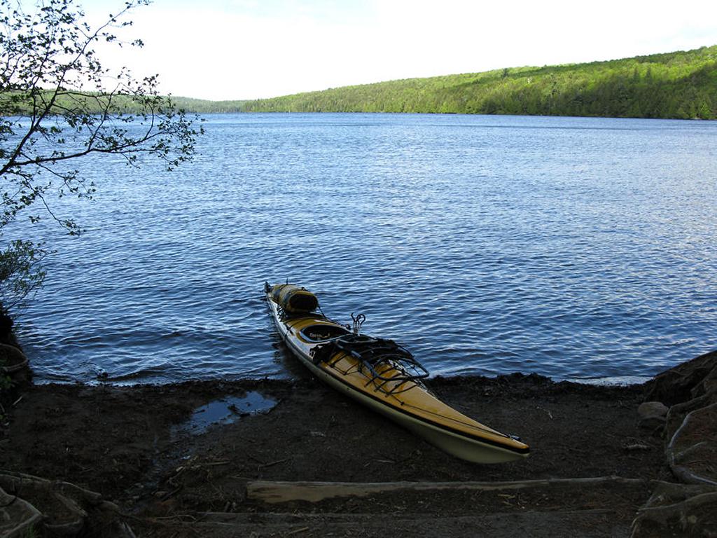
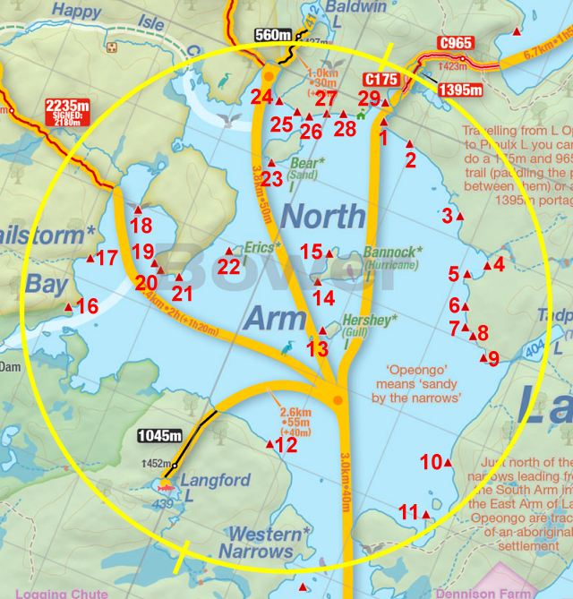
Thanks to Jeffrey McMurtrie of Jeff'sMap for supplying the base-layer map component by Creative Commons licensing.
Date visited: April 2010 ... Submitted by: Stephen Molson, March, 2010