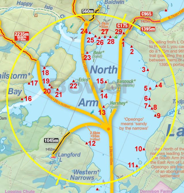
 Opeongo Lake North Arm Campsite #18
Landing
Topography of under-water approach: Gravel beach.
Impediments to disembarking from and/or unloading a canoe: None.
Topography to tent sites: Slight climb for 30 feet to campsite.
 |
|
| Landing on gravel beach. | |
Campsite
Campsite maintenance: Regular.
Size of open area: All of the point.
Extent of tree cover: 85%.
Degree of levelness: Level.
Number of level tent sites: 4+.
North exposure: Some shrubs.
East exposure: Open rock area, nice view.
South exposure: Thin bush.
West exposure: Shrubs, but can see the lake.
General description: A very large campsite with multiple tent pads. Tree covered, but open below the canopy. Sunlight filters down through the day. You can see the Happy Isle portage and Hailstorm creek.
Overall accessibility: Easy.
 |
|
| The whole campsite is located on a point. | |
 |
|
| Firepit facing south. | |
Thanks to Jeffrey McMurtrie of Jeff'sMap for supplying the base-layer map component by Creative Commons licensing.
Submitted by Wanda Spruyt .. Visited September, 2016 .. Submission November, 2016