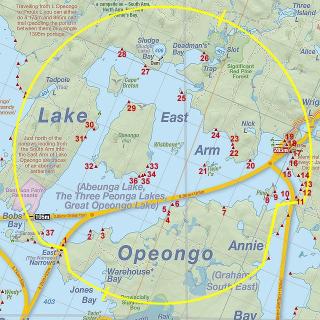
 Lake Opeongo - East Arm - Campsite #8
Landing
Topography of under-water approach: Large rocks form the shorline.
Impediments to disembarking from and/or unloading a canoe: Rocks are large enough that they form a shallow landing area.
Topography leading to tent sites: Slightly uphill over rocky ground.

|
|
| A rocky landing. | |
Campsite
Campsite maintenance: Regular.
Size of open area: Pie shaped 15m (deep) x 15m (at widest).
Extent of tree cover: 20%.
Degree of levelness: slightly angled.
Number of level tent sites: 1.
North exposure: trees.
East exposure: Lake Opeongo.
South exposure: Lake Opeongo.
West exposure: Lake Opeongo.
General description: Very open site with little protection from the elements. The ground is mostly rocky and rooty that limits the number of tenting options. One tent site that could be considered flat, and another that could be used in a pinch. Pie shaped, but only about 8m at the back (east side) of site could be used for tenting, hammocks could easily be hung in the other area.Overall accessibility: No real issues other than the rock could be slippery when wet.

|
|
| Great views all around from this firepit. | |

|
|
| The tentpad is on the right, area in front of large rock is a possibility?. | |

|
|
| Would it be OK for hammocks? | |

|
|
| The only flat and level tentpad. | |

|
|
| View to the west from the tentpad. | |

Thanks to Jeffrey McMurtrie of Jeff'sMap for supplying the base-layer map component by Creative Commons licensing.
Submitted by Chris Taylor .. Visited September, 2019 .. Submission April, 2020