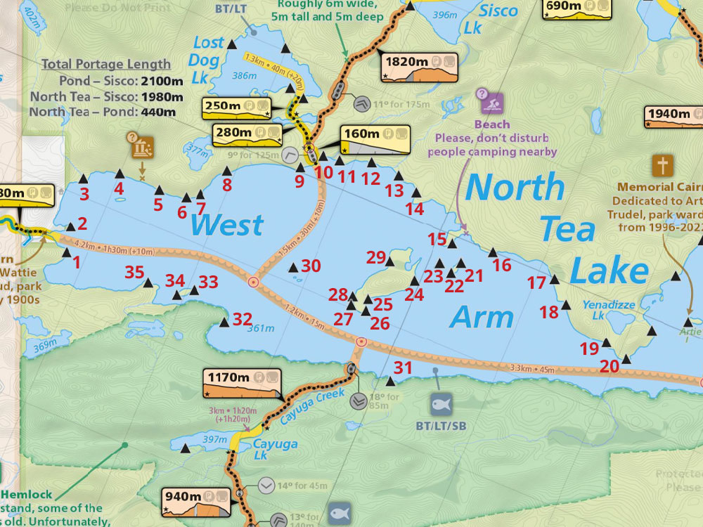
 North Tea Lake West, Campsite #34
Landing
Topography of under-water approach: Only 2 steps into the water before a steep drop into the lake.
Impediments to disembarking from and/or unloading a canoe: Very tiny unloading area at base of steep hill. No room for bags of any kind, other then between tree roots up the slope.
Topography to tent sites: Very steep grade and 20 foot climb up to campsite .
 |
|
| Very steep rough grade up to campsite. | |
 |
|
| Fire pit and campsite are closer to waterlevel. But that’s not the landing. | |
 |
|
| Fancy thunderbox. | |
Campsite
Campsite maintenance: Regular
Open ground area: 20 x 20 feet.
Extent of tree cover: None.
Degree of levelness: Poor.
Number of tent sites: 1 (small).
North exposure: High rock, cedars and pine.
East exposure: Rock and pines.
South exposure: Lake.
West exposure: Lake.
General Description: Very scenic island, lots of blue berries.
Overall accessibility: Difficult access.
Thanks to Jeffrey McMurtrie of Maps By Jeff for supplying the base map.
Submission by Wanda Spruyt August, 2017 ... visited August, 2017