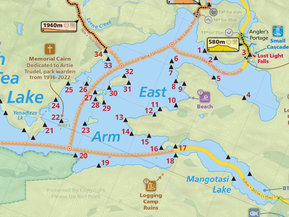
 North Tea Lake East, Campsite #17
Landing
Topography of under-water approach: Shallow sandy approach.
Impediments to disembarking from and/or unloading a canoe: None.
Topography to tent sites: A slight rise on sand and gravel, then a step over some roots.
 |
|
| Landing & glimpse of eastern tentpad, seen from south side of channel to Mangotasi Lake. | |
 |
|
| Mostly sandy landing. | |
Campsite
Campsite maintenance: Regular
Open ground area: 15m x 5m.
Extent of tree cover: 90% .
Degree of levelness: Level.
Number of tent sites: 4+.
North exposure: : trees.
East exposure: trees, partial view of Mangotasi Lake.
South exposure: trees, partial view of channel to Mangotasi Lake and southeast bay of the East Arm of North Tea Lake.
West exposure: trees.
General description: A well treed site that is level and offers a excellent spot at the eastern edge of the site for viewing Mangotasi Lake, or this area can be used as another tentpad (early morning sunshine could be an issue if you are a late sleeper). Dappled light enters the site, otherwise it is well covered and well protected from most wind..
Overall accessibility: No issues, a smooth sand/gravel beach makes this site very accessible..
 |
|
| Firepit. | |
 |
|
| Looking west from the top of the landing. | |
 |
|
| View from the eastern tentpad. | |
 |
|
| Tentpad with eastern view. | |
 |
|
| Thanks to Jeffrey McMurtrie of Maps By Jeff for supplying the base map. | |
Submission by Chris Taylor Dec. 2019 ... visited July 2018