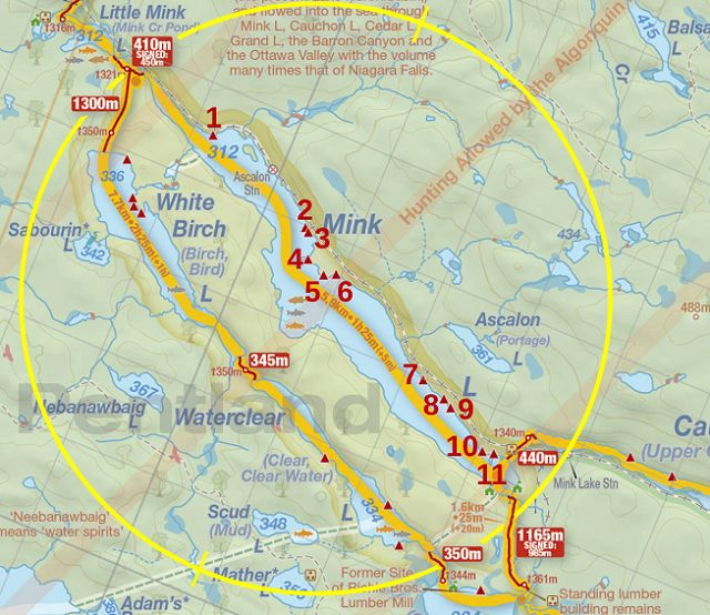
 Mink Lake Campsite #2
Landing
Topography of under-water approach: Gradual, shallow sloping gravel with small and medium rocks.
Impediments to disembarking from and/or unloading a canoe: None - no obstructions at the landing.
Topography to tent sites: 10 foot moderate rise with some rocks and roots.
From the water, the entire campsite is visible ...

![]()
Necessary to step into water to unload ...

![]()
Looking southeast across the firepit. Trail at far left eventually gets to campsite #3 ...

![]()
Westmost tentsite is set back close to the vegetation ...

![]()
Second tentsite is close to the firepit. ...

![]()
Third tentsite is nestled into the vegetation ...

![]()
Looking southwest across the firepit ...

![]()
Campsite maintenance: regular.
Size of open area: 80' x 25'.
Extent of tree cover: two thirds canopied.
Degree of levelness 80% flat terrain within open area.
Number of level tent sites: Three medium-sized tents.
North exposure: Well protected from north wind.
East exposure: Protected from much of the eastern wind by forest.
South exposure: Open to the south wind and mid-day sun.
West exposure: Protected from much of the western wind by forest.
General description: Decent size, flat and open. However, it has very limited view of sunrise and sunset. Not being on a point could mean buggy unless the wind is very strong.
Overall accessibility: Generally good accessibility, aside from short rocky rise from the water.

Thanks to Jeffrey McMurtrie of Jeff'sMap for supplying the base-layer map component by Creative Commons licensing.
Submitted by Barry Bridgeford .. Visited July, 2015 .. Submission August 22, 2015