 McIntosh Lake Campsite #3
Landing
Topography of under-water approach: Rock and gravel.
Impediments to disembarking from and/or unloading a canoe: Could only find one spot (high winds) that was sheltered enough to allow for an easy disembark. There were some rocks and exposed roots at the water's edge that could be used to stand on. And the under-water bed was level enough on this rocky approach. It was much easier to stand in slightly more than ankle deep water to unload the canoe. The lift and climb on to the site was slightly more than 1 meter.
Topography to tent sites: On site as soon as you make a 1 meter climb.
Risky takeout if you don't want to stand in water ...

Campsite
Regular or low-maintenance: Regular
Size of open area: 25 meters x 15 meters.
Extent of tree cover: Extensive.
Degree of levelness: Good.
Number of level tent sites: 4+.
North exposure: Trees, slight view of lake.
East exposure: Trees, slight view of lake
South exposure: Trees.
West exposure: Trees.
General description: Big site, ground is level but "lumpy". Lots of trees and fallen trees on site to limit useable area. Well protected from the wind. Not a lot of sun.
Overall accessibility: Could be a challenge at the takeout if you don't want to stand in the water. There are other places that could be used, but each presents its own challenge.
Firepit looking west ...

Looking north from the southern side of the site ...

Coming down trail from thunderbox, lots of trees break up site ...

Looking east from western side of site ...


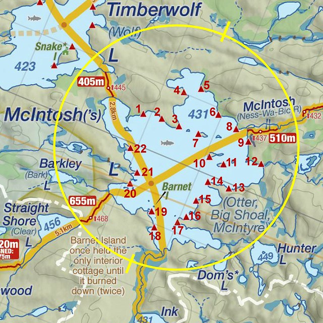
Thanks to Jeffrey McMurtrie of Jeff'sMap for supplying the base-layer map component by Creative Commons licensing.
Submitted by Chris Taylor .. September 2013 .. Visited July, 2013