 Maple Lake Campsite #7
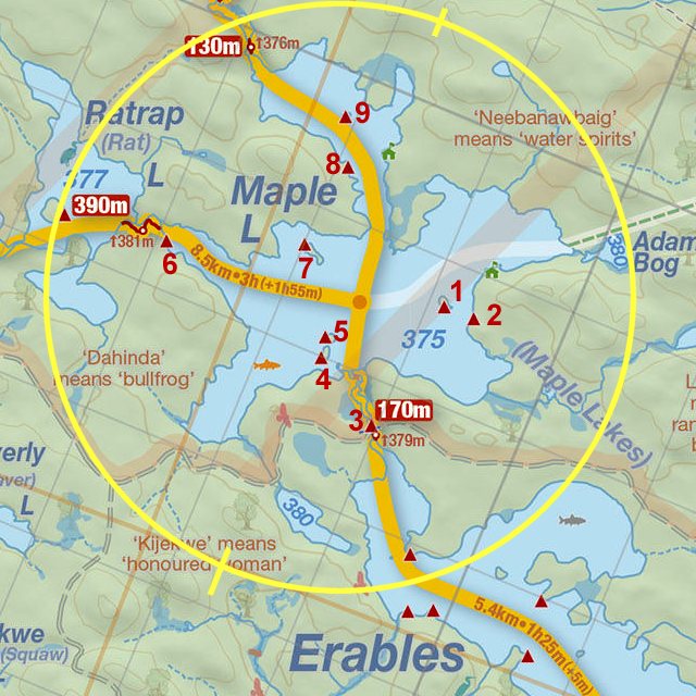
Campsite Location
GPS - UTM location: N46° 01.274' W78° 49.760'
Landing
Topography of under-water approach: Large rock.
Impediments to disembarking from and/or unloading a canoe: None.
Topography leading to tent sites: A smooth rise of 2m over a 10m carry.
 |
|
| - A large rock to land on, and an easy carry to the site. | |
 |
|
| - Path to the site. | |
Campsite
Regular or low-maintenance: Regular
Size of open ground area: 8m x 7m.
Extent of tree cover: 70%.
Degree of levelness: Fairly level with some slight changes in elevation.
Number of tent sites: 3 sites (1 fairly large).
North exposure: Trees, slight view of lake.
East exposure: Trees.
South exposure: Trees.
West exposure: Trees and a view of lake at the landing.
 |
|
| - Firepit and the start of path to landing area. | |
 |
|
| - Tent-pads on north side of site seen from trail to thunderbox. | |
 |
|
| - Tent-pad south of firepit seen from trail to thunderbox. | |
General description: Somewhat closed-in site with good protection from wind from all directions. Fairly level site with a large tent pad that could handle 2 - 3 tents.
Overall accessibility: No issues, as it is a smooth walk to site from landing area, and site has few obstacles.
 |
|
| - Campsite Diagram. | |
Thanks to Jeffrey McMurtrie of Jeff'sMap for supplying the base-layer map component by Creative Commons licensing.
Submitted by: Chris Taylor .. Visited May, 2015 .. Submission October 19th, 2015