 Portage 455 meters - Manitou To North Tea
Length of portage: 455 meters (signed 410 meters).
Portage maintenance regular or low: Regular.
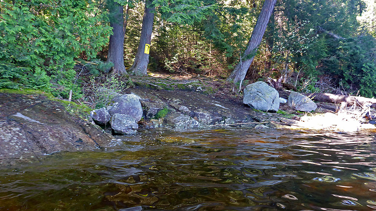
Landing on Manitou Lake, at east (downstream) end
Topography of under-water approach: Landing is a large rock with some smaller rock underwater.
Impediments to disembarking from and/or unloading a canoe: None, rock could be slippery when wet.
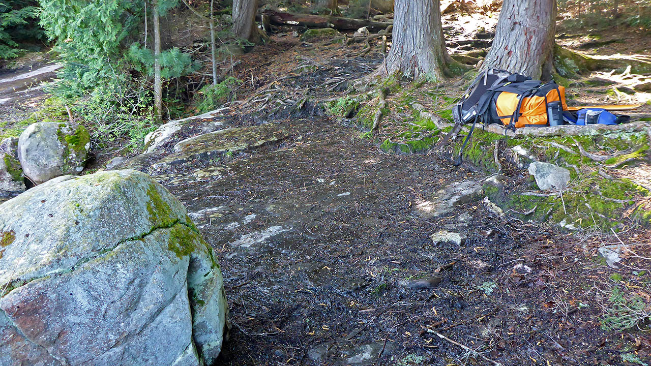
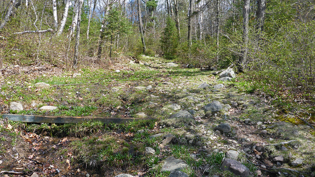
Topography of the ascending grade: Very rocky and rooty, steady climb to apex of trail. Significant grade.
Impediments to moving gear to portage trail: None.
A large rock fronts this landing ...
![]()
Portage Trail (max. elevation = 388m)
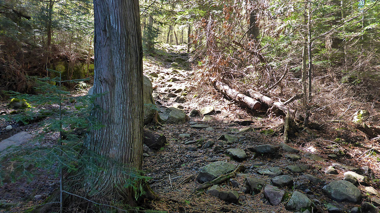
General description: I revisited this portage in 2018 after originally doing it in 2015. It helped to remind me why I normally use the 585m portage to the east of this one! A significant grade that is rocky and rooty for the entire length, care must be taken.
Topographical impediments to traveling: Steep, rocky, and rooty.
Areas susceptible to impact by periods of rain or beaver flooding: Excellent drainage on this trail.
Elevation Profile (not to scale) ...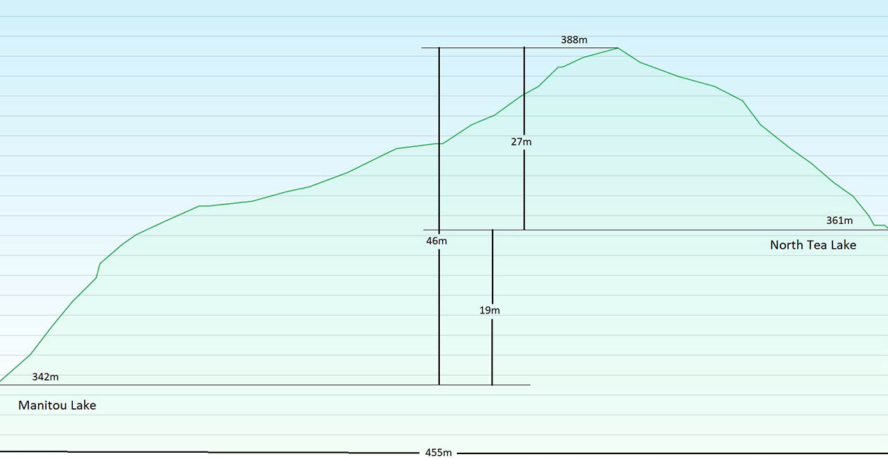
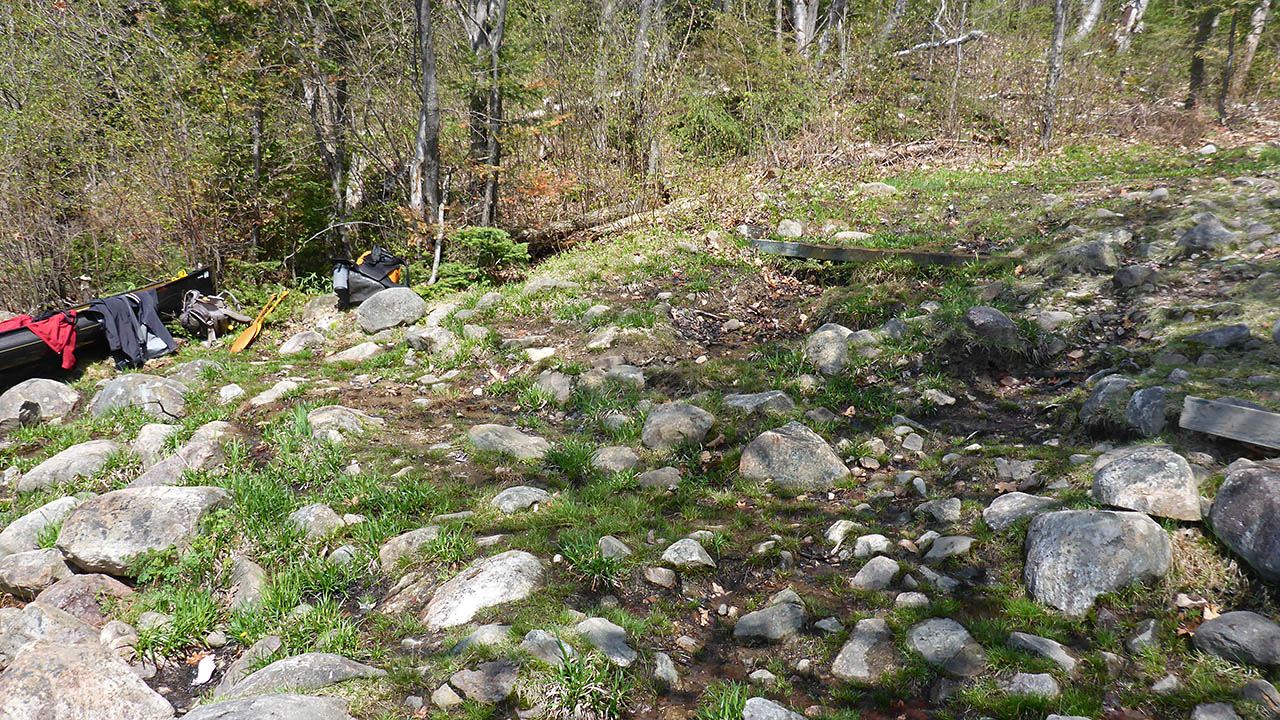
Landing on North Tea Lake, west (upstream) end, (elevation 361 meters).
Topography of under-water approach: Small, medium size rock.
Impediments to disembarking from and/or unloading a canoe: Small and medium size rock line the shore as well as dominating the landing area.
Topography of the ascending grade: A wide, rocky, and rooty trail that climbs steadily to the apex of the trail.
Impediments to moving gear to portage trail: None
Mostly medium size rocks line the shore ...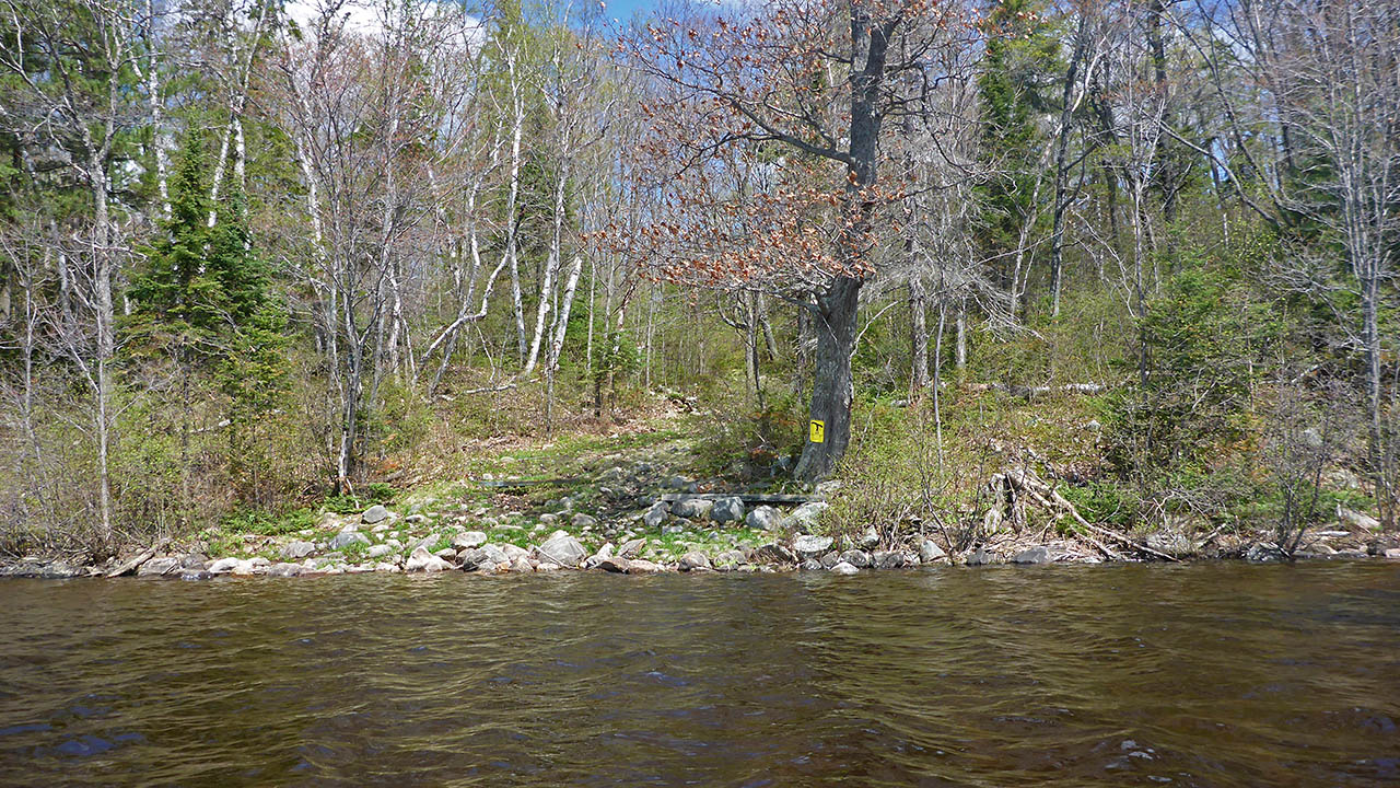
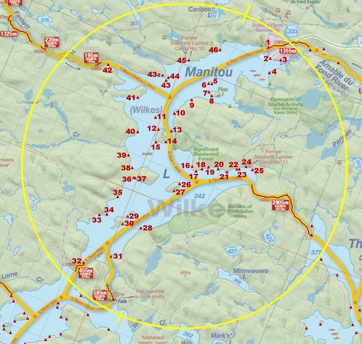
Thanks to Jeffrey McMurtrie of Jeff'sMap for supplying the base-layer map component by Creative Commons licensing.
Submitted by Chris Taylor, visited May 2015, submitted September 30, 2019