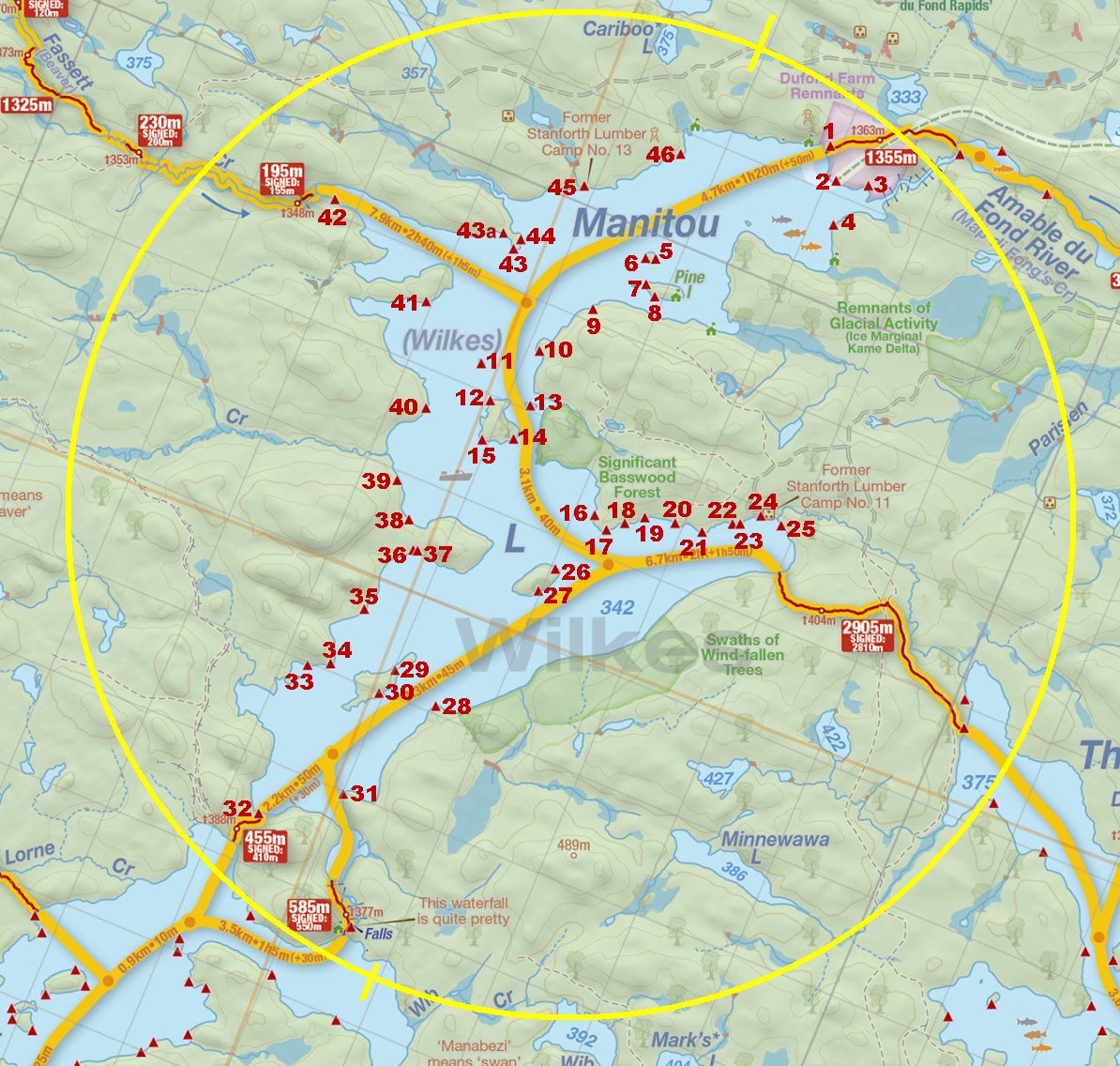
 Manitou Lake Campsite #29
Landing
Topography of under-water approach: Sand and gravel (both landings).
Impediments to disembarking from and/or unloading a canoe: None.
Topography leading to tent sites: West landing is a short carry. East landing is a short carry of approximately 5 meters on smooth path.
Campsite
Regular or low-maintenance: Regular
Size of open ground area: 20m x 5m (site curves from west to south around the eastern landing)
Extent of tree cover: 15%.
Degree of levelness: Level.
Number of tent sites: 3+.
North exposure: Some trees on the northern point of island.
East exposure: View of the lake.
South exposure: Trees.
West exposure: Partial view of lake.
General description: A very open site to the elements. Shade can be found easily at any time of the day at the back of the campsite. 2 good landing areas make site accessible from the east or west, and both landings are unobstructed.
Overall accessibility: From the west landing there is a quick step up of 1.5 meters, on the east landing this is smoothed over the length of the path.
View of site from eastern landing ...

![]()
View of site from western landing. The tenting area to right and behind firepit gets shade only late in the day ...

![]()

Thanks to Jeffrey McMurtrie of Jeff'sMap for the base-layer map component by Creative Commons licensing.
Submitted by: Chris Taylor .. Visited July, 2018 .. Submission December 1, 2018


