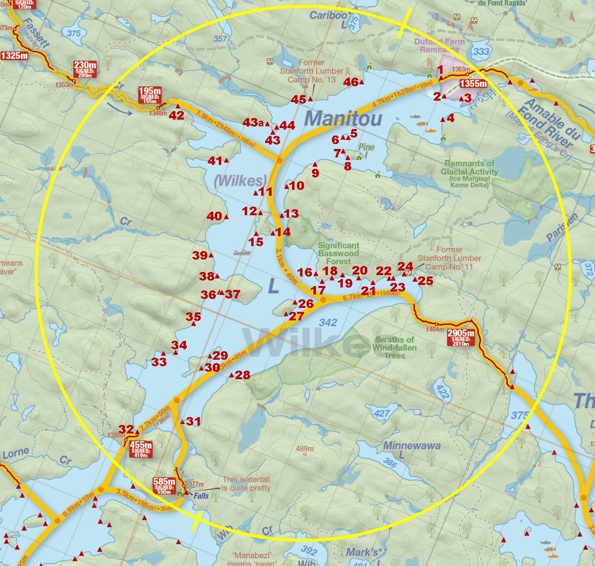
 Manitou Lake Campsite #2
Landing
Topography of under-water approach: Gravel close to shore, sand just further out.
Impediments to disembarking from and/or unloading a canoe: None.
Topography leading to tent sites: Approximately a 3 meter climb using stairs.
View of the campsite from the lake ...

![]()
Landing as seen from the front of the site ...

![]()
Campsite
Regular or low-maintenance: Regular
Size of open ground area: 10 x 8 meters.
Extent of tree cover: 20% heavily treed perimeter from southeast to west, quite open above site proper.
Degree of levelness: Level.
Number of tent sites: 3+.
North exposure: Trees.
East exposure: Trees.
South exposure: View of lake.
West exposure: Partial view of lake.
General description: The front of the site offers a nice view of the lake. It is level and able to accommodate 3 tents, and a further 15 meters to the east, there's another area where a tent could be pitched that would offer some privacy. A 5 meter band of gravel extends from the treeline out into the lake where it changes to a sandy bottom.
Overall accessibility: No accessibility issues.
Looking west across the site to a tentpad ...

![]()
Tentpad on the eastern side of the point ...

![]()

Thanks to Jeffrey McMurtrie of Jeff'sMap for the base-layer map component by Creative Commons licensing.
Submitted by: Chris Taylor .. Visited July, 2018 .. Submission December 1, 2018

