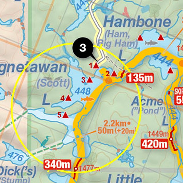
 Magnetawan Lake Campsite #4
GPS - UTM location N 45.662036 W78.991418
Landing
Topography of under-water approach: Rock shelf.
Impediments to disembarking from and/or unloading a canoe: The rock shelf is a little slippery, but not too steep. Care is required loading and unloading and to protect your canoe.
Topography leading to tent sites: Rock slab sloping up from the water.

|
|
| Canoe landing. | |

|
|
| Canoe landing detail. | |

|
|
| Grade from landing to campsite. | |
Campsite
Campsite maintenance: Regular.
Extent of tree cover: The fire pit area and "ground floor" tentsites are quite exposed. The tent site on the 2nd level is more sheltered.
Degree of levelness: The tent sites are fairly level.
Number of level tent sites: 2, or 3 in a pinch.
North exposure: Lake and forest.
East exposure: Lake
South exposure: Lake
West exposure: Forest.

|
|
| The firepit is small, furnished with a metal grill, two logs and a stump. | |

|
|
| One tentsite. | |

|
|
| The second tentsite. | |
General description: This is a quiet site with two distinct levels.
The fire pit area and room for 1-2 tents is at the ground level, and there is a second level separated by a rock shelf with a dramatic looking tree growing out of it.
It is nestled into a little cove and gives the illusion of being more secluded than it is, despite being relatively close to the access point.
We visited in the autumn, but I expect the bugs would be quite active in the summer months as there is a wet marshy area in behind the site.
One note - the path to the thunderbox is not marked and we had to hunt around a bit to find it. From the second level tentsite, follow the path that heads roughly south west.
Overall accessibility: Very accessible.

Thanks to Jeffrey McMurtrie of Jeff'sMap for supplying the base-layer map component by Creative Commons licensing.
Submitted by Andrew M. .. Visited September 28, 2021 .. Submission October 1st, 2021