 Lake Louisa Campsite #9
Landing
Topography of under-water approach: Shallow dirt area beside sloped rock.
Impediments to disembarking from and/or unloading a canoe: Some care required, perhaps involving a wet foot or two.
Topography leading to tent sites: Moderate slope up sloping rocks, plus a short climb up dirt rise to actual campsite.
West side of the campsite as seen from the water ...

![]()
South end of the campsite's west shore ...

![]()
Where the south-end rock slopes to the water is this shallow landing area ...

![]()
Looking down to the landing from the actual campsite ...

![]()
Campsite
Regular or low-maintenance: Regular
Size of open ground area: 20' x 30'.
Extent of tree cover: 80%.)
Degree of levelness: Generally level.
Number of level tent sites: 4+.
North exposure: Forest.
East exposure: Forest.
South exposure: Lake.
West exposure: Lake.
The firepit is amidst cedar trees, close to the edge of the rock shelf ...

![]()
One tentsite area is located behind the firepit ...

![]()
Another tentsite area is set deeper into the forest. Note the proximity of the thunderbox behind the tree ...

![]()
General description: Hidden away at the south end of a bay, this campsite doesn't have a large view. However, it will serve a group either before or after doing the long Florence Lake portage.
Overall accessibility: Moderate accessibility, on account of the landing and rise to the campsite.
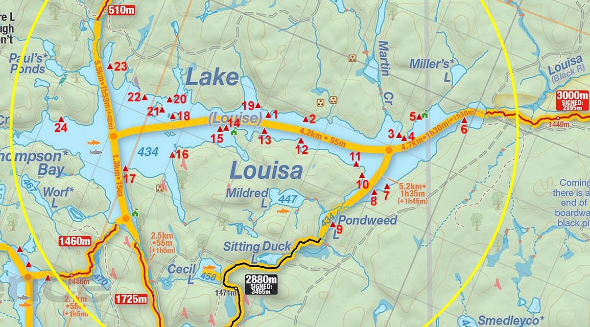
Thanks to Jeffrey McMurtrie of Jeff'sMap for supplying the base-layer map component by Creative Commons licensing.
Submitted by Barry Bridgeford .. Nov. 1st, 2013 .. visited August, 2011