 Lake Louisa Campsite #8
Landing
Topography of under-water approach: The greatest part of the rock shoreline has a pronounced slope continuing deep into the water. At the north end of the shoreline is a small section with a shallow bottom which could be used for 'wet-foot' disembarking and unloading.
Impediments to disembarking from and/or unloading a canoe: The sloped area could be both dangerous underfoot and allow gear to roll back down into the water.
Topography leading to tent sites: The sloping rock has to be travelled to get back-and-forth to the actual campsite.
Large erosion-exposed rock face across front of campsite ...

![]()
Slope of rock could make unloading tricky, particularly when wet ...

![]()
At the north end of the rock is this landing area with shallows and less slope ...

![]()
Campsite
Regular or low-maintenance: Regular
Size of open ground area: 15' x 20' around the firepit, the majority of the sloped rock, and a couple of tentsites in the forest.
Extent of tree cover: 80%.
Degree of levelness: Not generally level overall.
Number of level tent sites: 2 large or 4 small.
North exposure: Trees.
East exposure: Forest.
South exposure: Trees.
West exposure: Lake.
The firepit area has been heavily used over the years ...

![]()
One of tentsites located behind in the forest ...

![]()
Another of the tentsites in the forest ...

![]()
General description: This campsite is centered around an exposed rock face that slopes down into the water. While it has a good view to the west, the firepit area is confined by its smallness, and the tentsites are located at a distance.
Overall accessibility: Difficult accessibility due to the pronounced slope to the rock and the spread-out unlevel locations of the firepit & tentsites.
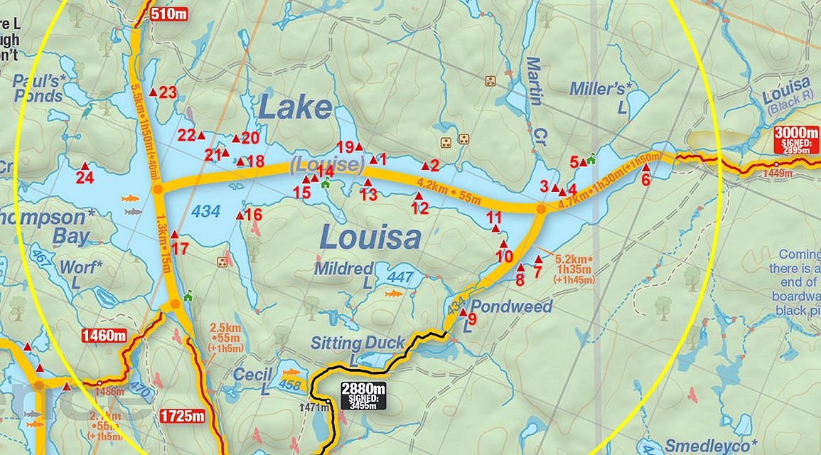
Thanks to Jeffrey McMurtrie of Jeff'sMap for supplying the base-layer map component by Creative Commons licensing.
Submitted by Barry Bridgeford .. Nov. 1st, 2013 .. visited August, 2011