 Lake Louisa Campsite #18
Landing
Topography of under-water approach: Large rock and rubble, shallow rocky flat emerging out of 20+' depth of water.
Impediments to disembarking from and/or unloading a canoe: Some emergent and shallow rock scattered about to watch out for, sandy/pebbly up on shore.
Topography to tent sites: Mostly flat with some depressions, lots of rock and root.
Landing area, south-western shoreline, looking south-west ...

![]()
Looking northwest .. northern island with single campsite visible in distance ...

![]()
Firepit and kitchen area, looking NNW. Note large rock serving as kitchen table ...

![]()
Campsite
Campsite: regular maintenance.
Size of open area: estimated as 80 x 60'.
Extent of tree cover: guestimate of 80% canopied over tent/kitchen area.
Number of level tent sites: Easily two 3-man tents
Tent area: flat, as is the kitchen/firepit location.
North exposure: Protected from the North winds.
East exposure: Protected from eastern winds.
South exposure: Southern exposure from canoe landing only. Nice lounging sunny rocks along shore at campsite.
West exposure: Good western exposure .. would be rough in the event of strong westerly winds, but tenting area nicely protected.
General description: Good campsite from what I remember. A unique large circular rock suspended on top of boulder makes for a nice kitchen table. Rough benches around firepit. Firepit well protected from any wind direction. I don't recollect any remarkable rise between boat launch and tenting/kitchen area, likely nicely tapered and within <4' vertical of water level. Good sunset view and lots of late morning-afternoon and evening sun exposure. Nice views in all directions other then east.
Overall accessibility: Good.
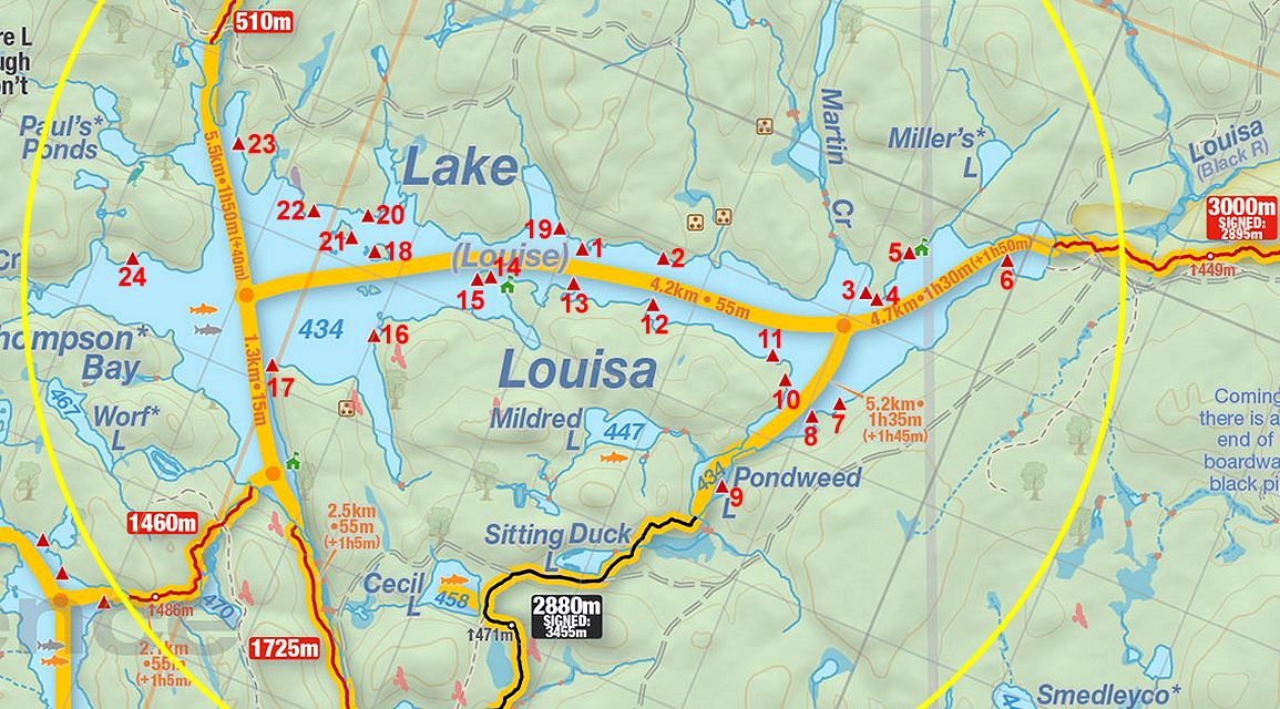
Thanks to Jeffrey McMurtrie of Jeff'sMap for supplying the base-layer map component by Creative Commons licensing.
Submitted by Stephen Molson .. Visited June 2004 .. Submission Feb. 9, 2009