 Longer Lake Campsite #1
Landing
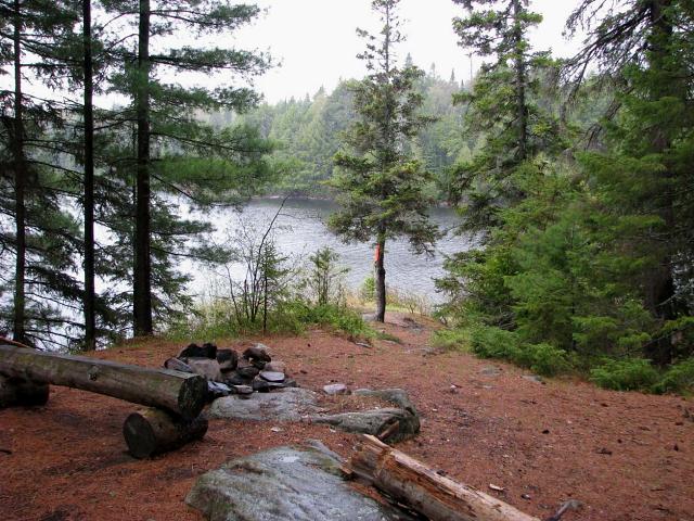
Topography of under-water approach: Gently shallowing water – small peninsula allows access from either side, easiest from southeast.
Impediments to disembarking from and/or unloading a canoe: Few, if any, during spring water levels. Summer levels could reveal some rock obstructions.
Topography leading to tent sites: Slight incline up from landing, perhaps 10’-12’ elevation from landing to firepit/tent site.
Campsite
Regular or low-maintenance: regular
Size of open area: 20’ X 45’
Extent of tree cover: 40%
Degree of levelness: gentle slope from water up past firepit to large trees, then gentle slope back down to thunderbox
Number of tent sites: one, possibly two for 3-man tents.
North exposure: Protected on northern side by conifer/deciduous forest
East exposure: Protected from east by conifer/deciduous forest
South exposure: Potential exposure from southerly winds due to thin row of pines protecting that side of the peninsula
West exposure: Exposed to strong western/southwestern winds but narrowness of lake here limits the extent of groundwinds from that direction
General description: An merely average campsite suitable for a small party. Landing was adequate (sorry no photo) but firepit was in just average shape, no grill visible with one log bench at a bit of an angle. Approximately 1.5 kilometers southeast to nearest campsites on Longer Lake and approximately 3 kilometers (with two portages) north to nearest campsites on Redpine Bay (Burntroot). We merely paused on this site to ride out a string of thunderstorms for an hour so my experience is limited.
Overall accessibility: excellent.
Photo: view of firepit southeast from tent site
![]()
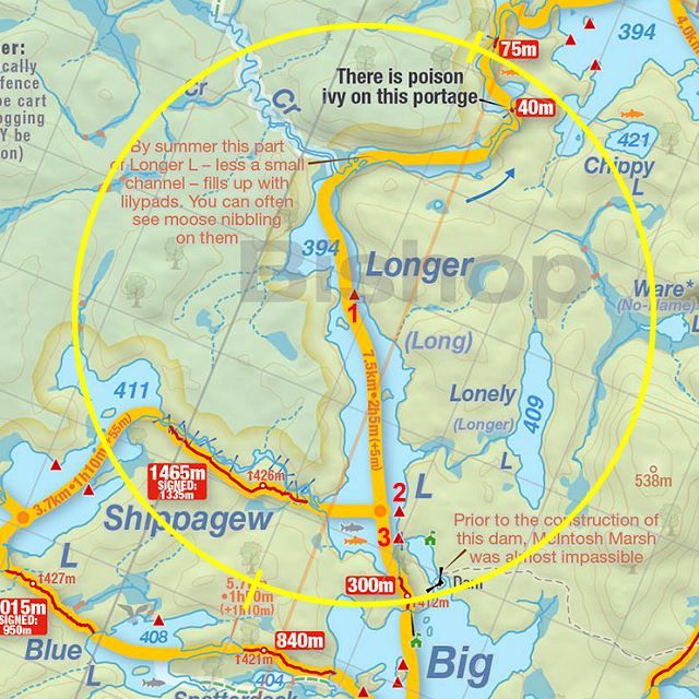
Thanks to Jeffrey McMurtrie of Jeff'sMap for supplying the base-layer map component by Creative Commons licensing.
Submitted by Joe Zaleski, January 2011 .. visited May 2010.