 Little Trout Lake Campsite #7
Landing
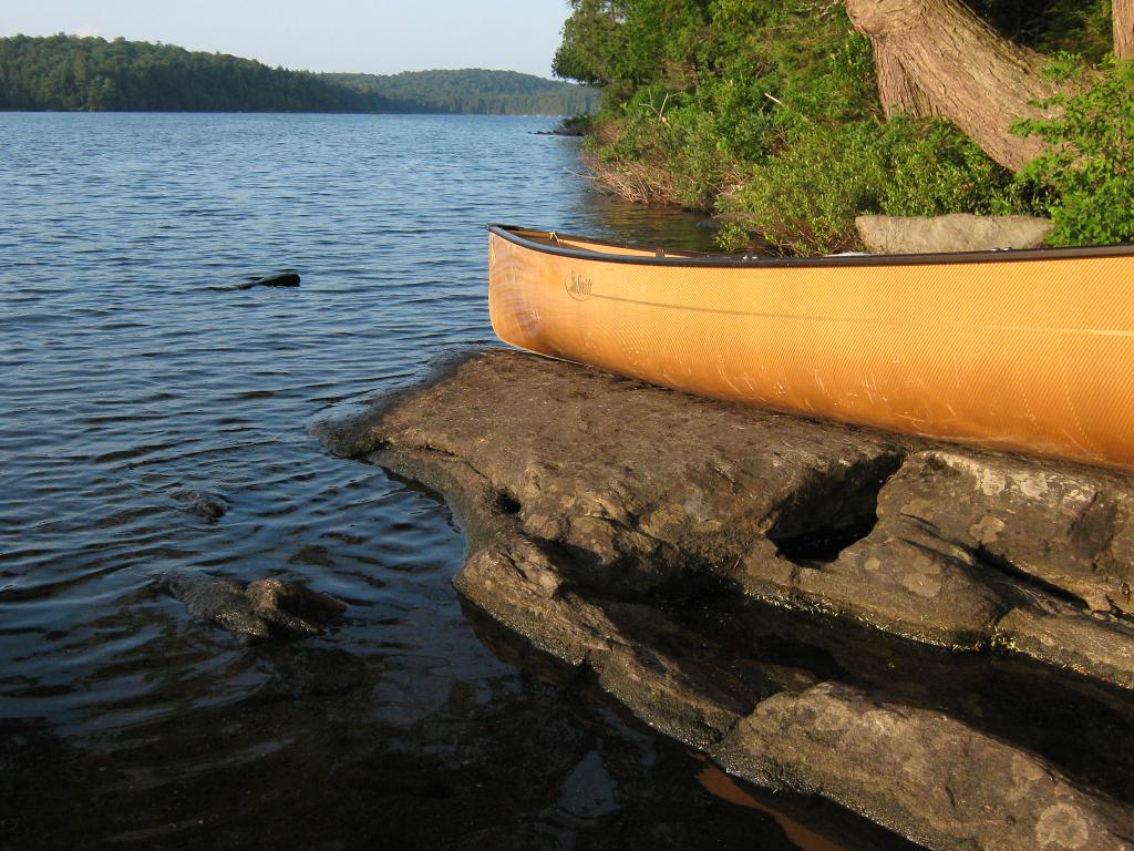
Canoe hauled up on the shoreline slab of rock ...
![]()
Looking down at canoe on landing's slab of rock ...

![]()
Topography of under-water approach: Slab of rock provides single canoe slip between it and the shore. Under water rocks prevent approach on northwest side of slab.
Impediments to disembarking from and/or unloading a canoe: Slab of rock provides place to step out onto .. to unload canoe from. However, it only has room to land and unload one canoe at a time. Unloaded canoe would have to be hauled further onshore to allow second canoe to enter landing slip.
Topography to tent sites: Approximately 10 foot rise at 45 degrees to get to tent sites. Cedars and their roots,near shore, produce an abrupt step-up.
Looking up from landing, toward firepit area ...

![]()
Campsite
Regular or low-maintenance: Regular
Size of open area: 20' x 30'.
Firepit and two of the tentsites ...

![]()
Extent of tree cover: 80%
Degree of levelness: Once in from firepit, the site is quite level.
Number of level tent sites: 3 plus.
North exposure: Open to north wind .. with a view across channel between campsite's island and another island to the north.
East exposure: The island extends due east from the campsite. While it is treed heavily in hemlock, the understory is open and thunderbox doesn't have much privacy.
South exposure: Island is narrower to the south behind the tentsites, but forest on the west point of the island changes over to a pine/hardwood mix.
West exposure: Small mixed forest area provides some shelter from west wind, but allows afternoon sun to filter through somewhat.
Looking northeast from tent to firepit and across channel to other island ...

![]()
Looking northwest across bay, with west end of other island visible at right ...

![]()
General description: Confined under tree cover, yet quite open to north wind. Firewood on the island limited to hemlock.
Overall accessibility: Only fair accessibility from the water .. limited to one canoe at a time.
Thanks to Jeffrey McMurtrie of Jeff'sMap for supplying the base-layer map component by Creative Commons licensing.
Submitted by Barry Bridgeford .. December 30, 2011 .. visited July, 2010