 Lauder Lake Campsite #1 Lat.- Long.: N46 08 33.2 W78 49 53.9
Landing
Topography of under-water approach: Nicely tapered sandy shallow beach landing. No underwater obstructions. At high water the shrubbery along shore may be an issue.
Impediments to disembarking from and/or unloading a canoe: Landing is great, the topography of shoreline just above the landing is steep and eroded due to cold spring.
Topography to tent sites: Steep but short incline up to campsite area from the landing. Roughly 3 meters elevation from waterfront.
Landing area, looking south ...
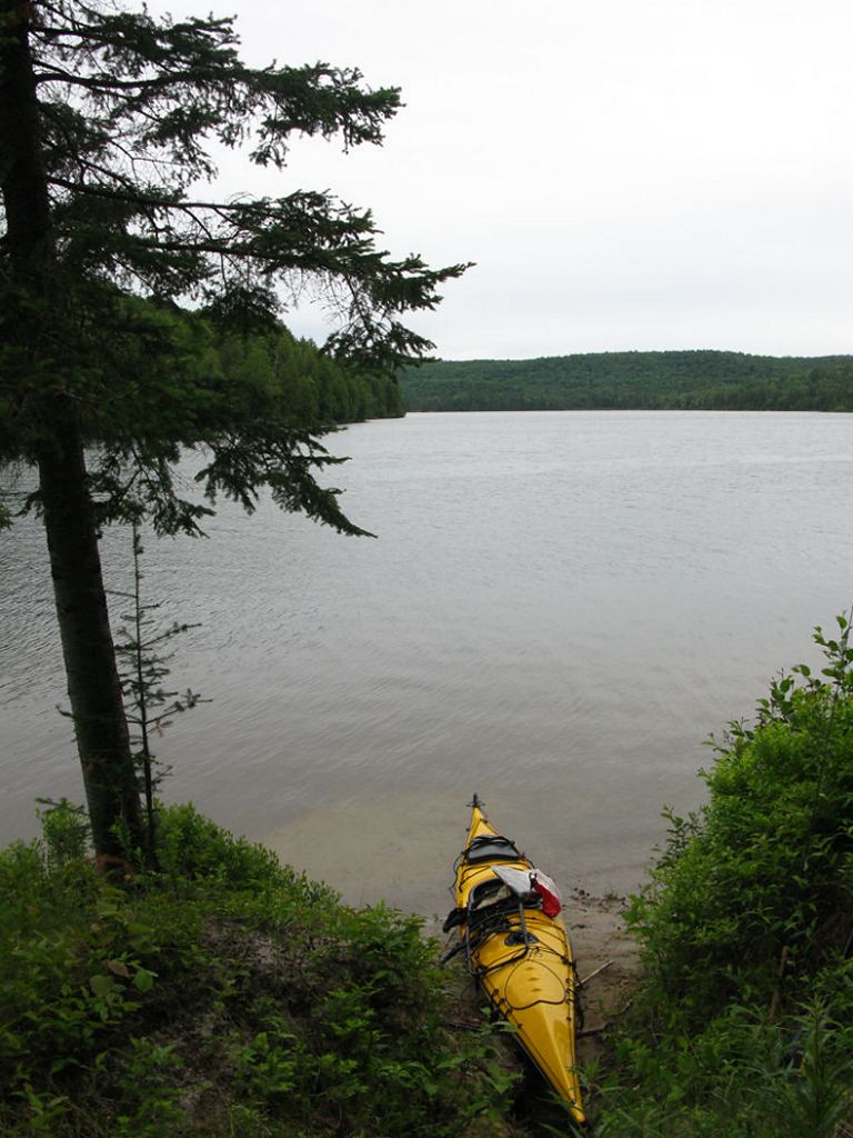
![]()
Eroded bank due to spring seepage ...
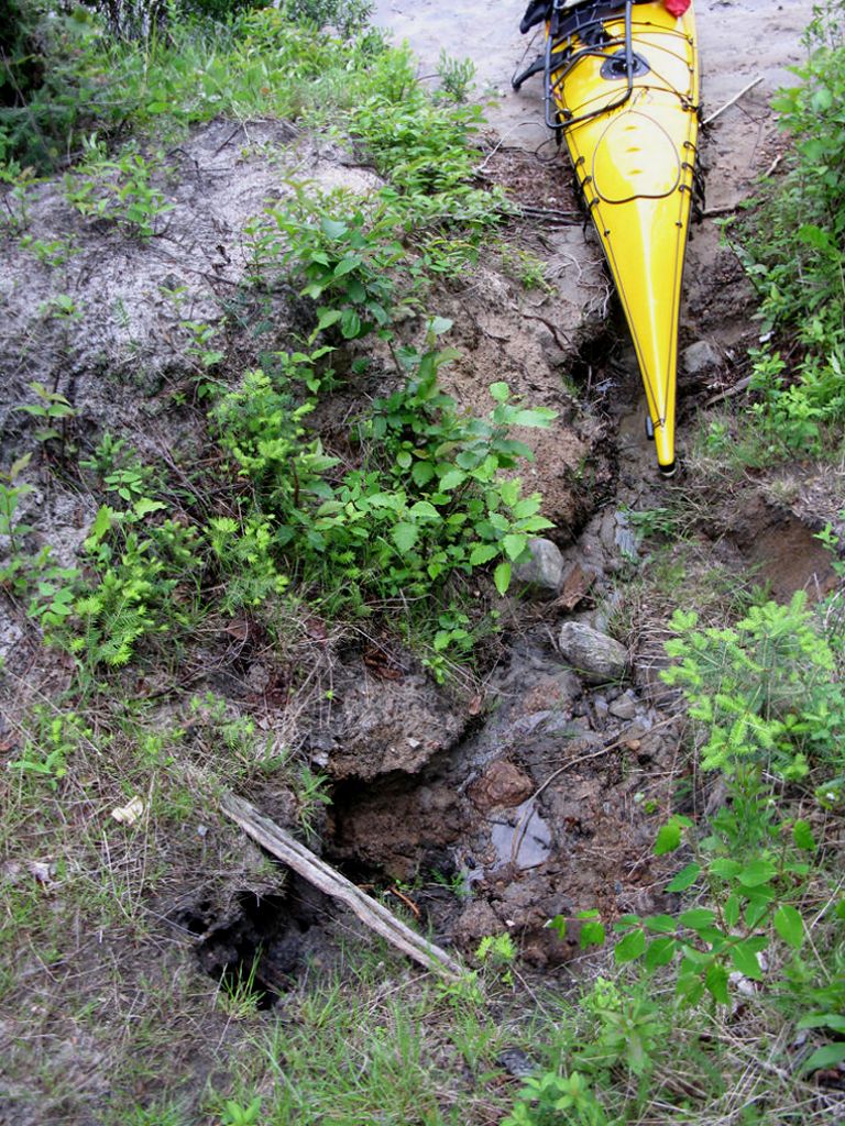
![]()
South-West view down lake ...
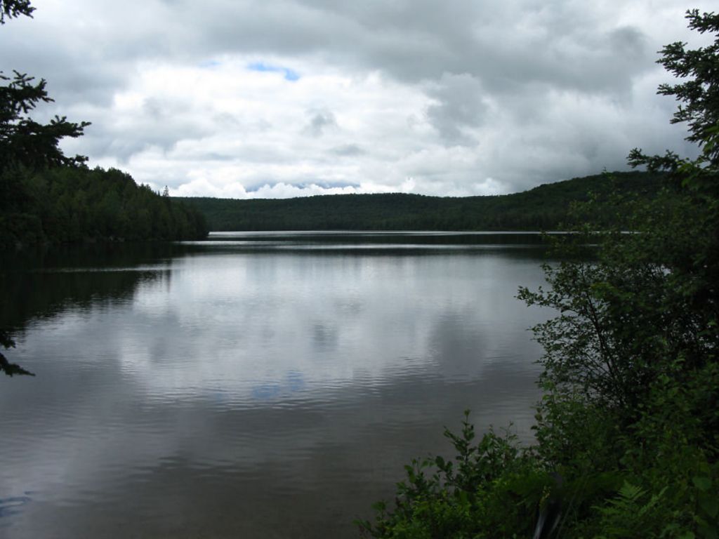
![]()
Campsite
Campsite .. regular or low-maintenance: Regular
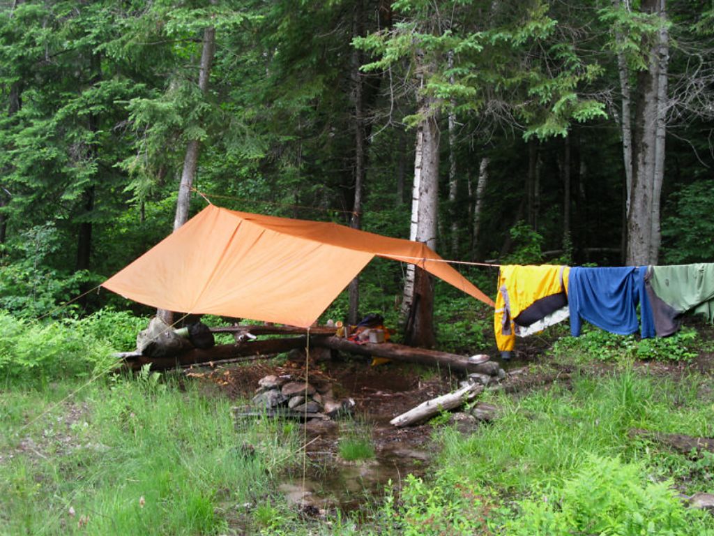
Size of open area 60’ x 30’. Extent of tree cover 20% canopied over firepit/kitchen and tenting location.
Degree of levelness Sufficiently flat around tenting area, firepit and kitchen located in slight depression. Number of level tent sites: 2 flat sites adequate for a <=3 person tent or one large tent.
North exposure: Protected from the North winds – site backs on to evergreen forest.
East exposure: Landing, and camp site adequately protected from strong east winds.
South exposure: Landing and campsite exposed to south-west winds.
West exposure: Landing exposed to strong westerlies. Tent site and firepit adequately protected.
General description: Very poor, small campsite condition. Ground water seepage and spring flooded 50% of the kitchen and firepit area, spring snaked along periphery of the campsite and is the primary cause of erosion to vessel landing. Nice sandy landing but little flat space at beach and a steep climb to the site itself. Decent sun exposure and ok sunset and sunrise views. Appears to be a good swimming spot off the slow tapered sandy beach. Thunder box located north of campsite, a wet walk upstream. No issues with firewood. Little overhead cover if setting tent up on the only dry grassy –rocky area. Two 5’ long benches provided seating close to firepit. This site should be closed in my opinion – let nature reclaim her.
Overall accessibility: Poor
Spring wound its way along and through the firepit area ...
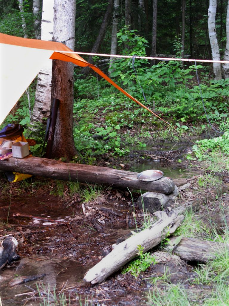
![]()
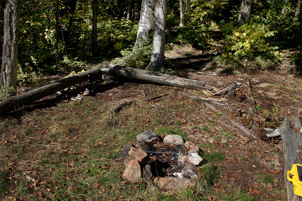
Site’s firepit and bench seating. Spring seepage flooded nearly half of firepit area ...
![]()
This shot of the firepit area was taken in September of 2013 by Mike Bowers - much drier!
![]()
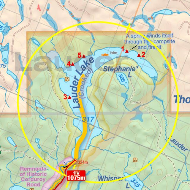
Thanks to Jeffrey McMurtrie of Jeff'sMap for supplying the base-layer map component by Creative Commons licensing.
Submitted by Stephen Molson, Feb. 2011 .. visited June 2010.