 Joe Lake (& Western Narrows) Campsite #10
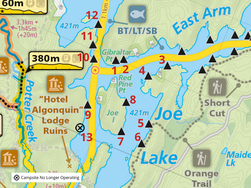
Note: The reservation sysytem distinguishes between "Joe & Western Narrows" and "Little Joe & East Arm" reservation zones. This campsite is #10 in "Joe & Western Narrows", which has a total of 13 campsites, of which 10 reservations are issued at any one time.
Landing
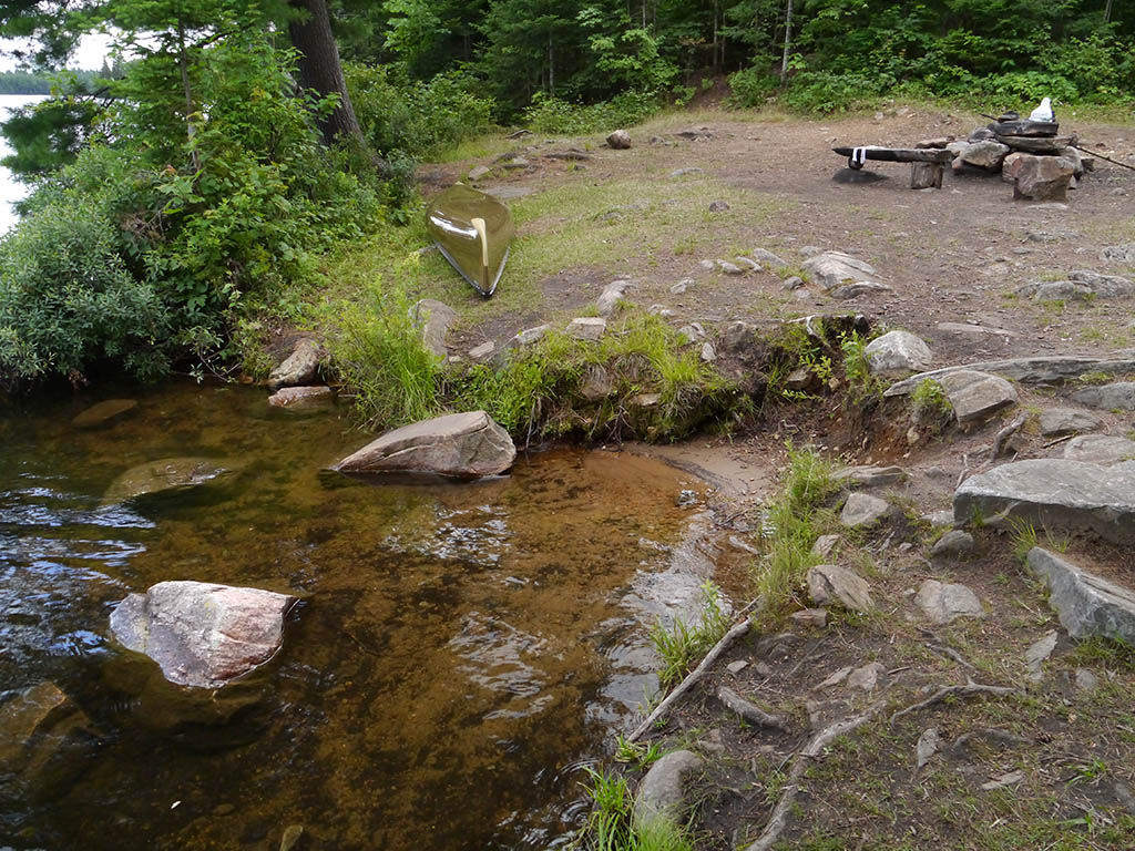
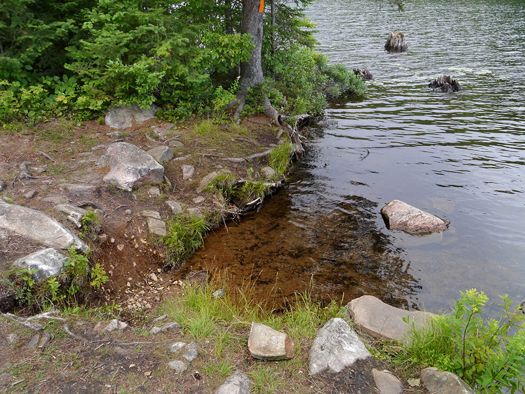
Topography of under-water approach: Sandy approach with number of medium and large-size rocks.
Impediments to disembarking from and/or unloading a canoe: A notch cuts into the shoreline, allowing one canoe at a time to slide in between the shore and submerged rocks.
Topography to tent sites: Once the shoreline's two-foot rise is climbed, one is at the campsite's level.
Looking south across the landing's "notch" ...
![]()
Looking north across the landing's "notch" ...
![]()
Campsite
Regular or low-maintenance: Regular
Size of open area: Main open area is approximately 50 x 100 feet. A second open tentsite area is approximately 15 x 20 feet.
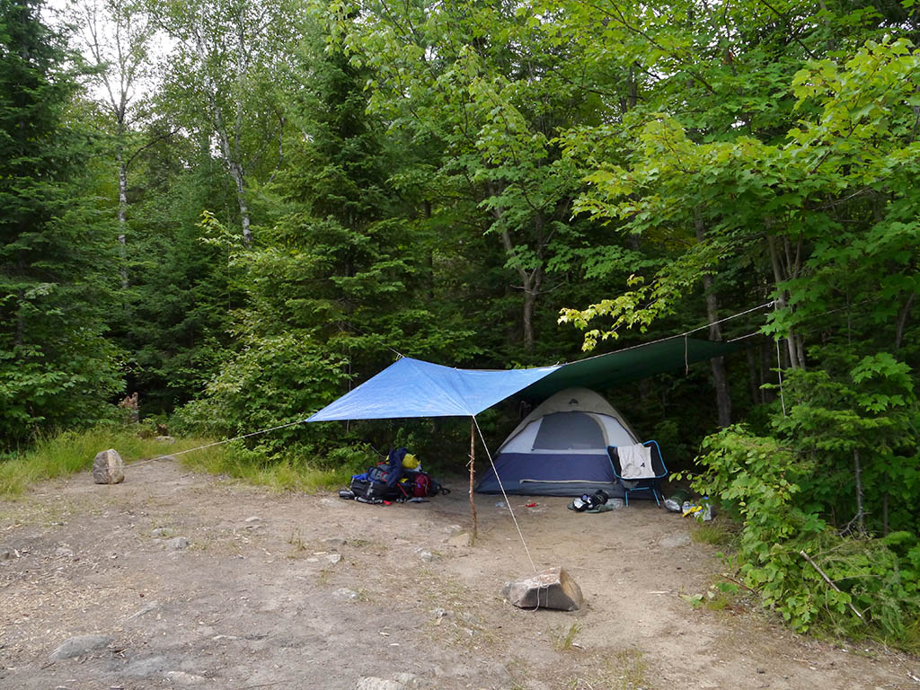
Extent of tree cover: Very little tree cover. One tent can be placed close to the trees to benefit from some tarp tie-downs.
Degree of levelness: Generally smooth level surface.
Number of level tent sites: 5+ tent sites.
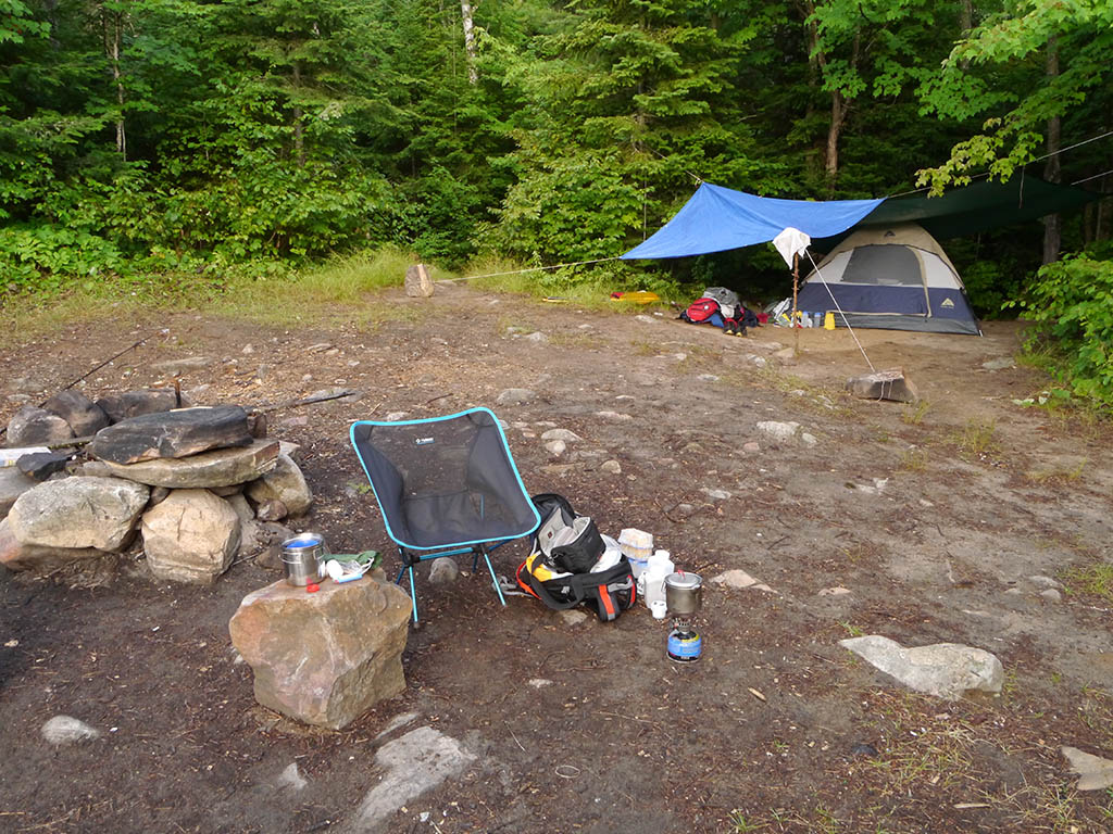
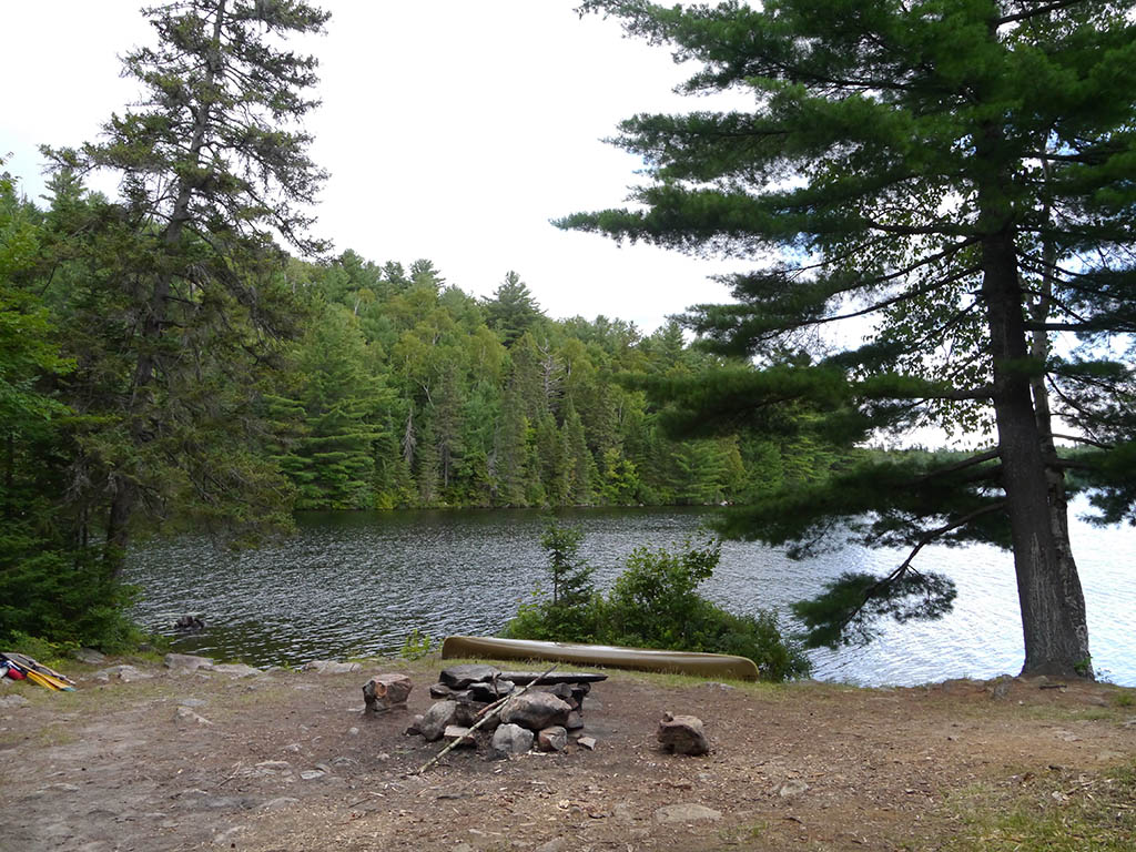
The firepit is totally out in the open ...
![]()
A piece of deadwood and rocks had to be used to complete tarp tie-downs ...
![]()
Following a trail west into the forest, leads to a somewhat secluded additional tentsite ...
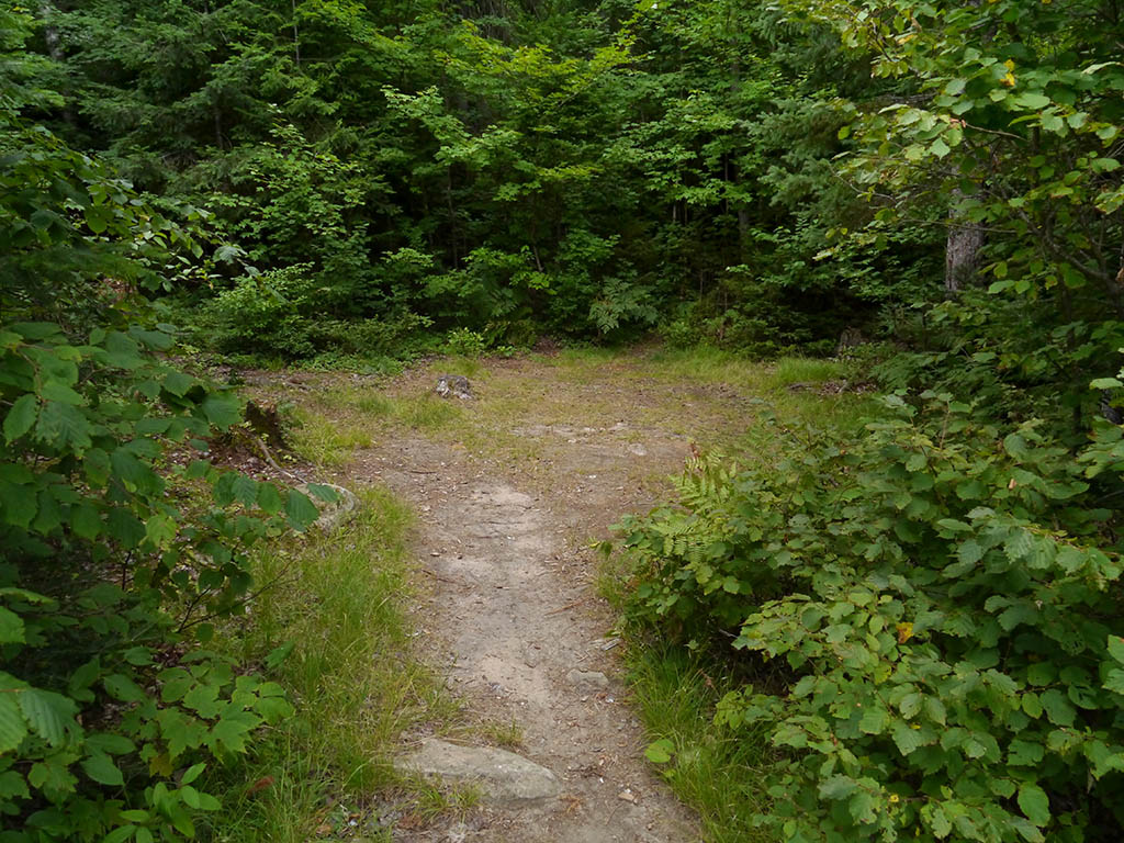
![]()
North exposure: Forest.
East exposure: A view of the Western Narrows and a part of Joe Lake.
South exposure: Forest and the narrow's west shore to the south.
West exposure: Forest.
Looking east across the campsite and the Western Narrows ...
![]()
The post-sunset view due south from the landing ...
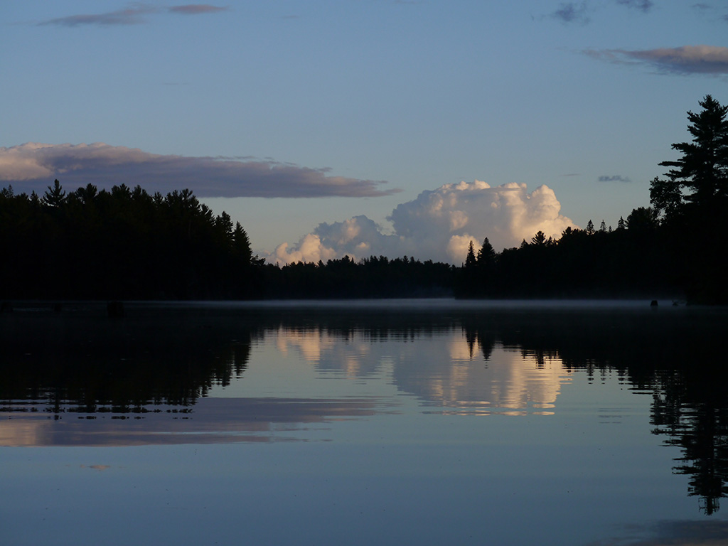
![]()
General description: While the campsite is quite level and spacious, it has no overhead sheltering trees. Only being open to the east, it doesn't have late afternoon sunset-viewing opportunities .. nor does it have exposure to the bug-chasing prevailing NW wind.
Overall accessibility: Once clear of the landing, being all on one smooth level, the actual campsite is quite accessible.
Thanks to Jeffrey McMurtrie of Jeff'sMap for supplying the base-layer map component by Creative Commons licensing.
Submitted by Barry Bridgeford .. January 2014 .. Visited July, 2013