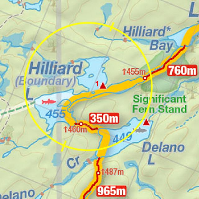
 Portage 760 meters - To Hilliard Lake From Cache Lake
Portage Location: from Cache Lake up to Hilliard Lake.
Length of portage: 760 meters
Portage maintenance: regular.
Elevation above Sea Level @ Cache L. 428 meters.
Elevation above Sea Level @ Hilliard L. 455 meters.
Difference in elevation: 27 meters.
Elevation of highest point: 456 meters.
Overall Rise/Fall: 28 meters.
Cross Section of Portage Elevation changes ...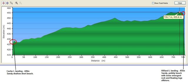
Landing at Cache Lake (downstream)
Co-ordinates of location (optional): N45 31 45.1 W78 35 34.8
Topography of under-water approach: 2 meter long sandy beach landing with a few emergent boulders near shore.
Impediments to disembarking from and/or unloading a canoe: None during Spring water conditions. Strong (30km/hr+) north-east winds will pile the waves up along landing.
Topography of the ascending grade: Easy uphill taper.
Impediments to moving gear to portage trail: None. Sufficient space at landing for 2-3 canoes on the water with another 2 up on shore with adequate gear placement areas in small clearing and up along portage. Rough cut bench seating for 1 or a cozy 2.
Cache Lake landing from the water (Bridgeford, summer 2003) ...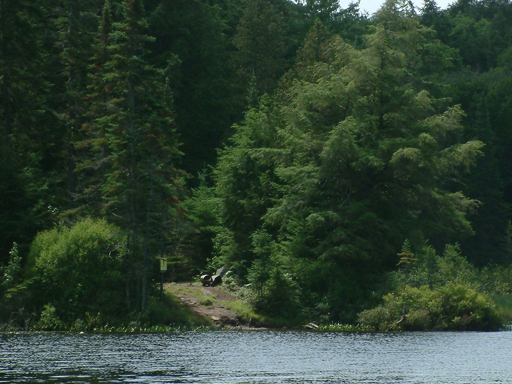
Portage Trail
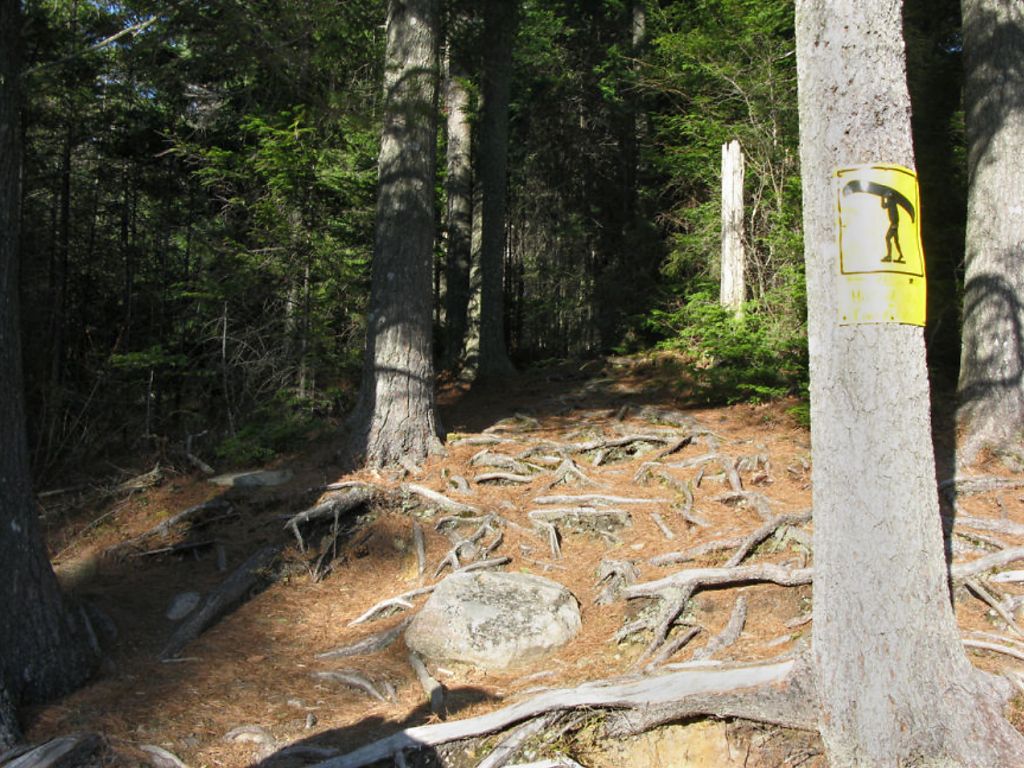
General description: A well groomed fairly straight and easy portage. During spring there were 3 x ~3 m long sections of soft muddy ground but no standing water in the depressions/collection areas. Otherwise it was firm footing with few roots/rocks and a nice easy uphill grade towards Hilliard Lake from Cache L. No steep short climbs. Portage is through a mixed evergreen/hardwood fairly open mature forest and follows a creek to its west through much of its length. Lots of spring flowers in bloom – violet species, trout lilies, purple trilliums and spring beauties late April. Two short boardwalk sections also present – mostly embedded into the dirt.
Topographical impediments to traveling: None.
Areas susceptible to impact by periods of rain or beaver flooding: A couple of depressions held some moisture over ankle-deep muddy ground, but easy enough to walk through or step/hop on the rocks/tree limbs within the muddy sections for firmer footing (boardwalk partially sunk). April 2010 was a very dry Spring, so conditions were unusually dry.
Start of portage from Cache Lake landing ...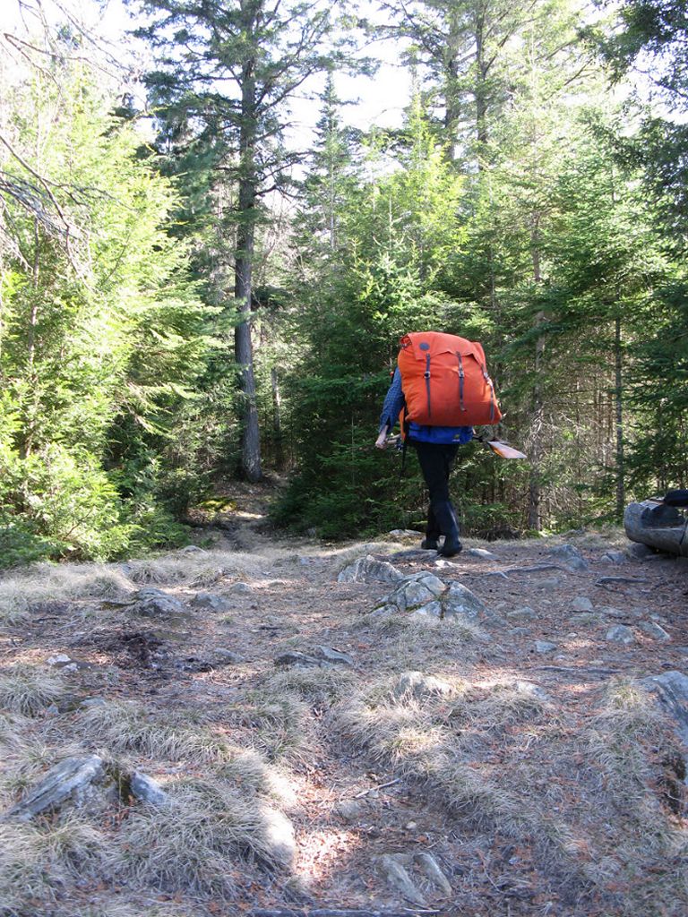

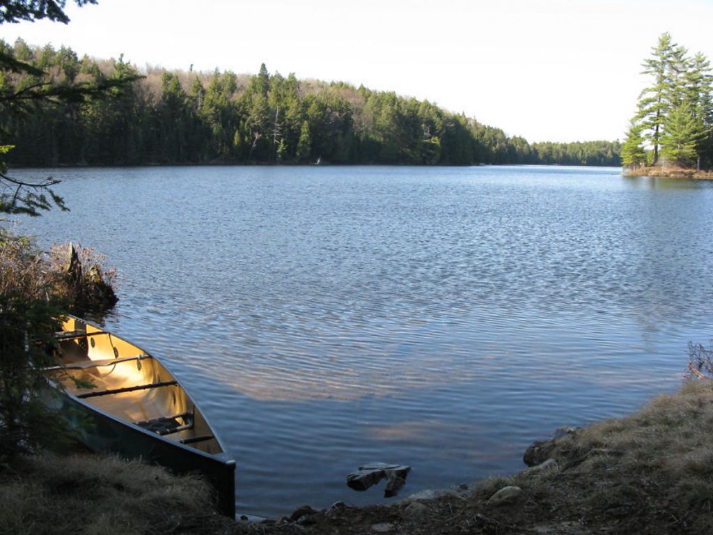
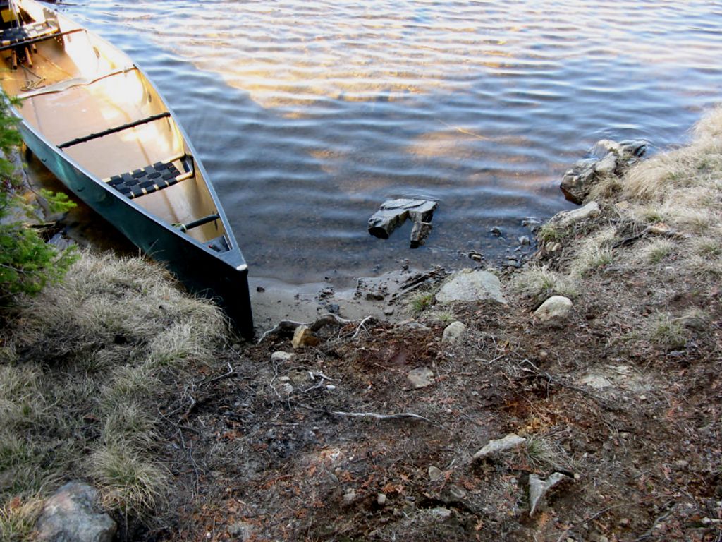
Landing at Hilliard Lake (upstream)
Co-ordinates of location (optional): N45 31 24.6 W78 35 51.2
Topography of under-water approach: Shallow sandy landing, a number of potentially obstructive logs floating just offshore form a natural wind-break.
Impediments to disembarking from and/or unloading a canoe: None during Spring conditions. Strong south-west winds will push the waves up on shore.
Topography of the ascending grade: A very short rise up from the landing area then mostly downhill for the trip to Cache. L
Impediments to moving gear to portage trail: None, sufficient space for at least 2 canoes in the water and 1 up on shore. Gear storage for 2 groups.
Landing at Hilliard Lake ...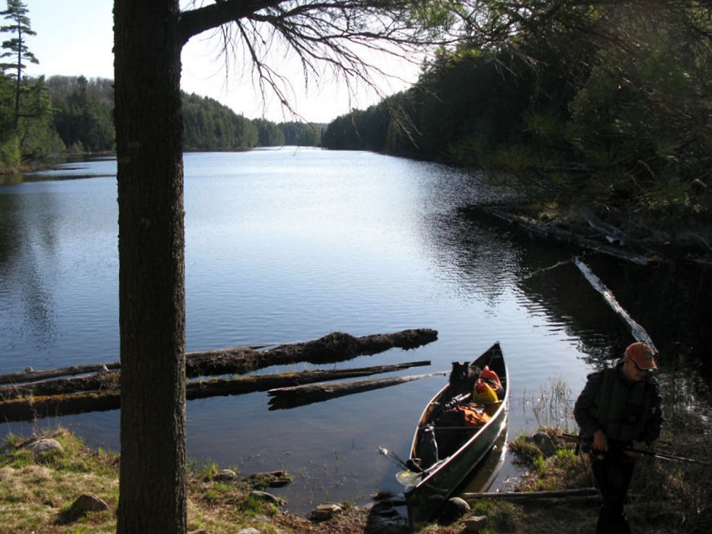
Thanks to Jeffrey McMurtrie of Jeff'sMap for supplying the base-layer map component by Creative Commons licensing.
Date visited: April 2010 ... Submitted by: Stephen Molson, May 2010