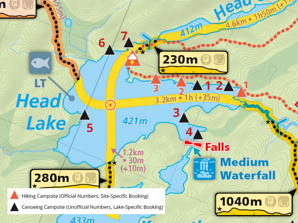
 Portage 1640 meters - To Head Lake From Cache Lake
Portage Location: from Cache lake to Head Lake.
Length of portage: 1640 meters
Portage maintenance: regular.
Elevation above Sea Level @ Cache L. 428 meters.
Elevation above Sea Level @ Head L. 421 meters.
Difference in elevation: 7 meters.
Elevation of highest point: 439 meters.
Overall Rise/Fall: 18 meters.
Cross Section of Portage Elevation changes ...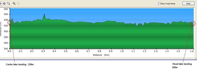
Landing at Cache Lake (upstream)
Location: N45 31 50.8 W78 34 54.6
Topography of under-water approach: Small, short sandy beach landing on Cache Lake side, a high dock also available for motorized landing and gear storage/people/management.
Impediments to disembarking from and/or unloading a canoe: Nothing major encountered during spring conditions. Landing located in a protected bay. Strong winds should only be an issue when blowing from the north. During spring conditions beach was too small and angled to lay gear out on .. had to be carried up steep incline or could be placed on dock.
Available area for managing canoes: Room for at least 3 canoes + gear at a time.
Topography of the ascending grade: Short steep grade on landing immediately up from beach. But footing was decent enough on dry bank or you can walk up the steps. Remainder of the portage relatively flat. Landing nestled against a short sloped and treed incline. Steep bank to climb on the Cache Lake side which opens up to a large flat gear-storage area at top of bank.
Landing at Cache Lake ...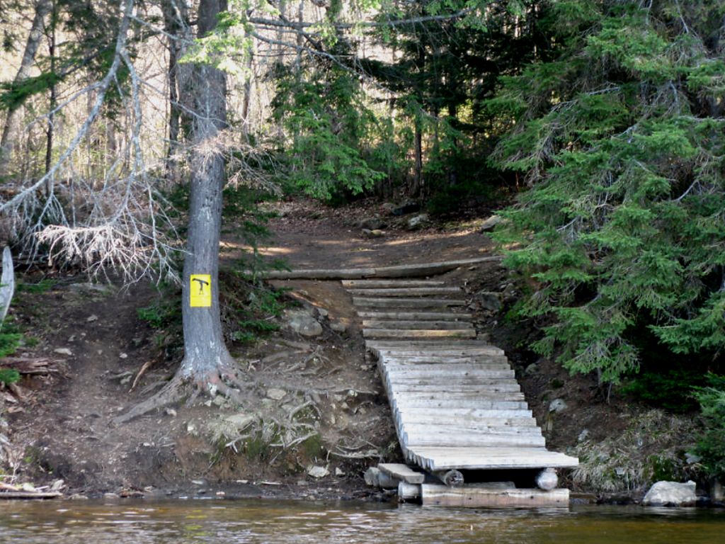
Portage Trail
General description: A well maintained portage with at least ten boardwalk areas of various length (including a < 100 meter section just before the Head Lake put-in). The only steep rise was at the very beginning at the Cache Lake landing. Portage otherwise is flat. It has firm footing with a few minor and short rises/dips through its length. A few sections early on (Cache L side) have knobby roots and fields of small rocks to navigate. Surrounding forest is mixed hardwood/evergreen forest (lots of spruce), mature trees with secondary growth and shrubs along the trail.
Topographical impediments to traveling: None. It's fairly flat throughout, other than Cache L landing.
Areas susceptible to impact by periods of rain or beaver flooding: Early spring typical conditions would be high water on landing areas. A few depressions may be muddy and/or contain puddles in spring, but these areas were < 10 meters long and detours or strategic hops on logs/rocks would be available when required.
*** Note: More photographs are invited! ***
Staircase to landing at Head Lake (submitted by David Pile, from his 1999 trip-log) ...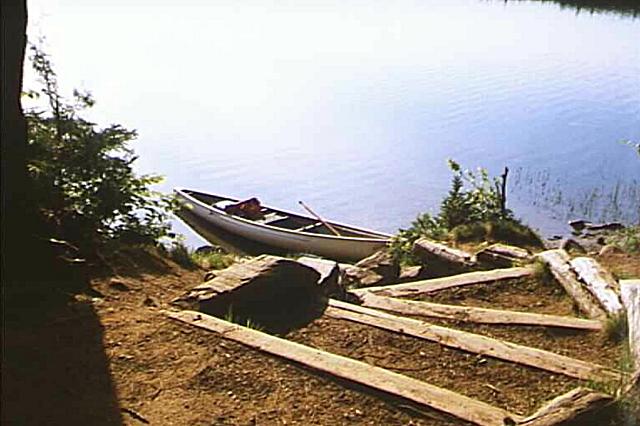
Landing at Head Lake (downstream)
Topography of under-water approach: Rocky landing, roughly 1.5-2’ deep right at shoreline.
Impediments to disembarking from and/or unloading a canoe: Landing likely rough in strong east winds. Otherwise, fairly protected and sufficient gear space above landing. Landing is along a treed shoreline, with 3-4 wooden steps leading down to the main put-in. There are a few secondary landings along the same shore, close to the steps, should the primary put-in be busy. Water is 2’ deep at the shoreline with a few emergent boulders.
Available area for managing canoes: Approximately two canoes in the water at a time along main landing.
Impediments to moving gear to portage trail: Mostly a treed shoreline, narrow landing over 2’ of water at shoreline. Emergent boulders help keep one’s feet dry for loading/unloading, should that be a concern. Lots of flat gear storage 20’ up from shore.
Thanks to Jeffrey McMurtrie of Jeff'sMap for supplying the base-layer map component by Creative Commons licensing.
Submitted by Stephen Molson, March 6, 2010