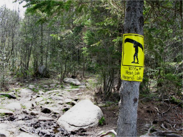
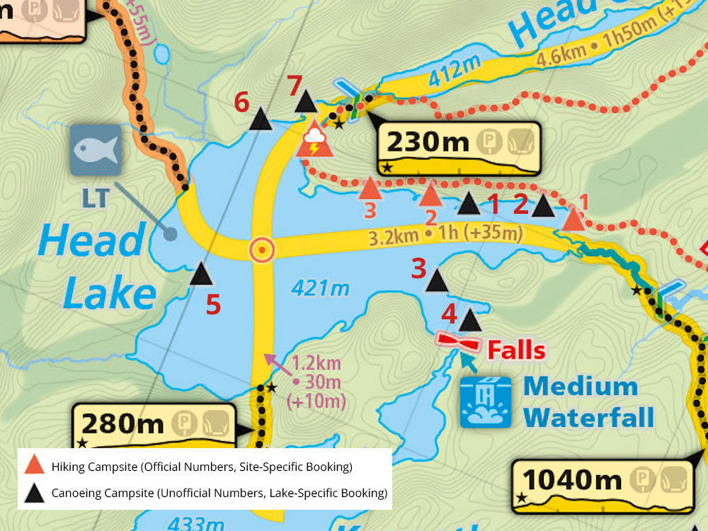
 Portage 1035 meters - Head Lake To Harness Lake
Portage Location: from Head Lake To Harness Lake.
Length of portage: 1035m
Portage maintenance regular or low: Regular.
Landing at Head Lake. (GPS-DMS) location: N45 31 21.8 W78 32 42.7
Landing at Harness Lake. (GPS-DMS) location: N45 31 01.0 W78 32 12.5
Elevation above Sea Level @ start of portage (Head Lake) ~426 meters
Elevation above Sea Level @ end of portage (Harness Lake) ~429 meters
Rise/Fall Overall: 3 meter rise in elevation starting from Head L to Harness L
Cross Section of Portage Elevation changes ...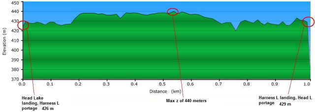
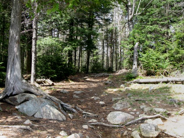
Portage Trail:
General Description: A well maintained portage. A steep but short rise early on from the Head Lake side (160 meters in) was the only elevation challenge. Otherwise generally flat throughout with a number of boardwalks. Trail not dolly (Wheel-Eze type) friendly, on account of the roots/rocks and boardwalks. Walk is through a mixture of mature, handsome hardwoods (elms/maples/birch) with few evergreens other than start/end of portage. Dogwoods, trout lilies, purple trilliums (e.g. carrion trilliums) and violets in flower.
Topographical impediments to traveling: None.
Areas susceptible to impact by periods of rain or beaver flooding: Early spring typical conditions would be high water on landing areas but don’t expect any challenging flooding along the portage itself. The low lying area closer to the Harness L end may be muddy during wet spring conditions, otherwise the existing boardwalks circumvent the odd creek and any standing water.
Landing at: Head Lake (downstream)
Available area for managing canoes: Room for at least 3 canoes along shore + gear at a time. Sufficient space for multiple canoes to be hauled up along portage trail.
Topography of under-water approach: Shallow with emergent / barely submergent rocks/boulders on the Head L (creek) side. Current is not an issue during spring water levels.
Impediments to disembarking from and/or unloading a canoe: None during Spring conditions. An 8’ long beaver dam along the creek forced a quick haul-over to gain access to the portage. However the water was shallow and there was sufficient manoeverability space for managing this. Slight creek current to the east of the landing was not an issue. At low water times the landing may be very rocky and could force an early pull-out before the shore is reached.
Topography of the ascending grade: Very little elevation grade. Hard earth with boulders at the beginning.
Impediments to moving gear to portage trail: None – adequate pack and other gear-resting layout.
Landing at Head L. (creek) ...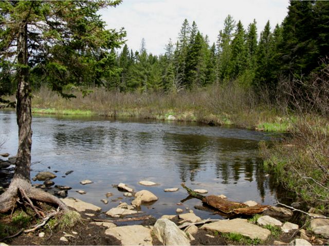

Start of portage above landing at Head Lake ...
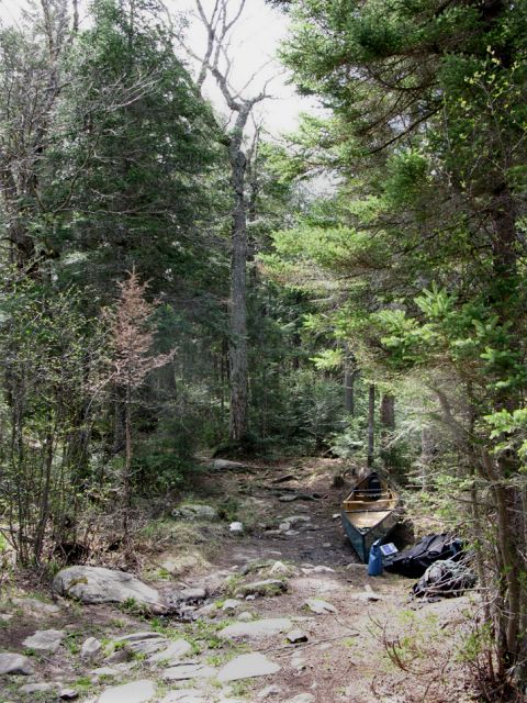
Landing at: Harness Lake (upstream)
Available area for managing canoes: At least 6 canoes at landing, sufficient space for hauling another ˝ dozen up on shore.
Topography of under-water approach: Shallow sandy beach landing on Harness Lake side.
Impediments to disembarking from and/or unloading a canoe: None during Spring conditions.
Topography of the ascending grade: A bit of elevation grade. Hard earth with boulders at the beginning.
Impediments to moving gear to portage trail: None – adequate pack and other gear-resting layout. Fairly large open space (20’ x 40’) at the landing.
Landing looking south up Harness Lake ...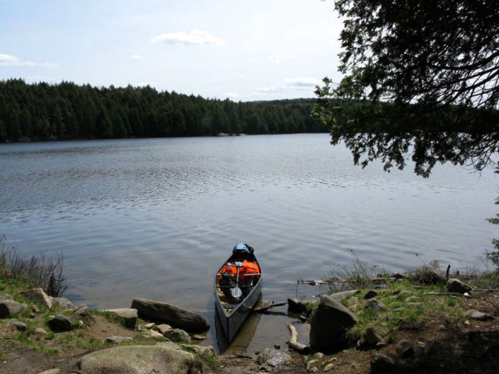
Thanks to Jeffrey McMurtrie of Jeff'sMap for supplying the base-layer map component by Creative Commons licensing.
Submitted by Stephen Molson, March, 2010